Yards, Virginia and West Virginia
| Yards | |
|---|---|
| Unincorporated community | |
 Yards  Yards Location within the state of West Virginia | |
| Coordinates: 37°17′32″N 81°18′36″W / 37.29222°N 81.31000°WCoordinates: 37°17′32″N 81°18′36″W / 37.29222°N 81.31000°W | |
| Country | United States |
| States | Virginia and West Virginia |
| County | Tazewell (Virginia) and Mercer (West Virginia) |
| Elevation | 2,382 ft (726 m) |
| Time zone | Eastern (EST) (UTC-5) |
| • Summer (DST) | EDT (UTC-4) |
| GNIS feature ID | 1477028[1] |
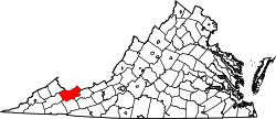
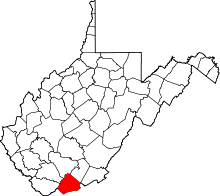
Yards is an unincorporated community straddling the border between Tazewell County, Virginia and Mercer County, West Virginia, United States. Yards is located on the Bluestone River, 4 miles (6.4 km) northwest of Bluefield, Virginia. Yards had a post office on the Virginia side of the border from 1888 until May 28, 1994.[2] The community was named for its railroad yards.[3]
References
- ↑ U.S. Geological Survey Geographic Names Information System: Yards, Virginia and West Virginia
- ↑ "Postmaster Finder - Post Offices by ZIP Code". United States Postal Service. Retrieved December 22, 2012.
- ↑ Tennis, Joe (2004). Southwest Virginia Crossroads: An Almanac of Place Names And Places to See. The Overmountain Press. p. 166. ISBN 9781570722561.
This article is issued from Wikipedia - version of the 7/28/2016. The text is available under the Creative Commons Attribution/Share Alike but additional terms may apply for the media files.

