Raven Rock, New Jersey
| Raven Rock, New Jersey | |
|---|---|
| Unincorporated community | |
|
Saxtonville Tavern in Raven Rock | |
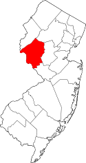
 Raven Rock  Raven Rock  Raven Rock Location of Raven Rock in Hunterdon County Inset: Location of county within the state of New Jersey | |
| Coordinates: 40°24′39″N 75°02′00″W / 40.41083°N 75.03333°WCoordinates: 40°24′39″N 75°02′00″W / 40.41083°N 75.03333°W | |
| Country |
|
| State |
|
| County | Hunterdon |
| Township | Delaware |
| Elevation[1] | 92 ft (28 m) |
| GNIS feature ID | 879623[1] |
Raven Rock is an unincorporated community and hamlet along the Delaware River approximately three miles (4.8 km) north of Stockton along New Jersey Route 29.[2] The hamlet was known earlier as Saxtonville. It is located within Delaware Township in Hunterdon County, New Jersey, United States.[3] It is the site of Bull's Island Recreation Area. The rock outcrop for which it is named is the southwest corner of the Hunterdon Plateau.
The Lumberville–Raven Rock Bridge is a free pedestrian bridge over the Delaware River, owned and operated by the Delaware River Joint Toll Bridge Commission. The bridge, formerly a road bridge from 1856 to 1944, connects Bull's Island Recreation Area to Lumberville, Solebury Township, Pennsylvania.[4]
From 1852 to 1952 the Pennsylvania Railroad operated a passenger stop in Raven Rock via their Belvidere Division. The railroad continued to be used for freight until 1978 when the line closed and was subsequently demolished for a recreational trail in the early 1980s.[5]
References
- 1 2 "Raven Rock". Geographic Names Information System. United States Geological Survey.
- ↑ Google (October 12, 2015). "Aerial view of Raven Rock" (Map). Google Maps. Google. Retrieved October 12, 2015.
- ↑ Locality Search, State of New Jersey. Accessed February 1, 2015.
- ↑ DRJTBC - Lumberville-Raven Rock Pedestrian Bridge Rehabilitation, Delaware River Joint Toll Bridge Commission. Accessed July 8, 2016.
- ↑ National Register of Historic Places Registration Form for Raven Rock Historic District, National Park Service, received September 22, 2015. Accessed July 8, 2016.
