Polebridge, Montana
Polebridge
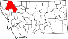
Polebridge is an unincorporated community in Flathead County, Montana, United States, 35 miles (56 km) northwest of Columbia Falls in the northwestern part of the state. This community is named for the log bridge that formerly connected the "inner" North Fork Road in Glacier National Park to the "outer" North Fork Road which leads to Montana Secondary Highway 486, over the North Fork Flathead River. Polebridge lies near the Canada–United States border.
See also
- Glacier View Dam, proposed in the 1940s, which would have inundated Polebridge
Coordinates: 48°45′55″N 114°17′06″W / 48.76528°N 114.28500°W
This article is issued from Wikipedia - version of the 8/8/2016. The text is available under the Creative Commons Attribution/Share Alike but additional terms may apply for the media files.
