Orcas Village, Washington
| Orcas Village | |
|---|---|
| Unincorporated community | |
|
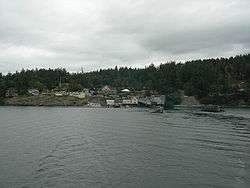
Orcas Village, seen from the water (August 2007) | |
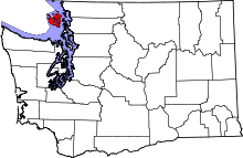
 Orcas Village Location within the state of Washington | |
| Coordinates: 48°35′52.4″N 122°56′40.7″W / 48.597889°N 122.944639°WCoordinates: 48°35′52.4″N 122°56′40.7″W / 48.597889°N 122.944639°W | |
| Country | United States |
| State | Washington |
| County | San Juan |
| Time zone | Pacific (PST) (UTC-8) |
| • Summer (DST) | PDT (UTC-7) |
Orcas Village (sometimes just called Orcas) is an unincorporated community located at southeastern corner of the West Sound watershed[1] on Orcas Island in San Juan County, Washington, United States. It is where the Washington State Ferry lands on the island,[2] and consequently handles all vehicular traffic to and from the island.[1]
While the island can also be accessed by Orcas Island Airport or by private boats, the ferry connection means that most people enter and leave the island through this small village, which consequently has several restaurants and souvenir stands.[2] It is also home to the Orcas Hotel—built 1904 and listed on the National Register of Historic Places since 1982[3]—and also has a small public dock and private marina, a fuel dock and storage tanks, and parking for islanders who commute off-island by ferry. It is designated for future commercial growth as an activity center under San Juan County's comprehensive plan.[1]
References
- 1 2 3 San Juan County Characterization Report: West Sound on official San Juan County site, accessed online 13 August 2007.
- 1 2 Summary: Orcas Village - Meeting # 1 - Saturday, September 26, 1998 on official San Juan County site, accessed online 13 August 2007.
- ↑ WASHINGTON - San Juan County, National Register of Historic Places, accessed online 13 August 2007.
External links
| Wikimedia Commons has media related to Orcas Village, Washington. |
-
 Orcas Village travel guide from Wikivoyage
 - Orcas Village Planning, San Juan County Community Development and Planning Department—Long-Range Planning, includes links to several detailed maps and planning documents.

