No Name, Colorado
| No Name, Colorado | |
|---|---|
| Census-designated place | |
|
Sign at Exit 119 of Interstate 70 | |
 No Name  No Name | |
| Coordinates: 39°33′37″N 107°17′36″W / 39.56028°N 107.29333°WCoordinates: 39°33′37″N 107°17′36″W / 39.56028°N 107.29333°W | |
| Country |
|
| State |
|
| County | Garfield County |
| Area | |
| • Total | 0.18 sq mi (0.46 km2) |
| • Land | 0.18 sq mi (0.46 km2) |
| • Water | 0.0 sq mi (0.0 km2) |
| Elevation | 5,880 ft (1,790 m) |
| Population (2010) | |
| • Total | 123 |
| • Density | 694/sq mi (267.9/km2) |
| Time zone | MST (UTC-7) |
| • Summer (DST) | MDT (UTC-6) |
| Area code(s) | 970 |
| FIPS code | 08-53875 |
| GNIS feature ID | 2583271 |
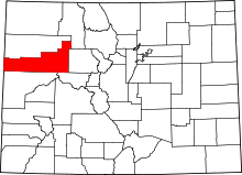
No Name[1] is a census-designated place in Garfield County, Colorado, United States. The population as of the 2010 census was 123.[2] It is located east of Glenwood Springs, off Exit 119 of Interstate 70 in Glenwood Canyon. It is named for No Name Creek and No Name Canyon. The No Name Tunnel of I-70 is nearby. It has frequently been noted on lists of unusual place names.[3]
The exit sign for No Name is visible in passing in the film Vanishing Point.
There are two exits along Interstate 70 in Colorado that are truly nameless: Exit 218 east of Loveland Pass, and Exit 354 west of Limon - in both these instances, advance signage is marked merely with an exit number and the distance to that exit.
See also
References
- ↑ U.S. Geological Survey Geographic Names Information System: No Name, Colorado CDP
- ↑ "Geographic Identifiers: 2010 Demographic Profile Data (G001): No Name CDP, Colorado". American Factfinder. U.S. Census Bureau. Retrieved November 16, 2016.
- ↑ Parker, Quentin (Jul 18, 2010). Welcome to Horneytown, North Carolina, Population: 15: An insider's guide to 201 of the world's weirdest and wildest places. Adams Media. p. xi.
External links
This article is issued from Wikipedia - version of the 11/16/2016. The text is available under the Creative Commons Attribution/Share Alike but additional terms may apply for the media files.


