| [3] |
Name on the Register[4] |
Image |
Date listed[5] |
Location |
Description |
|---|
| 1 |
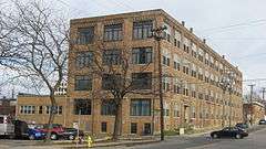
American Can Company Building |
|
000000002007-10-17-0000October 17, 2007
(#07001092) |
4101 Spring Grove Ave.
39°09′37″N 84°32′14″W / 39.160278°N 84.537222°W / 39.160278; -84.537222 (American Can Company Building) |
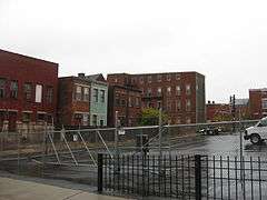
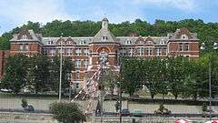
Historic former factory built in 1921 where can-making machines were manufactured. Now loft-style apartments.
|
| 2 |
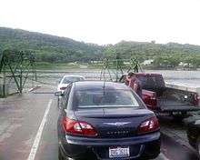
Anderson Ferry |
|
000000001982-06-10-0000June 10, 1982
(#82003575) |
Off U.S. Route 50
39°04′35″N 84°37′28″W / 39.076389°N 84.624444°W / 39.076389; -84.624444 (Anderson Ferry) |
|
| 3 |
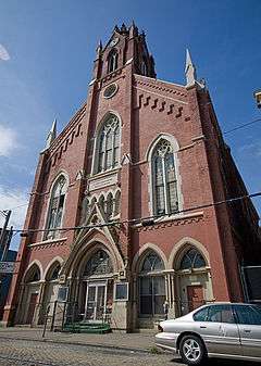
Apostolic Bethlehem Temple Church |
|
000000001973-04-11-0000April 11, 1973
(#73001453) |
1205 Elm St.
39°06′29″N 84°31′07″W / 39.108056°N 84.518611°W / 39.108056; -84.518611 (Apostolic Bethlehem Temple Church) |
|
| 4 |
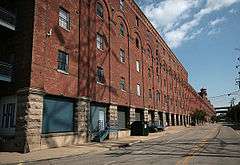
B&O Freight Terminal |
|
000000001986-12-29-0000December 29, 1986
(#86003521) |
700 Pete Rose Way
39°05′44″N 84°31′28″W / 39.095556°N 84.524444°W / 39.095556; -84.524444 (B&O Freight Terminal) |
|
| 5 |
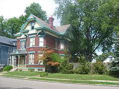
Balch House |
|
000000001980-03-03-0000March 3, 1980
(#80003036) |
267 Greendale Ave.
39°09′04″N 84°31′04″W / 39.151111°N 84.517778°W / 39.151111; -84.517778 (Balch House) |
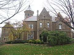
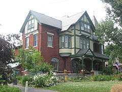
Queen Anne style house built in 1896, designed by Cincinnati architect Samuel Hannaford for Cincinnati, Hamilton, and Dayton Railroad executive George Balch.
|
| 6 |
Beech Avenue Houses |
|
000000001979-02-16-0000February 16, 1979
(#79001853) |
1120 and 1128 Beech Ave.
39°06′46″N 84°34′38″W / 39.112778°N 84.577222°W / 39.112778; -84.577222 (Beech Avenue Houses) |
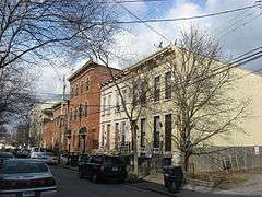
|
| 7 |
Betts-Longworth Historic District |
|
000000001983-11-29-0000November 29, 1983
(#83004304) |
Roughly bounded by Ezzard Charles Dr., Central Ave., and Mound and Old Court Sts.
39°06′26″N 84°31′21″W / 39.107222°N 84.5225°W / 39.107222; -84.5225 (Betts-Longworth Historic District) |
|
| 8 |
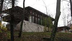
Cedric G. and Patricia Neils Boulter House |
|
000000001999-05-14-0000May 14, 1999
(#99000512) |
1 Rawson Woods Circle
39°09′06″N 84°31′24″W / 39.151667°N 84.523333°W / 39.151667; -84.523333 (Cedric G. and Patricia Neils Boulter House) |
Designed by Frank Lloyd Wright.
|
| 9 |
Frederick E. and Catherine Bullerdick House |
|
000000002007-12-20-0000December 20, 2007
(#07001295) |
4321 Hamilton Ave.
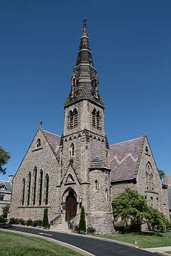
39°09′58″N 84°32′29″W / 39.166111°N 84.541389°W / 39.166111; -84.541389 (Frederick E. and Catherine Bullerdick House) |
|
| 10 |
Calvary Episcopal Church Sunday School |
|
000000001980-03-03-0000March 3, 1980
(#80003040) |
3770 Clifton Ave.
39°09′08″N 84°31′03″W / 39.152222°N 84.5175°W / 39.152222; -84.5175 (Calvary Episcopal Church Sunday School) |
|
| 11 |
Freeman Grant Cary Pleasant Hill Academy |
|
000000001999-04-29-0000April 29, 1999
(#99000511) |
5651 Hamilton Ave.
39°11′39″N 84°32′46″W / 39.194028°N 84.546111°W / 39.194028; -84.546111 (Freeman Grant Cary Pleasant Hill Academy) |
|
| 12 |
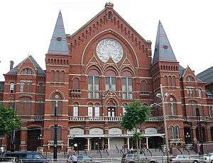
Cincinnati Music Hall |
|
000000001970-01-26-0000January 26, 1970
(#70000496) |
1243 Elm St.
39°06′34″N 84°31′08″W / 39.109444°N 84.518889°W / 39.109444; -84.518889 (Cincinnati Music Hall) |
|
| 13 |
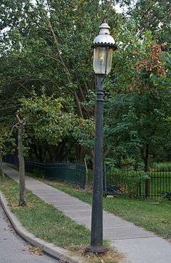
Cincinnati Street Gas Lamps |
|
000000001978-12-22-0000December 22, 1978
(#78002073) |
1109 street lamps at various locations throughout Cincinnati
|
|
| 14 |
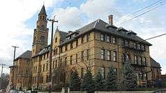
Cincinnati Union Terminal |
|
000000001972-10-31-0000October 31, 1972
(#72001018) |
1301 Western Ave.
39°06′36″N 84°32′16″W / 39.11°N 84.537778°W / 39.11; -84.537778 (Cincinnati Union Terminal) |
|
| 15 |
Cincinnati Work House and Hospital |
|
000000001980-03-03-0000March 3, 1980
(#80003044) |
3208 Colerain Ave.
39°08′32″N 84°32′13″W / 39.142222°N 84.536944°W / 39.142222; -84.536944 (Cincinnati Work House and Hospital) |
|
| 16 |
Clifton Avenue Historic District |
|
000000001978-12-08-0000December 8, 1978
(#78002074) |
Irregular pattern along Clifton Ave.
39°09′18″N 84°31′01″W / 39.155°N 84.516944°W / 39.155; -84.516944 (Clifton Avenue Historic District) |
|
| 17 |
Clifton Methodist Episcopal Church |
|
000000002007-04-12-0000April 12, 2007
(#07000297) |
3418 Clifton Ave.
39°08′39″N 84°31′07″W / 39.144167°N 84.518611°W / 39.144167; -84.518611 (Clifton Methodist Episcopal Church) |
|
| 18 |
College Hill Town Hall |
|
000000001978-03-17-0000March 17, 1978
(#78002075) |
Belmont Ave. and Larch St.
39°11′37″N 84°32′59″W / 39.193611°N 84.549722°W / 39.193611; -84.549722 (College Hill Town Hall) |
|
| 19 |
Cote Bonneville |
|
000000001984-11-29-0000November 29, 1984
(#84000448) |
4850 Colerain Ave.
39°10′13″N 84°33′21″W / 39.170278°N 84.555833°W / 39.170278; -84.555833 (Cote Bonneville) |
|
| 20 |
George B. Cox House |
|
000000001973-11-06-0000November 6, 1973
(#73001456) |
Brookline and Jefferson Aves.
39°08′33″N 84°30′54″W / 39.1425°N 84.515°W / 39.1425; -84.515 (George B. Cox House) |
Home to "Boss" Cox, Cincinnati political leader. Designed by Samuel Hannaford.
|
| 21 |
Crosley Building |
|
000000002015-02-24-0000February 24, 2015
(#15000042) |
1329-1333 Arlington St.
39°08′42″N 84°32′24″W / 39.145000°N 84.540000°W / 39.145000; -84.540000 (Crosley Building) |
|
| 22 |
Dayton Street Historic District |
|
000000001973-01-25-0000January 25, 1973
(#73001457) |
Roughly bounded by Bank, Linn, and Poplar Sts. and Winchell Ave.
39°07′03″N 84°31′50″W / 39.1175°N 84.530556°W / 39.1175; -84.530556 (Dayton Street Historic District) |
|
| 23 |
Domhoff Buildings |
|
000000001980-03-11-0000March 11, 1980
(#80003047) |
4201-4203 Hamilton Ave. and 1604-1614 Chase Ave.
39°09′45″N 84°32′22″W / 39.1625°N 84.539444°W / 39.1625; -84.539444 (Domhoff Buildings) |
|
| 24 |
Eighteenth District School |
|
000000001980-03-03-0000March 3, 1980
(#80003051) |
1326 Hopple St.
39°08′14″N 84°32′18″W / 39.137222°N 84.538333°W / 39.137222; -84.538333 (Eighteenth District School) |
|
| 25 |
Episcopal Church of the Resurrection |
|
000000001977-04-13-0000April 13, 1977
(#77001064) |
7346-7348 Kirkwood Lane
39°07′36″N 84°42′10″W / 39.126667°N 84.702778°W / 39.126667; -84.702778 (Episcopal Church of the Resurrection) |
|
| 26 |
Fairview Public School and Annex |
|
000000002010-09-16-0000September 16, 2010
(#10000756) |
255 Warner St. and 2232 Stratford Ave.
39°07′30″N 84°31′20″W / 39.125°N 84.522222°W / 39.125; -84.522222 (Fairview Public School and Annex) |
|
| 27 |
Findlay Market Building |
|
000000001972-06-05-0000June 5, 1972
(#72001020) |
Esplanade at Elder St., between Elm and Race Sts.
39°06′55″N 84°31′09″W / 39.115278°N 84.519167°W / 39.115278; -84.519167 (Findlay Market Building) |
|
| 28 |
First German Methodist Episcopal Church |
|
000000001980-03-03-0000March 3, 1980
(#80003054) |
1310 Race St.
39°06′35″N 84°30′59″W / 39.109722°N 84.516389°W / 39.109722; -84.516389 (First German Methodist Episcopal Church) |
|
| 29 |
Freund-Heintz House |
|
000000002003-08-21-0000August 21, 2003
(#03000806) |
3332 Whitfield Ave.
39°08′35″N 84°31′26″W / 39.143056°N 84.523889°W / 39.143056; -84.523889 (Freund-Heintz House) |
|
| 30 |
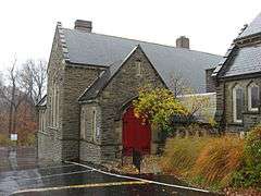
German Evangelical Protestant Cemetery Chapel |
|
000000002008-02-28-0000February 28, 2008
(#08000115) |
3701 Vine St.
39°09′21″N 84°30′32″W / 39.155833°N 84.508889°W / 39.155833; -84.508889 (German Evangelical Protestant Cemetery Chapel) |
|
| 31 |
Moses Goldsmith Building |
|
000000001982-06-10-0000June 10, 1982
(#82003580) |
356 Bryant
39°08′45″N 84°31′18″W / 39.145833°N 84.521667°W / 39.145833; -84.521667 (Moses Goldsmith Building) |
|
| 32 |
Sir Alfred T. Goshorn House |
|
000000001973-04-03-0000April 3, 1973
(#73001459) |
3540 Clifton Ave.
39°08′50″N 84°31′06″W / 39.147222°N 84.518333°W / 39.147222; -84.518333 (Sir Alfred T. Goshorn House) |
|
| 33 |
Hamilton County Memorial Building |
|
000000001978-12-04-0000December 4, 1978
(#78002076) |
Elm and Grant Sts.
39°06′31″N 84°31′06″W / 39.108611°N 84.518333°W / 39.108611; -84.518333 (Hamilton County Memorial Building) |
|
| 34 |
Samuel Hannaford House |
|
000000001980-03-03-0000March 3, 1980
(#80003056) |
768 Derby Ave.
39°10′17″N 84°31′09″W / 39.171389°N 84.519167°W / 39.171389; -84.519167 (Samuel Hannaford House) |
|
| 35 |
George Hatch House |
|
000000002008-07-03-0000July 3, 2008
(#08000583) |
830 Dayton St.
39°07′06″N 84°31′42″W / 39.118453°N 84.528239°W / 39.118453; -84.528239 (George Hatch House) |
|
| 36 |
Joseph A. Hemann House |
|
000000001980-04-16-0000April 16, 1980
(#80003057) |
49 W. McMillan St.
39°07′38″N 84°30′51″W / 39.127222°N 84.514167°W / 39.127222; -84.514167 (Joseph A. Hemann House) |
|
| 37 |
Hewson-Gutting House |
|
000000001979-12-21-0000December 21, 1979
(#79001857) |
515 Lafayette Ave.
39°09′17″N 84°31′30″W / 39.154722°N 84.525°W / 39.154722; -84.525 (Hewson-Gutting House) |
|
| 38 |
Hoffner Historic District |
|
000000001978-10-03-0000October 3, 1978
(#78002077) |
Bounded by Blue Rock, Moline Court, Langland, and Hamilton Aves.
39°09′38″N 84°32′22″W / 39.160556°N 84.539444°W / 39.160556; -84.539444 (Hoffner Historic District) |
|
| 39 |
Hulbert House and McAlpin Bridal Cottage |
|
000000001982-04-29-0000April 29, 1982
(#82003583) |
333 and 341 Lafayette Ave.
39°09′22″N 84°31′12″W / 39.156111°N 84.52°W / 39.156111; -84.52 (Hulbert House and McAlpin Bridal Cottage) |
|
| 40 |
George Hummel House |
|
000000001980-03-03-0000March 3, 1980
(#80003059) |
3423 Whitfield Ave.
39°08′42″N 84°31′25″W / 39.145000°N 84.523611°W / 39.145000; -84.523611 (George Hummel House) |
|
| 41 |
Kirby Road School |
|
000000002013-09-03-0000September 3, 2013
(#13000681) |
1710 Bruce Ave.
39°10′04″N 84°32′45″W / 39.167778°N 84.545833°W / 39.167778; -84.545833 (Kirby Road School) |
|
| 42 |
Laurel Homes Historic District |
|
000000001987-05-19-0000May 19, 1987
(#87000690) |
Roughly bounded by Liberty and John Sts., Ezzard Charles Dr., and Linn St.
39°06′41″N 84°31′27″W / 39.111389°N 84.524167°W / 39.111389; -84.524167 (Laurel Homes Historic District) |
|
| 43 |
John Uri Lloyd House |
|
000000001973-03-07-0000March 7, 1973
(#73001461) |
3901 Clifton Ave.
39°09′26″N 84°31′03″W / 39.157222°N 84.5175°W / 39.157222; -84.5175 (John Uri Lloyd House) |
|
| 44 |
Lower Price Hill Historic District |
|
000000001988-11-15-0000November 15, 1988
(#88002536) |
Roughly bounded by W. 8th, State, Burns, and English St.
39°06′13″N 84°33′08″W / 39.103611°N 84.552222°W / 39.103611; -84.552222 (Lower Price Hill Historic District) |
|
| 45 |
Matthew McWilliams House |
|
000000002005-04-28-0000April 28, 2005
(#05000341) |
3586 River Rd.
39°04′52″N 84°35′27″W / 39.081111°N 84.590833°W / 39.081111; -84.590833 (Matthew McWilliams House) |
|
| 46 |
Melbourne Flats |
|
000000001984-10-18-0000October 18, 1984
(#84000132) |
39 W. McMillan St.
39°07′39″N 84°30′48″W / 39.1275°N 84.513333°W / 39.1275; -84.513333 (Melbourne Flats) |
|
| 47 |
Charles A. Miller House |
|
000000001980-03-03-0000March 3, 1980
(#80003064) |
1817 Chase St.
39°09′52″N 84°32′53″W / 39.164444°N 84.548056°W / 39.164444; -84.548056 (Charles A. Miller House) |
|
| 48 |
Mohawk Place Historic District |
|
000000002015-09-01-0000September 1, 2015
(#15000563) |
241-290 McMicken Ave., 2009-2024 Mohawk Pl., 218-256 Mohawk St., and 2026 Central Parkway
39°07′13″N 84°31′26″W / 39.1202°N 84.5240°W / 39.1202; -84.5240 (Mohawk Place Historic District) |
|
| 49 |
Morrison House |
|
000000001973-04-03-0000April 3, 1973
(#73001463) |
750 Ludlow Ave.
39°08′54″N 84°31′43″W / 39.148333°N 84.528611°W / 39.148333; -84.528611 (Morrison House) |
|
| 50 |
Mount Airy Forest |
|
000000002010-04-13-0000April 13, 2010
(#10000191) |
5083 Colerain Ave.
39°10′47″N 84°33′57″W / 39.179728°N 84.565883°W / 39.179728; -84.565883 (Mount Airy Forest) |
|
| 51 |
Northside United Methodist Church |
|
000000001980-03-03-0000March 3, 1980
(#80003068) |
1674 Chase
39°09′50″N 84°32′37″W / 39.163889°N 84.543611°W / 39.163889; -84.543611 (Northside United Methodist Church) |
|
| 52 |
Oesterlein Machine Company-Fashion Frocks, Inc. Complex |
|
000000002005-10-27-0000October 27, 2005
(#05001186) |
3301 Colerain Ave., 1326 Monmouth Ave.
39°08′36″N 84°32′20″W / 39.143333°N 84.538889°W / 39.143333; -84.538889 (Oesterlein Machine Company-Fashion Frocks, Inc. Complex) |
|
| 53 |
Ohio National Guard Armory |
|
000000001980-03-03-0000March 3, 1980
(#80003069) |
1437-1439 Western Ave.
39°06′41″N 84°31′57″W / 39.111389°N 84.5325°W / 39.111389; -84.5325 (Ohio National Guard Armory) |
|
| 54 |
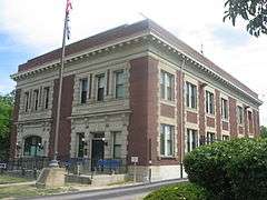
Old College Hill Post Office |
|
000000001976-06-16-0000June 16, 1976
(#76001437) |
1624 Pasadena Ave.
39°11′32″N 84°32′49″W / 39.192222°N 84.546944°W / 39.192222; -84.546944 (Old College Hill Post Office) |
|
| 55 |
Our Lady of Mercy High School |
|
000000001980-03-03-0000March 3, 1980
(#80003070) |
1409 Western Ave.
39°06′39″N 84°31′57″W / 39.110833°N 84.5325°W / 39.110833; -84.5325 (Our Lady of Mercy High School) |
|
| 56 |
Over-the-Rhine Historic District |
|
000000001983-05-17-0000May 17, 1983
(#83001985) |
Roughly bounded by Dorsey, Sycamore, Liberty, Reading, Central Parkway, McMicken Ave., and Vine Sts.; 308-322, 500-550 Reading Rd., 222 W. 12th St., 1208, 1416-1430, 1544, 1600, 1628, 1900 Central Pkwy.
39°06′52″N 84°30′54″W / 39.114444°N 84.515°W / 39.114444; -84.515 (Over-the-Rhine Historic District) |
Extends into eastern Cincinnati. Second set of addresses represents a boundary increase on 2014-06-13.
|
| 57 |
Parkside Apartments |
|
000000002008-02-28-0000February 28, 2008
(#08000116) |
3315-3317 Jefferson Ave.
39°08′27″N 84°30′50″W / 39.140833°N 84.513889°W / 39.140833; -84.513889 (Parkside Apartments) |
|
| 58 |
Pinecroft |
|
000000002008-12-17-0000December 17, 2008
(#08001197) |
2336 Kipling Ave.
39°12′10″N 84°34′13″W / 39.202639°N 84.570278°W / 39.202639; -84.570278 (Pinecroft) |
|
| 59 |
Police Station No. 3 |
|
000000001981-05-18-0000May 18, 1981
(#81000435) |
3201 Warsaw Ave.
39°06′34″N 84°33′47″W / 39.109444°N 84.563056°W / 39.109444; -84.563056 (Police Station No. 3) |
|
| 60 |
Police Station No. 5 |
|
000000001980-03-03-0000March 3, 1980
(#80003075) |
1024-1026 York St.
39°07′04″N 84°31′57″W / 39.117778°N 84.5325°W / 39.117778; -84.5325 (Police Station No. 5) |
|
| 61 |
Police Station No. 7 |
|
000000001981-05-18-0000May 18, 1981
(#81000437) |
355 McMillan St.
39°07′41″N 84°31′31″W / 39.128056°N 84.525278°W / 39.128056; -84.525278 (Police Station No. 7) |
|
| 62 |
Probasco Fountain |
|
000000001980-03-03-0000March 3, 1980
(#80003077) |
Clifton Ave.
39°09′02″N 84°31′07″W / 39.150556°N 84.518611°W / 39.150556; -84.518611 (Probasco Fountain) |
|
| 63 |
Henry Probasco House |
|
000000001972-11-09-0000November 9, 1972
(#72001022) |
430 W. Cliff Lane
39°09′29″N 84°31′26″W / 39.158056°N 84.523889°W / 39.158056; -84.523889 (Henry Probasco House) |
|
| 64 |
Heinrich A. Rattermann House |
|
000000001980-05-23-0000May 23, 1980
(#80003080) |
510 York St.
39°07′02″N 84°31′25″W / 39.117222°N 84.523611°W / 39.117222; -84.523611 (Heinrich A. Rattermann House) |
|
| 65 |
Rawson House |
|
000000001973-07-24-0000July 24, 1973
(#73001465) |
3767 Clifton Ave.
39°09′08″N 84°31′10″W / 39.152222°N 84.519444°W / 39.152222; -84.519444 (Rawson House) |
|
| 66 |
William Resor House |
|
000000001973-03-07-0000March 7, 1973
(#73001466) |
254 Greendale Ave.
39°09′06″N 84°31′01″W / 39.151667°N 84.516944°W / 39.151667; -84.516944 (William Resor House) |
|
| 67 |
Charles B. Russell House |
|
000000001980-03-03-0000March 3, 1980
(#80003081) |
3416 Brookline Ave.
39°08′35″N 84°30′54″W / 39.143056°N 84.515°W / 39.143056; -84.515 (Charles B. Russell House) |
|
| 68 |
Sacred Heart Academy |
|
000000001973-04-11-0000April 11, 1973
(#73001467) |
525 Lafayette St.
39°09′11″N 84°31′38″W / 39.153056°N 84.527222°W / 39.153056; -84.527222 (Sacred Heart Academy) |
|
| 69 |
St. Aloysius-on-the-Ohio |
|
000000002014-12-23-0000December 23, 2014
(#14001075) |
134 Whipple St., 6207, 6214, and 6218 Portage St., and 6206 Gracely Dr.
39°06′20″N 84°41′04″W / 39.105556°N 84.684444°W / 39.105556; -84.684444 (St. Aloysius-on-the-Ohio) |
|
| 70 |
St. Francis Hospital |
|
000000001984-04-19-0000April 19, 1984
(#84003714) |
1860 Queen City Ave.
39°07′37″N 84°33′37″W / 39.126944°N 84.560278°W / 39.126944; -84.560278 (St. Francis Hospital) |
|
| 71 |
St. George Parish and Newman Center |
|
000000001980-03-03-0000March 3, 1980
(#80003088) |
42 Calhoun St.
39°07′43″N 84°30′45″W / 39.128611°N 84.512500°W / 39.128611; -84.512500 (St. George Parish and Newman Center) |
|
| 72 |
St. Patrick's Catholic Church |
|
000000001978-12-04-0000December 4, 1978
(#78002081) |
1662 Blue Rock
39°09′38″N 84°32′30″W / 39.160556°N 84.541667°W / 39.160556; -84.541667 (St. Patrick's Catholic Church) |
|
| 73 |
St. Peter's Lick Run Historic District |
|
000000001989-10-04-0000October 4, 1989
(#89001453) |
2145-2153 Queen City Ave.
39°07′39″N 84°34′20″W / 39.127500°N 84.572222°W / 39.127500; -84.572222 (St. Peter's Lick Run Historic District) |
|
| 74 |
Scarlet Oaks |
|
000000001973-03-07-0000March 7, 1973
(#73001468) |
440 Lafayette Ave.
39°09′25″N 84°31′32″W / 39.156944°N 84.525556°W / 39.156944; -84.525556 (Scarlet Oaks) |
|
| 75 |
George Scott House |
|
000000001980-03-03-0000March 3, 1980
(#80003084) |
565 Purcell Ave.
39°06′11″N 84°33′55″W / 39.103056°N 84.565278°W / 39.103056; -84.565278 (George Scott House) |
|
| 76 |
Sedamsville River Road Historic District |
|
000000002008-10-10-0000October 10, 2008
(#08000975) |
2449-2734 River Rd., 309-317 Mt. Hope Ave., and 604 Mt. Echo Park Dr.
39°05′44″N 84°33′32″W / 39.095556°N 84.55875°W / 39.095556; -84.55875 (Sedamsville River Road Historic District) |
|
| 77 |
Sedamsville Village Historic District |
|
000000002012-07-03-0000July 3, 2012
(#12000393) |
Steiner, Delhi, and Fairbanks Aves., and Sedam and Edwin Sts.
39°05′32″N 84°34′20″W / 39.092222°N 84.572222°W / 39.092222; -84.572222 (Sedamsville Village Historic District) |
|
| 78 |
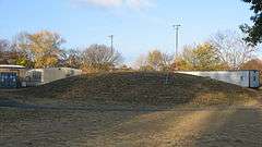
Short Woods Park Mound |
|
000000001974-10-01-0000October 1, 1974
(#74001521) |
Northern side of Sayler Park[6]
39°07′17″N 84°41′42″W / 39.121333°N 84.695°W / 39.121333; -84.695 (Short Woods Park Mound) |
|
| 79 |
Spring Grove Cemetery |
|
000000001976-05-13-0000May 13, 1976
(#76001440) |
4521 Spring Grove Ave.
39°10′11″N 84°31′32″W / 39.169722°N 84.525556°W / 39.169722; -84.525556 (Spring Grove Cemetery) |
|
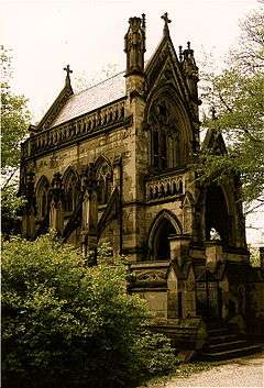
| 80 |
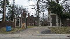
Spring Grove Cemetery Chapel |
|
000000001980-03-03-0000March 3, 1980
(#80003086) |
4521 Spring Grove Ave.
39°09′52″N 84°31′25″W / 39.164444°N 84.523611°W / 39.164444; -84.523611 (Spring Grove Cemetery Chapel) |
|
| 81 |
Story Mound |
|
000000001975-06-11-0000June 11, 1975
(#75001436) |
Gracely Dr.[7]
39°07′01″N 84°41′22″W / 39.116944°N 84.689333°W / 39.116944; -84.689333 (Story Mound) |
In Sayler Park
|
| 82 |
Peter G. Thomson House |
|
000000001979-11-29-0000November 29, 1979
(#79001860) |
5870 Belmont Ave.
39°11′56″N 84°33′16″W / 39.198889°N 84.554444°W / 39.198889; -84.554444 (Peter G. Thomson House) |
|
| 83 |
Union Baptist Cemetery |
|
000000002002-09-20-0000September 20, 2002
(#02001057) |
4933 Cleves Warsaw Pike
39°07′00″N 84°36′10″W / 39.116667°N 84.602778°W / 39.116667; -84.602778 (Union Baptist Cemetery) |
|
| 84 |
Westwood Town Center Historic District |
|
000000001974-12-02-0000December 2, 1974
(#74001515) |
Epworth and Harrison Aves.
39°08′57″N 84°35′56″W / 39.149167°N 84.598889°W / 39.149167; -84.598889 (Westwood Town Center Historic District) |
|
| 85 |
Westwood United Methodist Church |
|
000000001980-03-03-0000March 3, 1980
(#80003090) |
Epworth and Urwiler Sts.
39°09′03″N 84°35′58″W / 39.150833°N 84.599444°W / 39.150833; -84.599444 (Westwood United Methodist Church) |
|
| 86 |
Samuel and Sally Wilson House |
|
000000002000-11-15-0000November 15, 2000
(#00001295) |
1502 Aster Place
39°11′31″N 84°32′40″W / 39.191944°N 84.544444°W / 39.191944; -84.544444 (Samuel and Sally Wilson House) |
|
| 87 |
Winton Place Methodist Episcopal Church |
|
000000001980-03-03-0000March 3, 1980
(#80003091) |
700 E. Epworth Ave.
39°10′24″N 84°30′59″W / 39.173333°N 84.516389°W / 39.173333; -84.516389 (Winton Place Methodist Episcopal Church) |
|
| 88 |
Daniel Thew Wright House |
|
000000001982-09-28-0000September 28, 1982
(#82003590) |
3716 River Rd.
39°04′45″N 84°35′46″W / 39.079167°N 84.596111°W / 39.079167; -84.596111 (Daniel Thew Wright House) |
|

