| [3] |
Name on the Register |
Image |
Date listed[4] |
Location |
City or town |
Description |
|---|
| 1 |
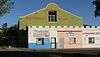
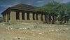
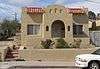
10 Cottages on Short Street |
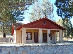
|
000000001985-08-29-0000August 29, 1985
(#85001873) |
Short Street[5]
31°20′00″N 110°56′16″W / 31.333242°N 110.937675°W / 31.333242; -110.937675 (10 Cottages on Short Street) |
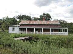
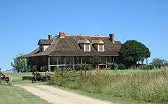
Nogales |
|
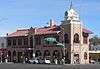
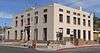
| 2 |
Arizona-Sonora Manufacturing Company Machine Shop |
|
000000001985-08-29-0000August 29, 1985
(#85001851) |
Grand Ave. at Arroyo Boulevard
31°20′24″N 110°56′17″W / 31.339913°N 110.938113°W / 31.339913; -110.938113 (Arizona-Sonora Manufacturing Company Machine Shop) |
Nogales |
|
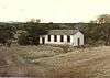
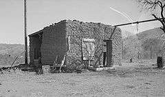
| 3 |
Atascosa Lookout House |
Upload image |
000000001988-01-28-0000January 28, 1988
(#87002462) |
Coronado National Forest
31°25′33″N 111°08′47″W / 31.425833°N 111.146389°W / 31.425833; -111.146389 (Atascosa Lookout House) |
Tubac |
Lookout cabin destroyed, other structures damaged by 2011 fire[6]
|
| 4 |
Barrio de Tubac Archeological District |
Upload image |
000000002003-09-12-0000September 12, 2003
(#03000912) |
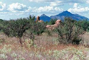
Address Restricted
|
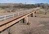
Tubac |
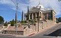
|
| 5 |
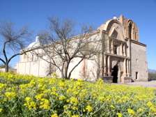
Bowman Hotel |
|
000000001985-08-29-0000August 29, 1985
(#85001852) |
245 Grand Ave.[5]
31°20′13″N 110°56′24″W / 31.33696°N 110.94012°W / 31.33696; -110.94012 (Bowman Hotel) |
Nogales |
|
| 6 |
W.G. Bowman House |
|
000000001985-08-29-0000August 29, 1985
(#85001850) |
613 Sierra[5]
31°20′34″N 110°56′13″W / 31.34287°N 110.937°W / 31.34287; -110.937 (W.G. Bowman House) |
Nogales |
|
| 7 |
Burton Building |
|
000000001985-08-29-0000August 29, 1985
(#85001848) |
253 Grand Ave.[5]
31°20′14″N 110°56′24″W / 31.33724°N 110.93989°W / 31.33724; -110.93989 (Burton Building) |
Nogales |
|
| 8 |
Cady Hall |
|
000000001992-12-02-0000December 2, 1992
(#92001635) |
346 Duquesne
31°32′20″N 110°45′14″W / 31.53881°N 110.75398°W / 31.53881; -110.75398 (Cady Hall) |
Patagonia |
Now the Patagonia Public Library.[7]
|
| 9 |
Calabasas |
|
000000001971-06-03-0000June 3, 1971
(#71000118) |
North of Nogales
31°27′41″N 110°58′00″W / 31.461389°N 110.966667°W / 31.461389; -110.966667 (Calabasas) |
Nogales |
|
| 10 |
Canelo Ranger Station |
|
000000001993-06-10-0000June 10, 1993
(#93000513) |
Forest Rd. 52B north of Canelo in the Coronado National Forest
31°33′05″N 110°30′59″W / 31.551389°N 110.516389°W / 31.551389; -110.516389 (Canelo Ranger Station) |
Canelo |
|
| 11 |
Canelo School |
|
000000001991-07-31-0000July 31, 1991
(#91000981) |
18 miles southeast of Sonoita on State Route 93
31°32′32″N 110°30′36″W / 31.542222°N 110.51°W / 31.542222; -110.51 (Canelo School) |
Canelo |
|
| 12 |
Frank F. Cranz House |
|
000000001985-08-29-0000August 29, 1985
(#85001849) |
321 Arroyo[5]
31°20′19″N 110°56′25″W / 31.338597°N 110.940321°W / 31.338597; -110.940321 (Frank F. Cranz House) |
Nogales |
|
| 13 |
Crawford Hill Historic Residential District |
|
000000001985-08-29-0000August 29, 1985
(#85001874) |
Roughly bounded by Oak St., Terrace Ave., Compound St., and Interstate 19 and Grindell
31°20′07″N 110°56′12″W / 31.335278°N 110.936667°W / 31.335278; -110.936667 (Crawford Hill Historic Residential District) |
Nogales |
|
| 14 |
George Dunbar House |
|
000000001985-08-29-0000August 29, 1985
(#85001853) |
605 Sierra[5]
31°20′34″N 110°56′14″W / 31.342684°N 110.93729°W / 31.342684; -110.93729 (George Dunbar House) |
Nogales |
|
| 15 |
James Finley House |
|
000000001974-11-19-0000November 19, 1974
(#74000462) |
7.2 miles southwest of Patagonia in the Coronado National Forest
31°27′55″N 110°42′24″W / 31.465278°N 110.706667°W / 31.465278; -110.706667 (James Finley House) |
Harshaw |
|
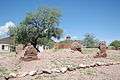
| 16 |
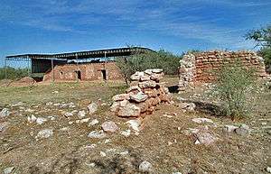
Guevavi Mission Ruins |
|
000000001971-11-05-0000November 5, 1971
(#71000119) |
6 miles north of U.S./Mexico border
31°24′36″N 110°54′10″W / 31.41°N 110.902778°W / 31.41; -110.902778 (Guevavi Mission Ruins) |
Nogales |
|
| 17 |
Sen. James A. Harrison House |
|
000000001985-08-29-0000August 29, 1985
(#85001854) |
Morley Avenue[5]
31°20′17″N 110°56′12″W / 31.338165°N 110.936683°W / 31.338165; -110.936683 (Sen. James A. Harrison House) |
Nogales |
|
| 18 |
Hotel Blanca |
|
000000001985-08-29-0000August 29, 1985
(#85001861) |
456 Morley Avenue[5]
31°20′26″N 110°56′04″W / 31.34049°N 110.93432°W / 31.34049; -110.93432 (Hotel Blanca) |
Nogales |
|
| 19 |
House at 220 Walnut Street |
|
000000001985-08-29-0000August 29, 1985
(#85001856) |
365 Walnut St.[5]
31°20′21″N 110°56′32″W / 31.339162°N 110.942285°W / 31.339162; -110.942285 (House at 220 Walnut Street) |
Nogales |
|
| 20 |
House at 334-338 Walnut Street |
|
000000001985-08-29-0000August 29, 1985
(#85001857) |
459-465 Walnut St.[5]
31°20′24″N 110°56′39″W / 31.340029°N 110.944074°W / 31.340029; -110.944074 (House at 334-338 Walnut Street) |
Nogales |
|
| 21 |
House at 665 Morley Avenue |
|
000000001985-08-29-0000August 29, 1985
(#85001858) |
Morley Avenue[5]
31°20′25″N 110°56′04″W / 31.340278°N 110.934492°W / 31.340278; -110.934492 (House at 665 Morley Avenue) |
Nogales |
|
| 22 |
Kentucky Camp Historic District |
|
000000001995-11-22-0000November 22, 1995
(#95001312) |
Near Forest Road 163 off State Route 83[8]
31°44′13″N 110°43′43″W / 31.736944°N 110.728611°W / 31.736944; -110.728611 (Kentucky Camp Historic District) |
Coronado National Forest |
|
| 23 |
Pete Kitchen Ranch |
|
000000001975-02-20-0000February 20, 1975
(#75000360) |
3.5 miles north of Nogales off U.S. Route 89
31°24′08″N 110°57′16″W / 31.402222°N 110.954444°W / 31.402222; -110.954444 (Pete Kitchen Ranch) |
Nogales |
|
| 24 |
S.H. Kress & Co. Building |
|
000000001985-08-29-0000August 29, 1985
(#85001859) |
48 N. Morley Ave.[5]
31°20′01″N 110°56′27″W / 31.333488°N 110.940920°W / 31.333488; -110.940920 (S.H. Kress & Co. Building) |
Nogales |
|
| 25 |
Las Dos Naciones Cigar Factory |
|
000000001985-08-29-0000August 29, 1985
(#85001860) |
204 Morley Ave.[5]
31°20′09″N 110°56′20″W / 31.33586°N 110.9389°W / 31.33586; -110.9389 (Las Dos Naciones Cigar Factory) |
Nogales |
|
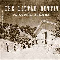
| 26 |
The Little Outfit Schoolhouse |
|
000000002009-01-08-0000January 8, 2009
(#08001275) |
571 Canelo Pass Road
31°29′43″N 110°34′25″W / 31.495278°N 110.573611°W / 31.495278; -110.573611 (The Little Outfit Schoolhouse) |
Patagonia |
Ranch school opened 1940, grades 3 to 8, teaching ideals of the West
|
| 27 |
Marsh Heights Historic District |
|
000000001985-10-29-0000October 29, 1985
(#85003407) |
Roughly bounded by Court St., Summit Ave., S. Court St., and Morley Ave.
31°20′09″N 110°56′38″W / 31.335833°N 110.943889°W / 31.335833; -110.943889 (Marsh Heights Historic District) |
Nogales |
|
| 28 |
George B. Marsh Building |
|
000000001985-08-29-0000August 29, 1985
(#85001855) |
142-154 Grand Ave.[5]
31°20′07″N 110°56′26″W / 31.335169°N 110.940677°W / 31.335169; -110.940677 (George B. Marsh Building) |
Nogales |
|
| 29 |
Mediterranean Style House |
|
000000001985-08-29-0000August 29, 1985
(#85001863) |
215 Walnut Street[5]
31°20′18″N 110°56′27″W / 31.338403°N 110.940782°W / 31.338403; -110.940782 (Mediterranean Style House) |
Nogales |
|
| 30 |
Mediterranean Style House |
|
000000001985-08-29-0000August 29, 1985
(#85001862) |
245 Walnut Street[5]
31°20′19″N 110°56′28″W / 31.33856°N 110.94108°W / 31.33856; -110.94108 (Mediterranean Style House) |
Nogales |
|
| 31 |
Hugo Miller House |
|
000000001985-08-29-0000August 29, 1985
(#85001864) |
565 Potrero[5]
31°20′33″N 110°56′08″W / 31.342449°N 110.935694°W / 31.342449; -110.935694 (Hugo Miller House) |
Nogales |
|
| 32 |
Montezuma Hotel |
|
000000001985-08-29-0000August 29, 1985
(#85001867) |
108–120 Morley Avenue[5]
31°20′03″N 110°56′25″W / 31.33417°N 110.94039°W / 31.33417; -110.94039 (Montezuma Hotel) |
Nogales |
|
| 33 |
Nogales Electric Light, Ice & Water Company Power House |
|
000000001985-08-29-0000August 29, 1985
(#85001865) |
491 Grand Avenue[5]
31°20′26″N 110°56′14″W / 31.340532°N 110.937144°W / 31.340532; -110.937144 (Nogales Electric Light, Ice & Water Company Power House) |
Nogales |
|
| 34 |
Nogales High School |
|
000000001985-08-29-0000August 29, 1985
(#85001866) |
310 W. Plum St.[5]
31°20′25″N 110°56′28″W / 31.34019°N 110.94124°W / 31.34019; -110.94124 (Nogales High School) |
Nogales |
|
| 35 |
Nogales Steam Laundry Building |
|
000000001985-08-29-0000August 29, 1985
(#85001868) |
223-219 East
31°20′03″N 110°56′19″W / 31.33426°N 110.9387°W / 31.33426; -110.9387 (Nogales Steam Laundry Building) |
Nogales |
|
| 36 |
A.S. Noon Building |
|
000000001985-08-29-0000August 29, 1985
(#85001871) |
185 Grand Avenue[5]
31°20′11″N 110°56′26″W / 31.33631°N 110.94044°W / 31.33631; -110.94044 (A.S. Noon Building) |
Nogales |
|
| 37 |
Old Nogales City Hall and Fire Station |
|
000000001980-04-03-0000April 3, 1980
(#80000772) |
136 Grand Avenue[5]
31°20′05″N 110°56′27″W / 31.33482°N 110.94086°W / 31.33482; -110.94086 (Old Nogales City Hall and Fire Station) |
Nogales |
|
| 38 |
Old Tubac Schoolhouse |
|
000000001970-11-10-0000November 10, 1970
(#70000115) |
Tubac Presidio State Historic Park[9]
31°36′43″N 111°02′48″W / 31.61197°N 111.04677°W / 31.61197; -111.04677 (Old Tubac Schoolhouse) |
Tubac |
|
| 39 |
Pennington Rural Historic Landscape |
Upload image |
000000002000-02-10-0000February 10, 2000
(#00000004) |
North of the junction of Royal Rd. and Calle Del Rio
31°20′55″N 110°50′52″W / 31.348611°N 110.847778°W / 31.348611; -110.847778 (Pennington Rural Historic Landscape) |
Nogales |
|
| 40 |
Jose Piscorski Building |
|
000000001985-08-29-0000August 29, 1985
(#85001870) |
186–190 Morley Avenue[5]
31°20′08″N 110°56′21″W / 31.33559°N 110.93915°W / 31.33559; -110.93915 (Jose Piscorski Building) |
Nogales |
|
| 41 |
Ruby |
|
000000001975-04-28-0000April 28, 1975
(#75000361) |
North of the U.S./Mexico border between Ruby and Montana peaks
31°29′01″N 111°14′14″W / 31.483611°N 111.237222°W / 31.483611; -111.237222 (Ruby) |
Ruby |
|
| 42 |
San Rafael Ranch Historic District |
|
000000002008-02-07-0000February 7, 2008
(#08000001) |
San Rafael Valley
31°21′14″N 110°36′47″W / 31.3537938°N 110.613118°W / 31.3537938; -110.613118 (San Rafael Ranch Historic District) |
Lochiel |
|
| 43 |
Santa Cruz Bridge No. 1 |
|
000000001988-09-30-0000September 30, 1988
(#88001635) |
South River Rd. over the Santa Cruz River
31°23′20″N 110°52′28″W / 31.38883°N 110.8745°W / 31.38883; -110.8745 (Santa Cruz Bridge No. 1) |
Nogales |
|
| 44 |
Santa Cruz County Courthouse |
|
000000001977-12-07-0000December 7, 1977
(#77000239) |
Court Street and Morley Avenue
31°20′11″N 110°56′16″W / 31.336414°N 110.937864°W / 31.336414; -110.937864 (Santa Cruz County Courthouse) |
Nogales |
|
| 45 |
Three Mediterranean Cottages on Pajarito Street |
|
000000001985-08-29-0000August 29, 1985
(#85001872) |
141 and 147 Pajarito, 533 Portrero[5]
31°20′30″N 110°56′11″W / 31.3418°N 110.93632°W / 31.3418; -110.93632 (Three Mediterranean Cottages on Pajarito Street) |
Nogales |
|
| 46 |
Tubac Presidio |
|
000000001970-12-02-0000December 2, 1970
(#70000116) |
Broadway and River Rd.
31°36′43″N 111°02′41″W / 31.611944°N 111.044722°W / 31.611944; -111.044722 (Tubac Presidio) |
Tubac |
|
| 47 |
Tubac Townsite Historic District |
|
000000001994-10-17-0000October 17, 1994
(#94001195) |
Roughly bounded by Tubac and Plaza Rds. and Presidio Dr.
31°36′44″N 111°02′43″W / 31.612222°N 111.045278°W / 31.612222; -111.045278 (Tubac Townsite Historic District) |
Tubac |
|
| 48 |
Tumacacori Museum |
|
000000001987-05-28-0000May 28, 1987
(#87001437) |
Tumacácori National Historical Park
31°34′04″N 111°03′04″W / 31.56781°N 111.05107°W / 31.56781; -111.05107 (Tumacacori Museum) |
Tumacacori |
|
| 49 |
Tumacacori National Monument |
|
000000001966-10-15-0000October 15, 1966
(#66000193) |
18 miles (29 km) north of Nogales on Interstate 19
31°34′07″N 111°02′58″W / 31.568611°N 111.049444°W / 31.568611; -111.049444 (Tumacacori National Monument) |
Tumacacori |
Mission site that was declared a National Monument and has since been converted to a National Historical Park
|
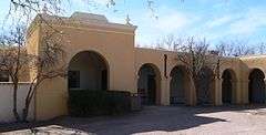
| 50 |
U.S. Custom House |
|
000000001987-08-06-0000August 6, 1987
(#87001344) |
Junction of International and Terrace Sts.
31°19′59″N 110°56′36″W / 31.3331°N 110.94327°W / 31.3331; -110.94327 (U.S. Custom House) |
Nogales |
|
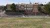
| 51 |
U.S. Custom House and U.S. Inspection Office, Morley Gate-Nogales, Arizona |
Upload image |
000000002016-08-09-0000August 9, 2016
(#14000244) |
International St. at Morley Ave.
31°19′58″N 110°56′29″W / 31.332838°N 110.941515°W / 31.332838; -110.941515 (U.S. Custom House and U.S. Inspection Office, Morley Gate-Nogales, Arizona) |
Nogales |
|
| 52 |
US Post Office and Immigration Station-Nogales Main |
|
000000001985-12-03-0000December 3, 1985
(#85003107) |
Hudgin St. and Morley Ave.
31°20′15″N 110°56′14″W / 31.33748°N 110.93733°W / 31.33748; -110.93733 (US Post Office and Immigration Station-Nogales Main) |
Nogales |
|
| 53 |
J.E. Wise Building |
|
000000001985-08-29-0000August 29, 1985
(#85001869) |
87 N. Grand Avenue[5]
31°20′04″N 110°56′30″W / 31.334447°N 110.941669°W / 31.334447; -110.941669 (J.E. Wise Building) |
Nogales |
|
.JPG)
_2.JPG)
_2.JPG)

.JPG)
.JPG)
.JPG)
_2.JPG)
_1.JPG)
.JPG)
_2.JPG)
.JPG)
_1.JPG)

.JPG)