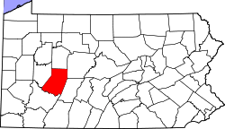
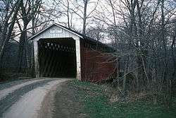
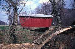
| [3] |
Name on the Register |
Image |
Date listed[4] |
Location |
Municipality |
Description |
|---|
| 1 |
Blairsville Armory |
|
000000001989-12-22-0000December 22, 1989
(#89002069) |
119 North Walnut Street
40°25′56″N 79°15′54″W / 40.432222°N 79.265000°W / 40.432222; -79.265000 (Blairsville Armory) |
Blairsville |
|
| 2 |
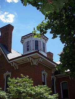
Breezedale |
|
000000001979-03-29-0000March 29, 1979
(#79002238) |
Indiana University of Pennsylvania campus
40°37′11″N 79°09′23″W / 40.619722°N 79.156389°W / 40.619722; -79.156389 (Breezedale) |
Indiana |
|
| 3 |
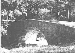
Bridge in West Wheatfield Township |
|
000000001988-06-22-0000June 22, 1988
(#88000774) |
Legislative Route 32008 over Richards Run, northeast of Robinson
40°24′11″N 79°07′45″W / 40.403056°N 79.129167°W / 40.403056; -79.129167 (Bridge in West Wheatfield Township) |
West Wheatfield Township |
|
| 4 |
Buffalo, Rochester & Pittsburgh Railway Indiana Passenger Station |
|
000000001993-05-10-0000May 10, 1993
(#93000365) |
1125 Philadelphia Street
40°37′24″N 79°09′42″W / 40.623333°N 79.161667°W / 40.623333; -79.161667 (Buffalo, Rochester & Pittsburgh Railway Indiana Passenger Station) |
Indiana |
|
| 5 |
Silas M. Clark House |
|
000000001978-06-15-0000June 15, 1978
(#78002406) |
6th Street and Wayne Avenue
40°37′12″N 79°09′05″W / 40.62°N 79.151389°W / 40.62; -79.151389 (Silas M. Clark House) |
Indiana |
|
| 6 |
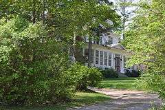
Sen. Joseph O. Clark House |
|
000000002011-09-08-0000September 8, 2011
(#11000646) |
247 1st Avenue
40°49′01″N 78°49′35″W / 40.816944°N 78.826389°W / 40.816944; -78.826389 (Sen. Joseph O. Clark House) |
Glen Campbell |
|
| 7 |
Commodore Historic District |
|
000000001994-08-26-0000August 26, 1994
(#94001057) |
Roughly bounded by Pennsylvania Route 286, Vanderbilt Avenue, Musser Street, and Fisher Avenue in Commodore
40°42′49″N 78°56′39″W / 40.713611°N 78.944167°W / 40.713611; -78.944167 (Commodore Historic District) |
Green Township |
|
| 8 |
George Diehl Homestead |
|
000000001987-04-30-0000April 30, 1987
(#87000672) |
East of U.S. Route 422 on Diehl Road, east of Indiana
40°36′29″N 78°58′43″W / 40.608056°N 78.978611°W / 40.608056; -78.978611 (George Diehl Homestead) |
Cherryhill Township |
|
| 9 |
Downtown Indiana Historic District |
|
000000001993-04-29-0000April 29, 1993
(#93000366) |
Roughly bounded by Water, 7th, and 6th Streets and Wayne Avenue
40°37′20″N 79°09′06″W / 40.622222°N 79.151667°W / 40.622222; -79.151667 (Downtown Indiana Historic District) |
Indiana |
|
| 10 |
Eliza Furnace |
|
000000001991-09-06-0000September 6, 1991
(#91001138) |
Lower Main Street, west of Vintondale
40°29′03″N 78°55′20″W / 40.484167°N 78.922222°W / 40.484167; -78.922222 (Eliza Furnace) |
Buffington Township |
Extends into Cambria County
|
| 11 |
Graff's Market |
|
000000001980-12-04-0000December 4, 1980
(#80003504) |
27 North 6th Street
40°37′25″N 79°09′02″W / 40.623611°N 79.150556°W / 40.623611; -79.150556 (Graff's Market) |
Indiana |
|
| 12 |
Harmon's Covered Bridge |
|
000000001979-08-03-0000August 3, 1979
(#79002242) |
T-488 Over S. Branch Plum Creek; 1/8 mile South of L.R. 32072, Northeast of Willet
40°44′02″N 79°10′31″W / 40.734°N 79.175381°W / 40.734; -79.175381 (Harmon's Covered Bridge) |
Washington Township |
|
| 13 |
Indiana Armory |
|
000000001991-11-14-0000November 14, 1991
(#91001698) |
621 Wayne Avenue
40°37′11″N 79°09′05″W / 40.619722°N 79.151389°W / 40.619722; -79.151389 (Indiana Armory) |
Indiana |
|
| 14 |
Indiana Borough 1912 Municipal Building |
|
000000001983-09-07-0000September 7, 1983
(#83002247) |
39 7th Street
40°37′14″N 79°09′11″W / 40.620556°N 79.153056°W / 40.620556; -79.153056 (Indiana Borough 1912 Municipal Building) |
Indiana |
|
| 15 |
Kintersburg Covered Bridge |
|
000000001979-08-03-0000August 3, 1979
(#79002241) |
South of Kintersburg
40°42′48″N 79°04′53″W / 40.713333°N 79.081389°W / 40.713333; -79.081389 (Kintersburg Covered Bridge) |
Rayne Township |
|
| 16 |
John B. McCormick House |
|
000000001974-05-03-0000May 3, 1974
(#74001787) |
West of Georgeville off Pennsylvania Route 210
40°50′19″N 79°07′00″W / 40.838611°N 79.116667°W / 40.838611; -79.116667 (John B. McCormick House) |
South Mahoning Township |
|
| 17 |
James Mitchell House |
|
000000001978-12-04-0000December 4, 1978
(#78002407) |
57 South 6th Street
40°37′18″N 79°09′02″W / 40.621667°N 79.150556°W / 40.621667; -79.150556 (James Mitchell House) |
Indiana |
|
| 18 |
Old Indiana County Courthouse |
|
000000001974-10-29-0000October 29, 1974
(#74001788) |
601 Philadelphia Street
40°37′23″N 79°09′07″W / 40.623056°N 79.151944°W / 40.623056; -79.151944 (Old Indiana County Courthouse) |
Indiana |
|
| 19 |
Old Indiana County Jail and Sheriff's Office |
|
000000001979-09-27-0000September 27, 1979
(#79002240) |
6th Street and Nixon Avenue
40°37′23″N 79°09′08″W / 40.623056°N 79.152222°W / 40.623056; -79.152222 (Old Indiana County Jail and Sheriff's Office) |
Indiana |
|
| 20 |
St. Peter's Episcopal Church and Rectory |
|
000000001988-05-09-0000May 9, 1988
(#88000463) |
36-38 West Campbell Street
40°25′55″N 79°15′56″W / 40.431944°N 79.265556°W / 40.431944; -79.265556 (St. Peter's Episcopal Church and Rectory) |
Blairsville |
|
| 21 |
Saltsburg Historic District |
|
000000001992-05-07-0000May 7, 1992
(#92000386) |
Roughly west of Plum and Walnut Alleys to the Kiskiminetas River
40°29′02″N 79°27′04″W / 40.483889°N 79.451111°W / 40.483889; -79.451111 (Saltsburg Historic District) |
Saltsburg |
|
| 22 |
John Sutton Hall |
|
000000001975-09-17-0000September 17, 1975
(#75001643) |
Indiana University of Pennsylvania campus
40°37′03″N 79°09′32″W / 40.6175°N 79.158889°W / 40.6175; -79.158889 (John Sutton Hall) |
Indiana |
|
| 23 |
Thomas Covered Bridge |
|
000000001979-08-03-0000August 3, 1979
(#79002237) |
T-414 over Crooked Creek, ½ mile south of its junction with L.R. 32061, north of Fulton Run, and southwest of Creekside
40°39′50″N 79°14′13″W / 40.663889°N 79.236944°W / 40.663889; -79.236944 (Thomas Covered Bridge) |
Armstrong Township |
|
| 24 |
Trusal Covered Bridge |
|
000000001979-08-03-0000August 3, 1979
(#79002243) |
T-406 Over Plum Creek, 1.75 miles (2.82 km) east of Five Points, and west of Willet
40°43′49″N 79°11′05″W / 40.730278°N 79.184722°W / 40.730278; -79.184722 (Trusal Covered Bridge) |
Washington Township |
|
