Moonville, Ohio


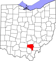
Moonville is a ghost town in southeastern Brown Township, Vinton County, Ohio, United States. Little remains of this former mining community except a few foundations, a cemetery, and an abandoned railroad tunnel which is the subject of numerous ghost stories.
History
In 1856, the Marietta and Cincinnati Railroad (M&C) was pushing through southeastern Ohio to reach Cincinnati. William Cutler, the owner of the fledgling railroad, was having financial problems and was looking to streamline and conserve money while building the railroad.
A man named Samuel Coe convinced Cutler to build the railroad on his large property for free, in exchange for a favor. The railroad would be routed through Coe's land in order to haul coal and clay off of his property. This move saved the railroad a great deal by reducing the distance the railroad traveled to Cincinnati.
Several coal mines sprang up, and it was found that there was a rich supply of it in the immediate area. Soon the mining town of Moonville was born.
Moonville never was a big town, with a peak population in the 1870s of a little over a hundred. It is thought to be named for a man named Moon who once operated a store in the town. The town was isolated in the woods and far away from any other towns; people had to walk the tracks to get from there to the nearest towns of Hope or Mineral. Vinton County is currently the least populated and most heavily forested county in Ohio; in those days it was even more wild and inhospitable.
Walking the tracks was incredibly dangerous, and was made even more hazardous by two long trestles in the area and the long Moonville tunnel. One trestle stood over Raccoon Creek less than 50 yards (46 m) away from the tunnel mouth. It is estimated that by 1920 alone, 5 or 6 people lost their lives on the bridges or within the tunnel. The last fatality was in 1986, when a 10-year-old girl was struck by a locomotive on that trestle directly in front of the tunnel.
In 1887 the M&C was bought out by the Baltimore and Ohio Railroad (B&O). It quickly became part of a vital line from St. Louis to Washington, DC. Train traffic increased dramatically, while the town entered a decline from which it never recovered. By the turn of the century the coal mines slowly started to be used up and closed down. The last family left town in 1947; by then the town itself was abandoned. By the 1960s all the buildings were gone and there was little to mark the site, other than the town cemetery and the tunnel.
The demise of the line
With the town long gone, the train traffic continued to increase on the single track line. In 1973 the B&O merged with the Chesapeake and Ohio Railway (C&O) and the Western Maryland Railway (WM) to form the Chessie System. Train traffic doubled, with as many as 14 trains per day.[1]
Railroad workers called the line the most lonesome, desolate eight miles (13 km) of track between Parkersburg, West Virginia and St. Louis. They hated the area because it was isolated and trains seemed to show up without warning. The line was "dark" (unsignaled) between Parkersburg and Cincinnati, and traffic was governed by train orders.[1]
In 1981, a signal was erected at Moonville. The railroad said that if a railroad worker needed to stop a train, they had to use this signal, not a flashlight or lantern. Engineers and conductors were ordered not to go into emergency unless the signal was red.
In June 1985, CSX announced that the line between Cumberland, Maryland and Cincinnati would be reduced to secondary status, and the last scheduled freight train passed through Moonville in August. Trains continued to run until the line was abandoned and the rails pulled up in 1988. The area remains accessible and the old roadbed provides access to the tunnel. Plans to turn the area into a formal rail trail, the Moonville Rail-Trail, have been implemented. Six and a half miles of trail are currently open, with nine and a half miles, plus twelve bridges, still needed.[2]
References
- 1 2 DePeel, Kirk (October 1993), Ghost of Moonville, retrieved 2007-06-23
- ↑ Tax Write-Off Lynchpin to Corridor Purchase, Ghost Stories Free.
External links
- Moonville, Ohio - The Haunted Train Tunnel
- Ghost of Moonville
- Ohio Exploration Society - Moonville Tunnel
- The Moonville Tunnel
- The Moonville Ghost
Coordinates: 39°18′24″N 82°19′17″W / 39.3067°N 82.3213°W
