Kani, Gifu
| Kani 可児市 | ||
|---|---|---|
| City | ||
| ||
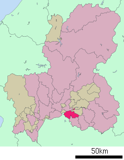
 Location of Kani in Gifu Prefecture | ||
 Kani Location in Japan | ||
| Coordinates: 35°26′N 137°4′E / 35.433°N 137.067°ECoordinates: 35°26′N 137°4′E / 35.433°N 137.067°E | ||
| Country | Japan | |
| Region | Chūbu | |
| Prefecture | Gifu Prefecture | |
| Government | ||
| • Mayor | Shigeki Tomida[1] | |
| Area | ||
| • Total | 87.60 km2 (33.82 sq mi) | |
| Population (July 2011[2]) | ||
| • Total | 97,435 | |
| • Density | 1,100/km2 (2,900/sq mi) | |
| Symbols | ||
| • Tree | Japanese Black Pine | |
| • Flower | Satsuki azalea and rose | |
| Time zone | Japan Standard Time (UTC+9) | |
| City hall address |
Hiromi 1-1, Kani-shi, Gifu-ken 509-0292 | |
| Website |
www | |
Kani (可児市 Kani-shi) is a city located in Gifu Prefecture, Japan.
As of July 2011, the city has an estimated population of 97,435 and a population density of 1,100 persons per km². The total area is 87.60 km².
The city was founded on April 1, 1982 when the town of Kani (可児町 Kani-chō) gained city status. The town of Kani was formed in 1955 by a merger of 7 towns and villages in the western part of Kani District.
On May 1, 2005, the town of Kaneyama (also from Kani District) was merged into Kani.[3]
Primary and secondary schools
International schools:
- Sociedade Educacional Brazilian School (ソシエダーデ・エドカショナル・ブラジリアン・スクール) - Brazilian school[4]
References
- ↑ 市長の部屋から. Kani official website (in Japanese). Retrieved August 11, 2011.
- ↑ 岐阜県の人口・世帯数人口動態統計調査結果. Gifu prefectural website (in Japanese). Gifu Prefecture. Retrieved September 11, 2011.
- ↑ 可児市の概要. Kani official website (in Japanese). Retrieved August 11, 2011.
- ↑ "Escolas Brasileiras Homologadas no Japão" (Archive). Embassy of Brazil in Tokyo. Retrieved on October 13, 2015.
External links
 Media related to Kani, Gifu at Wikimedia Commons
- Kani City official website (Japanese)
This article is issued from Wikipedia - version of the 9/17/2016. The text is available under the Creative Commons Attribution/Share Alike but additional terms may apply for the media files.
