Jhalawar district

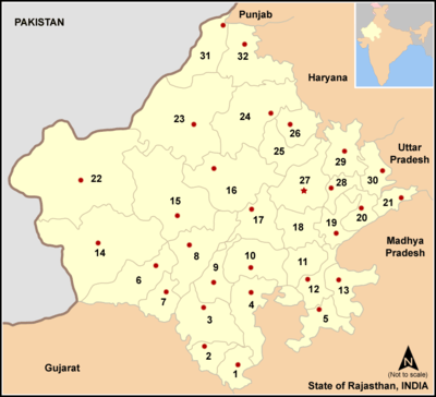
Jhalawar district (Rajasthani: झालावाड जिल्हा) is one of the 33 districts of Rajasthan state in western India. The district is bounded on the northwest by Kota district, on the northeast by Baran district, on the east by Guna district of Madhya Pradesh state, on the south by Rajgarh and Shajapur districts of Madhya Pradesh state and on the west by Ratlam, Mandsaur and Nimach districts of Madhya Pradesh state. The district occupies an area of 6928 km². The district is part of Kota division. The historical city of Jhalawar is the administrative headquarters of the district.
Origin of name
The name of the district is derived from the erstwhile princely state of Jhalawar (which literally means the abode of the Jhalas, a Rajput clan).
History
The territory of the present district belonged to the princely state of Jhalawar till India's independence in 1947. This princely state was carved out from another princely state of Kota on April 8, 1838 by a treaty between the British and the rulers of Kota state.
Geography
The district lies in the Hadoti region in southeast Rajasthan, on the edge of Malwa Plateau. The Kali Sindh River flows northward through the center of the district.
Economy
In 2006 the Ministry of Panchayati Raj named Jhalawar one of the country's 250 most backward districts (out of a total of 640).[1] It is one of the twelve districts in Rajasthan currently receiving funds from the Backward Regions Grant Fund Programme (BRGF).[1]
Divisions
The district is divided into six sub-divisions: Jhalawar, Aklera, Bhawani Mandi, Pirawa, Khanpur and Manohar Thana.
Demographics
According to the 2011 census Jhalawar district has a population of 1,411,327,[2] roughly equal to the nation of Swaziland[3] or the US state of Hawaii.[4] This gives it a ranking of 349th in India (out of a total of 640).[2] The district has a population density of 227 inhabitants per square kilometre (590/sq mi) .[2] Its population growth rate over the decade 2001-2011 was 19.57%.[2] Jhalawar has a sex ratio of 945 females for every 1000 males,[2] and a literacy rate of 62.13%.[2]
Jhalawar district is home to many tribes, including Gurjars, Meenas and Bhils.
References
- 1 2 Ministry of Panchayati Raj (September 8, 2009). "A Note on the Backward Regions Grant Fund Programme" (PDF). National Institute of Rural Development. Retrieved September 27, 2011.
- 1 2 3 4 5 6 "District Census 2011". Census2011.co.in. 2011. Retrieved 2011-09-30.
- ↑ US Directorate of Intelligence. "Country Comparison:Population". Retrieved 2011-10-01.
Swaziland 1,370,424
- ↑ "2010 Resident Population Data". U. S. Census Bureau. Retrieved 2011-09-30.
Hawaii 1,360,301
External links
Coordinates: 24°36′N 76°09′E / 24.600°N 76.150°E

