Holden, Alberta
| Holden | |
|---|---|
| Village | |
| Village of Holden | |
|
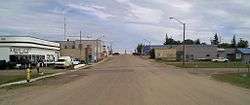
Main street | |
| Motto: Share the Charm of Country Living | |
 Holden | |
| Coordinates: 53°13′59″N 112°14′6″W / 53.23306°N 112.23500°WCoordinates: 53°13′59″N 112°14′6″W / 53.23306°N 112.23500°W | |
| Country |
|
| Province |
|
| Region | Central Alberta |
| Census Division | No. 10 |
| Municipal district | Beaver County |
| Incorporated[1] | |
| • Village | April 14, 1909 |
| Government[2] | |
| • Mayor | Mark Giebelhaus |
| • Governing body | Holden Village Council |
| • CAO | Katherine Whiteside |
| Area (2011)[3] | |
| • Total | 1.70 km2 (0.66 sq mi) |
| Elevation | 686 m (2,251 ft) |
| Population (2011)[3] | |
| • Total | 381 |
| • Density | 224.3/km2 (581/sq mi) |
| Time zone | MST (UTC-7) |
| • Summer (DST) | MDT (UTC-6) |
| Postal Code | T0B 2C0 |
| Area code(s) | 780 |
| Highways |
14 855 |
| Waterways | Creeks in the area form the head of Vermilion River |
| Website | Official website |
Holden is a village in central Alberta, Canada. It is located south of Vegreville. The village is named after former Alberta MLA James Holden.
Demographics
In the 2011 Census, the Village of Holden had a population of 381 living in 182 of its 213 total dwellings, a -4.3% change from its 2006 population of 398. With a land area of 1.7 km2 (0.66 sq mi), it had a population density of 224.1/km2 (580.5/sq mi) in 2011.[3]
In 2006, Holden had a population of 398 living in 186 dwellings, a 6.4% increase from 2001. The village has a land area of 1.70 km2 (0.66 sq mi) and a population density of 234.4 inhabitants per square kilometer.[4]
Notable people
- Dale Armstrong, drag racer
- Ted Newall, businessman
See also
References
- ↑ "Location and History Profile: Village of Holden" (PDF). Alberta Municipal Affairs. October 21, 2016. p. 372. Retrieved October 23, 2016.
- ↑ "Municipal Officials Search". Alberta Municipal Affairs. November 18, 2016. Retrieved November 21, 2016.
- 1 2 3 "Population and dwelling counts, for Canada, provinces and territories, and census subdivisions (municipalities), 2011 and 2006 censuses (Alberta)". Statistics Canada. 2012-02-08. Retrieved 2012-02-08.
- ↑ Statistics Canada. "Canada 2006 Census: Holden - Community Profile". Retrieved 2007-06-08.
External links
 |
Mundare | Vegreville | Innisfree |  |
| Ryley | |
Viking | ||
| ||||
| | ||||
| Bawlf | Daysland | Killam |
This article is issued from Wikipedia - version of the 11/7/2016. The text is available under the Creative Commons Attribution/Share Alike but additional terms may apply for the media files.

