Derry, Louisiana
| Derry, Louisiana | |
|---|---|
| Unincorporated community | |
|
Abandoned school near Derry in Natchitoches Parish | |
 Derry, Louisiana | |
| Coordinates: 31°32′03″N 92°56′52″W / 31.53417°N 92.94778°WCoordinates: 31°32′03″N 92°56′52″W / 31.53417°N 92.94778°W | |
| Country | United States |
| State | Louisiana |
| Parish | Natchitoches |
| Elevation[1] | 105 ft (32 m) |
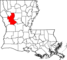
Derry is an unincorporated community in Natchitoches Parish, Louisiana, United States, located on Louisiana Highway 1.[1] It is the closest town to Magnolia Plantation, a National Historic Landmark.
There is an abandoned school adjacent to the St. Matthew Baptist Church off Louisiana Highway 119 near Derry.
References
- 1 2 "Derry, Louisiana". Geographic Names Information System. United States Geological Survey. Retrieved October 30, 2015.
This article is issued from Wikipedia - version of the 10/30/2015. The text is available under the Creative Commons Attribution/Share Alike but additional terms may apply for the media files.
