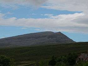
Beinn Spionnaidh
| Beinn Spionnaidh | |
|---|---|
 | |
| Highest point | |
| Elevation | 773 m (2,536 ft) |
| Listing | Corbett, Marilyn |
| Geography | |
| Location | Assynt, Scotland |
| Topo map | OS Landranger 9 |
Beinn Spionnaidh is a mountain of 773 m in Sutherland, the northwestern tip of the Scottish Highlands. It is a Corbett located west of Loch Eriboll and northeast of Cranstackie and Foinaven. It is like its neighbours in that the top, a 1 km long whaleback running southwest to northeast, is covered with loose, broken quartzite. A steep spur to the northwest, Cioch Mhor, provides one route to the top, and good views of the Kyle of Durness; the gentler slope to the southeast is tiring due to the loose rock on the upper section.
References
- The Corbetts and Other Scottish Hill, (SMC Guide) ISBN 0-907521-29-0
- Climbing the Corbetts, Hamish Brown, ISBN 1-898573-08-5
This article is issued from Wikipedia - version of the 3/1/2013. The text is available under the Creative Commons Attribution/Share Alike but additional terms may apply for the media files.