Ashby, Western Australia
| Ashby Perth, Western Australia | |||||||||||||
|---|---|---|---|---|---|---|---|---|---|---|---|---|---|
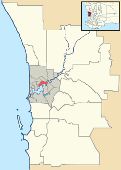
 Ashby Location in metropolitan Perth | |||||||||||||
| Coordinates | 31°43′59″S 115°47′53″E / 31.733°S 115.798°ECoordinates: 31°43′59″S 115°47′53″E / 31.733°S 115.798°E | ||||||||||||
| Population | 2,394 (2011 census)[1] | ||||||||||||
| • Density | 1,600/km2 (4,130/sq mi) | ||||||||||||
| Established | 1990s | ||||||||||||
| Postcode(s) | 6065 | ||||||||||||
| Area | 1.5 km2 (0.6 sq mi) | ||||||||||||
| Location | 26 km (16 mi) N of Perth CBD | ||||||||||||
| LGA(s) | City of Wanneroo | ||||||||||||
| State electorate(s) | Wanneroo | ||||||||||||
| Federal Division(s) | Cowan | ||||||||||||
| |||||||||||||
Ashby is a suburb of Perth, the capital city of Western Australia 26 kilometres (16 mi) north of Perth's central business district. Its local government area is the City of Wanneroo.
The suburb came into being in the late 1990s as a subdivision of Wanneroo, and was named in 1997 after a local landowner, Mr E E Ashby, who owned land in the area in 1913.[2]
Geography
Ashby is a triangular suburb and is bounded by Wanneroo Road to the southwest, Pinjar Road to the southeast and Conti Road to the north. About 40% of the suburb has been developed for residential purposes.[3]
References
- ↑ Australian Bureau of Statistics (31 October 2012). "State Suburbs: Ashby". 2011 Census QuickStats. Retrieved 4 July 2012.
- ↑ Western Australian Land Information Authority. "History of metropolitan suburb names – A". Retrieved 2008-02-15.
- ↑ Department of Land Information. StreetSmart® Perth Street Directory (54 (2013) ed.). West Australian Newspapers Ltd. pp. Map 221. ISBN 978-0-909439-67-5.
This article is issued from Wikipedia - version of the 8/22/2016. The text is available under the Creative Commons Attribution/Share Alike but additional terms may apply for the media files.
