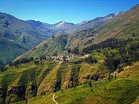
Huayna Cotoni
| Huayna Cotoni | |
|---|---|
 Huayna Cotoni Peru | |
| Highest point | |
| Elevation | 5,463 m (17,923 ft) [1] |
| Coordinates | 12°16′02″S 75°59′04″W / 12.26722°S 75.98444°WCoordinates: 12°16′02″S 75°59′04″W / 12.26722°S 75.98444°W [2] |
| Geography | |
| Location | Peru, Lima Region |
| Parent range | Andes, Cordillera Central, Pichqa Waqra |
Huayna Cotoni or Wayna Qutuni(Aymara wayna young (man), bachelor, qutu heap, pile,[3] -ni a suffix to indicate ownership ("the one with a heap"), Qutuni a neighboring mountain, "young Qutuni", hispanicized spellings Huayna Cotoni, Huaynacotoni, Huaynacutuni) is a mountain in the Cordillera Central in the Andes of Peru, about 5,463 metres (17,923 ft) high. It is located in the Lima Region, Yauyos Province, on the border of the districts of Ayaviri, Quinches and Tanta. Huayna Cotoni is in a sub-range of the Cordillera Central named Pichqa Waqra (Quechua for "five horns", also spelled Pichcahuajra) on the southern border of the Nor Yauyos-Cochas Landscape Reserve.[4] It lies between the lakes named Tikllaqucha in the north and Huayna Cotoni in the south, southwest of the peak of Qutuni and south of Aqupallqa.[5]

References
- ↑ peakery.com, retrieved on September 24, 2013
- ↑ ign.gob.pe IGN, Peru
- ↑ www.katari.org Aymara-Spanish dictionary
- ↑ ParksWatch, Park Profile - Peru Nor Yauyos – Cochas Landscape Reserve, p. 6
- ↑ escale.minedu.gob.pe - UGEL map of the Yauyos Province (Lima Region)