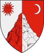
Târgu Ocna
| Târgu Ocna | ||
|---|---|---|
| Town | ||
| ||
 Târgu Ocna Location of Târgu Ocna | ||
| Coordinates: 46°16′48″N 26°37′12″E / 46.28000°N 26.62000°ECoordinates: 46°16′48″N 26°37′12″E / 46.28000°N 26.62000°E | ||
| Country |
| |
| County | Bacău County | |
| Status | Town | |
| Government | ||
| • Mayor | Silochi Stefan (Partidul Social Democrat) | |
| Area | ||
| • Total | 48.90 km2 (18.88 sq mi) | |
| Population (2011) | ||
| • Total | 11,300 | |
| Time zone | EET (UTC+2) | |
| • Summer (DST) | EEST (UTC+3) | |
| Website | website= http://www.targuocna-portal.ro | |
Târgu Ocna (Romanian pronunciation: [ˌtɨrɡu ˈokna]) is a town in Bacău County, Romania, situated on the left bank of the Trotuş River, an affluent of the Siret, and on a branch railway which crosses the Ghimeş Pass from Moldavia into Transylvania. Târgu Ocna is built among the Carpathian Mountains on bare hills formed of rock salt. In fact the English translation of Ocna is salt mine.
Târgu Ocna's main industry is salt production, as it is the largest provider in Moldavia. Other industries include wood processing, coal mining, steel producing, and petroleum-based industries.
The town administers two villages, Poieni and Vâlcele.
| Historical population | ||
|---|---|---|
| Year | Pop. | ±% |
| 1900 | 8,033 | — |
| 1912 | 7,989 | −0.5% |
| 1930 | 12,588 | +57.6% |
| 1948 | 9,796 | −22.2% |
| 1956 | 11,227 | +14.6% |
| 1966 | 11,647 | +3.7% |
| 1977 | 12,603 | +8.2% |
| 1992 | 16,071 | +27.5% |
| 2002 | 14,184 | −11.7% |
| 2011 | 11,300 | −20.3% |
| Source: Census data | ||
Natives
- Gabriela Adameşteanu, writer
- Sorin Antohi, political scientist
- Costel Caşcaval, actor
- Costache Negri, writer
- Ion Talianu, actor
| Wikimedia Commons has media related to Târgu Ocna. |
This article is issued from Wikipedia - version of the 1/6/2015. The text is available under the Creative Commons Attribution/Share Alike but additional terms may apply for the media files.

