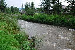
Săpânța River
| Săpânța River | |
| River | |
 | |
| Countries | Romania |
|---|---|
| Counties | Maramureş County |
| Tributaries | |
| - left | Valea Mlăcii, Nadoşa |
| - right | Săpâncioara, Runcu |
| Villages | Săpânța |
| Source | |
| - location | Gutâi Mountains, confluence of headwaters Săpâncioara and Valea Mlăcii |
| Mouth | Tisza |
| - location | Săpânța |
| - coordinates | 47°59′23″N 23°41′43″E / 47.9897°N 23.6954°ECoordinates: 47°59′23″N 23°41′43″E / 47.9897°N 23.6954°E |
| Length | 20 km (12 mi) |
| Basin | 135 km2 (52 sq mi) |
| Progression | Tisza→ Danube→ Black Sea |
The Săpânța River is a left tributary of the river Tisza in Romania. It discharges into the Tisza in Săpânța, on the border with Ukraine. It starts at the confluence of headwaters Săpâncioara and Valea Mlăcii.
References
- Administrația Națională Apelor Române - Cadastrul Apelor - București
- Institutul de Meteorologie și Hidrologie - Rîurile României - București 1971
- Capitolul 3 Apa
- Trasee turistice - județul Maramureș
This article is issued from Wikipedia - version of the 7/11/2016. The text is available under the Creative Commons Attribution/Share Alike but additional terms may apply for the media files.