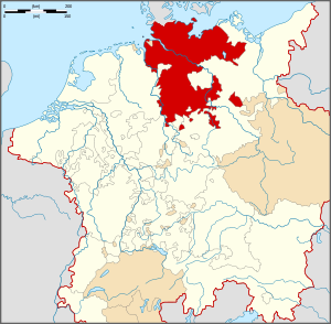
County of Regenstein
| County of Regenstein | ||||||||||
| Grafschaft Regenstein | ||||||||||
| State of the Holy Roman Empire | ||||||||||
| ||||||||||
|
| ||||||||||
| Capital | Derenburg | |||||||||
| Government | County | |||||||||
| Historical era | Middle Ages | |||||||||
| • | Partitioned from County of Blankenburg |
1160 1160 | ||||||||
| • | County of Regenstein-Heimburg |
1366 | ||||||||
| • | Personal union with Blankenburg |
1368 | ||||||||
| • | Joined Lower Saxon Circle |
1500 | ||||||||
| • | Fell to Bishopric of Halberstadt |
1599 1599 | ||||||||
| • | Acquired by Brandenburg-Prussia |
1648 | ||||||||
| ||||||||||
The County of Regenstein was a mediaeval statelet of the Holy Roman Empire.
History

The counts of Regenstein Castle near Heimburg were first mentioned in an 1169 deed, with Count Conrad of Regenstein, son of Poppo I, Count of Blankenburg (1095–1164), himself a nephew of Count Reinhard, Bishop of Halberstadt from the Ripuarian House of Reginbodo.[1]
The most renowned Count of Regenstein was Albert II (1310–49),[2] who in the 1330s was frequently in dispute with the leaders of the surrounding estates like the Halberstadt bishops and the abbess of Quedlinburg. These tales were romanticised in the ballad The Robber Count (German: Der Raubgraf) by Gottfried August Bürger, melodized by Johann Philipp Kirnberger and the novel of the same name by Julius Wolff.[3]
In the 15th century the comital family relocated its seat to Blankenburg; Regenstein Castle lapsed and was left to ruin. The last scion of the comital family, Count John Ernest, died in 1599. With Blankenburg it fell back to the Bishopric of Halberstadt. Shortly thereafter Blankenburg and Regenstein were separated. Regenstein remained with Halberstadt, while Blankenburg was annexed and held by the Dukes of Brunswick-Wolfenbüttel.
Counts of Regenstein
- Siegfried (-1073), brother of Konrad, Count of Blankenburg-Regenstein
- Henry (-1235), son
- Siegfried II (-1251), son
- Ulric, Count of Regenstein-Heimburg (-1267), brother
- Ulric III (1287–1322)
- Albert II (1310–1349), son
- Albert III (1341–1365), son
- John Ernest, Count of Blankenburg and Regenstein (-1599)
Notes
The following articles do not yet exist on the English Wikipedia, but do exist on the German Wikipedia:
Coordinates: 51°48′54″N 10°57′36″E / 51.815°N 10.960°E
References
- ↑ Reginbodonen (German)
- ↑ Albrecht II. von Regenstein (German)
- ↑ Julius Wolff (German)
