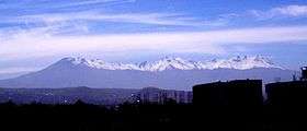
Pichu Pichu
| Pichu Pichu | |
|---|---|
 | |
| Highest point | |
| Elevation | 5,664 m (18,583 ft) |
| Listing | List of mountains in the Andes |
| Coordinates | 16°26′28″S 71°14′25″W / 16.4411388889°S 71.2403888889°WCoordinates: 16°26′28″S 71°14′25″W / 16.4411388889°S 71.2403888889°W |
| Geography | |
 Pichu Pichu Location of Pichu Pichu within Peru. | |
| Location | Arequipa, Peru |
| Parent range | Andes |
Pichu Pichu[1][2][3] or Picchu Picchu[4] (possibly from Quechua pikchu pyramid; mountain or prominence with a broad base which ends in sharp peaks,[5] the reduplication signifies there is a group or a complex of something, "a group of peaks") is an inactive[3] eroded volcano[2] in the Andes of Peru. It is located in the Arequipa Region, Arequipa Province, on the border of Pocsi and Tarucani districts.[6] Pikchu Pikchu reaches a height of 5,664 metres (18,583 ft)[1] and is part of Salinas and Aguada Blanca National Reserve.[3]
References
- 1 2 Peru 1:100 000, Characato (33-t). IGN (Instituto Geográfico Nacional - Perú).
as Nevado Pichu Pichu
- 1 2 "Nevado Pichu Pichu : Climbing, Hiking & Mountaineering : SummitPost". www.summitpost.org. Retrieved 2016-06-03.
- 1 2 3 "Nevado Pichu Pichu". Inventario Turístico del Perú (in Spanish). MINCETUR. Retrieved 2016-06-03.
- ↑ Cardelús, Borja; Guijarro, Timoteo (2013). Cápac Ñan. El Gran Camino Inca (in Spanish). Penguin Random House - Grupo Editorial Perú. p. 352. ISBN 9789972848711.
- ↑ Diccionario Quechua - Español - Quechua, Academía Mayor de la Lengua Quechua, Gobierno Regional Cusco, Cusco 2005
- ↑ escale.minedu.gob.pe - UGEL map of the Arequipa Province (Arequipa Region)
External links
This article is issued from Wikipedia - version of the 6/4/2016. The text is available under the Creative Commons Attribution/Share Alike but additional terms may apply for the media files.