Oregon City Municipal Elevator
|
Oregon City Municipal Elevator | |
 | |
   | |
| Location |
610 Bluff Street Oregon City, Oregon |
|---|---|
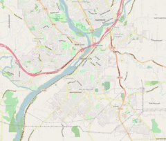
| Coordinates | 45°21′24.9″N 122°36′27.7″W / 45.356917°N 122.607694°WCoordinates: 45°21′24.9″N 122°36′27.7″W / 45.356917°N 122.607694°W |
| Built | 1955 |
| Built by | Otis Elevator Company |
| Architect | Gordon E. Trapp |
| NRHP Reference # | 14000181[1] |
| Added to NRHP | May 15, 2014[1] |
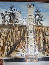
The Oregon City Municipal Elevator is a 130-foot (40 m)[2] elevator which connects two neighborhoods in Oregon City in the U.S. state of Oregon. It is the only outdoor municipal elevator in the U.S.[3] and one of only four in the world.[2] The upper portion contains an observation deck which accounts for its flying saucer appearance.
There have been two elevators at this location. The current elevator was built in 1954–55,[4] and it was added to the National Register of Historic Places in 2014.[1]
Geography of Oregon City
The city of Oregon City includes dramatic changes in elevation. The city's central business district is sandwiched between the Willamette River and a basalt cliff, and is only several blocks wide. At the top of the 90-foot (27 m) cliff lies another neighborhood. Indian trails negotiating the cliffside were used originally to connect the two areas beginning with the founding of the town in 1829.[5] Numerous stairways were built in the mid-1860s,[6] but a better transportation solution was needed.
Initial elevator

A bond measure to raise $12,000 for construction was put to voters in July 1912. This levy failed, but a second referendum passed in December of the same year. The elevator opened to the public in 1915, delayed by politics. The original elevator was water-powered and took three minutes for the ride. The elevator was so popular that most of the cliffside stairs were removed. The elevator was converted to electric drive in 1924, which reduced the time to 30 seconds.[6]
Current elevator


After 40 years of service, a replacement was authorized by a $175,000 bond by a special election held May 1952. The specifications called for the design to be "as plain as possible, without ornament".[6] The new elevator, designed by Gordon E. Trapp, engineered by Ervin Aksel Sööt, and manufactured by Otis Elevator, featured push-button operation and automatic doors,[2] and shortened the ride to about 15 seconds.[4] It was dedicated May 5, 1955 and remains in service today.[2][6] The machine room was upgraded with a digital controller in 2004.[2]
The elevator essentially serves as 7th Street, as both entrances (top and bottom) are on S. 7th Street, a major thoroughfare on both ends. The lower entrance is at the intersection of 7th Street (Oregon Route 43) and Railroad Avenue; a short pedestrian tunnel runs under the Union Pacific Railroad tracks, and into the elevator itself. The upper entrance is accessed from S. High Street, a short distance from the intersection with 7th Street and Singer Hill (a road which descends the side of the cliff, connecting 7th Street on the top with S. 10th Street on the bottom). The upper level includes an observation deck, from which one can see Willamette Falls, the Oregon City Bridge, and the Abernethy Bridge.
The elevator has an operator. It is open 6:45 AM to 7 PM, Monday through Saturday; 11 AM to 7 PM Sunday Pacific Time.[7] There is no charge to use the elevator. It was carrying an average of 500 people per day as of 1989,[4] and by 2008 this had grown to nearly 800.[2] Ridership is as high as 1,300 people per day during the city's summer tourist season.[2]
Currently the elevator has received a "facelift" of sorts at the hands of numerous private and public partnerships and a National Endowment for the Arts Our Town grant. The "Illuminate Oregon City" project has turned the elevator in to a massive video screen, showcasing video and images from area sites. The video mapping program is slated to run until 2015.[8]
See also
References
- 1 2 3 "Weekly list of actions taken on properties: 5/19/14 through 5/23/14". National Park Service. May 30, 2014. Retrieved 2014-06-12.
- 1 2 3 4 5 6 7 Deanna Hart, "Going to the next level," American City and County Magazine, June 2008, page 62
- ↑ "Mount Hood Territory History, Museums, Historic Sites and Transportation". Clackamas County Tourism Development Council. Retrieved 2006-12-12.
- 1 2 3 Bella, Rick (October 5, 1989). "Getting a lift out of life". The Oregonian, p. B3.
- ↑ Susan Hauser (January 2004). "Oregon City - The town at the end of the Oregon Trail is still a destination for travelers". VIA, the bimonthly travel magazine of the California State Automobile Association.
- 1 2 3 4 "Oregon City Municipal Elevator". End of the Oregon Trail Interpretive Center. Retrieved 2006-12-12.
- ↑ According to sign posted at bottom of elevator, see this photo.
- ↑ "Illuminate Oregon City". Retrieved 2014-01-23.
External links
| Wikimedia Commons has media related to Oregon City Municipal Elevator. |
- Oregon City Municipal Elevator at city's Department of Public Works web page