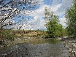
Niraj River
| Râul Niraj | |
| Nyárád, Niersch | |
| River | |
 | |
| Countries | Romania |
|---|---|
| Counties | Mureș County |
| Towns | Miercurea Nirajului, Ungheni |
| Source | confluence of headwaters Nirajul Mare and Nirajul Mic. |
| - location | Сâmpu Cetății |
| Mouth | Mureș |
| - location | near Ungheni |
| - coordinates | 46°28′52″N 24°25′37″E / 46.481°N 24.427°ECoordinates: 46°28′52″N 24°25′37″E / 46.481°N 24.427°E |
| Length | 82 km (51 mi) |
| Basin | 651 km2 (251 sq mi) |
| Progression | Mureș→ Tisza→ Danube→ Black Sea |
The Niraj (Hungarian: Nyárád; German: Niersch) is a river in the Gurghiu Mountains, Mureş County, northern Romania. Its name originates from the Hungarian word nyár, meaning "poplar". It is a left tributary of the river Mureș. It starts at the confluence of headwaters Nirajul Mare and Nirajul Mic.. It flows through the villages Câmpu Cetății, Eremitu, Mătrici, Călugăreni, Dămieni, Grâușorul, Vărgata, Miercurea Nirajului, Dumitreștii, Gălești, Bolintineni, Păsăreni, Murgești, Acățari, Stejeriș, Crăciunești, Ilieni, Gheorghe Doja, Leordeni and joins the Mureș near the town Ungheni.
Tributaries
The following rivers are tributaries to the river Niraj:
- Left: Nirajul Mic, Călugăreni, Nirajul Mic, Dorna, Pârâul Mare, Văleni, Tirimia
- Right: Nirajul Mare, Diceaiul, Hodoș, Valea, Tâmpa, Maiad
References
- Administrația Națională Apelor Române - Cadastrul Apelor - București
- Institutul de Meteorologie și Hidrologie - Rîurile României - București 1971
- ICPA - Comune vulnerabile - județul Mureș
- Trasee turistice - județul Mureș
Maps
This article is issued from Wikipedia - version of the 8/16/2016. The text is available under the Creative Commons Attribution/Share Alike but additional terms may apply for the media files.