Milton, Pennsylvania
| Milton, Pennsylvania | ||
|---|---|---|
| Borough | ||
|
Milton's old railroad depot and current borough office. | ||
| ||
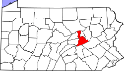
 Milton, Pennsylvania Location within the state of Pennsylvania | ||
| Coordinates: 41°00′43″N 76°51′15″W / 41.01194°N 76.85417°WCoordinates: 41°00′43″N 76°51′15″W / 41.01194°N 76.85417°W | ||
| Country | United States | |
| State | Pennsylvania | |
| County | Northumberland | |
| Settled | 1770 | |
| Incorporated (borough) | 1817 | |
| Area | ||
| • Total | 3.8 sq mi (9.7 km2) | |
| • Land | 3.5 sq mi (9.0 km2) | |
| • Water | 0.3 sq mi (0.7 km2) | |
| Elevation | 505 ft (154 m) | |
| Population (2010) | ||
| • Total | 7,042 | |
| • Density | 1,853.16/sq mi (725.98/km2) | |
| Time zone | Eastern (EST) | |
| • Summer (DST) | EDT (UTC) | |
| Zip code | 17847 | |
| Area code(s) | 570 | |
| Website |
www | |
Milton is a borough in Northumberland County, Pennsylvania, on the West Branch Susquehanna River, 50 miles (80 km) north of Harrisburg. It is about 10 miles upriver from the mouth of the West Branch Susquehanna River and about 30 miles downriver of Williamsport.
History
Settled in 1770, it was incorporated in 1817, and is governed by a charter that was revised in 1890. Formerly, its extensive manufacturing plants included car and woodworking machinery shops; rolling, flour, knitting, planing, and saw mills; washer, nut, and bolt works; and furniture, shoe, couch, nail, fly net, bamboo novelty, and paper-box factories. In 1900, 6,175 people lived in Milton. In 1940, 8,313 people lived there. The population was 6,650 at the 2000 census, and 7,042 at the 2010 census.
The Milton Historic District, Pennsylvania Canal and Limestone Run Aqueduct, Milton Armory, and Milton Freight Station are listed on the National Register of Historic Places.[1]
Industry
At the turn of the 20th century, several industrial and manufacturing companies were located within the borough. The six principal industries were Samuel J. Shimer & Sons, the Milton Manufacturing Company, the American Car and Foundry Company, the F.A. Godcharles Company, the Sydney H. Souter Silk Company, and the West Branch Novelty Company. Many smaller businesses flourished in parallel with the large manufacturing companies during this early period, which made the borough an industrial center in the region at the time.
Geography
Milton is located at 41°1′3″N 76°51′3″W / 41.01750°N 76.85083°W (41.017413, −76.850758).[3] According to the United States Census Bureau, the borough has a total area of 3.8 square miles (9.8 km2), of which, 3.5 square miles (9.1 km2) of it is land and 0.3 square miles (0.78 km2) of it (7.73%) is covered by water.
Milton's terrain is mostly flat with some scattered hills. The borough is home to the Milton State Park, and is served by Pennsylvania Route 254, Pennsylvania Route 405, and Pennsylvania Route 642.[4]
Demographics
| Historical population | |||
|---|---|---|---|
| Census | Pop. | %± | |
| 1820 | 1,016 | — | |
| 1830 | 1,270 | 25.0% | |
| 1840 | 1,508 | 18.7% | |
| 1850 | 1,649 | 9.4% | |
| 1860 | 1,702 | 3.2% | |
| 1870 | 1,909 | 12.2% | |
| 1880 | 2,102 | 10.1% | |
| 1890 | 5,317 | 152.9% | |
| 1900 | 6,175 | 16.1% | |
| 1910 | 7,460 | 20.8% | |
| 1920 | 8,638 | 15.8% | |
| 1930 | 8,552 | −1.0% | |
| 1940 | 8,313 | −2.8% | |
| 1950 | 8,578 | 3.2% | |
| 1960 | 7,972 | −7.1% | |
| 1970 | 7,723 | −3.1% | |
| 1980 | 6,730 | −12.9% | |
| 1990 | 6,746 | 0.2% | |
| 2000 | 6,650 | −1.4% | |
| 2010 | 7,042 | 5.9% | |
| Est. 2015 | 6,928 | [5] | −1.6% |
| Sources:[6][7][8] | |||

As of the census[7] of 2000, 6,650 people, 2,762 households, and 1,748 families resided in the borough. The population density was 1,922.6 people per square mile (742.1/km²). The 3,000 housing units averaged 867.3 per square mile (334.8/km²). The racial makeup of the borough was 94.81% White, 2.38% African American, 0.12% Native American, 0.21% Asian, 0.95% from other races, and 1.53% from two or more races. Hispanics or Latinos of any race were 2.17% of the population.
2010 Census
As of 2010, the 7,042 people populating the borough were 88.4% White, 4.5% African American, and 6.2% Hispanic. The community has a growing Puerto Rican population. The Hispanic population has tripled since the 2000 census.
Of the 2,762 households, 29.9% had children under the age of 18 living with them, 48.3% were married couples living together, 10.9% had a female householder with no husband present, and 36.7% were not families. About 32.6% of all households were made up of individuals, and 15.3% had someone living alone who was 65 years of age or older. The average household size was 2.29, and the average family size was 2.89.
In the borough, the population was distributed as 23.7% under the age of 18, 7.2% from 18 to 24, 27.6% from 25 to 44, 22.6% from 45 to 64, and 18.9% who were 65 years of age or older. The median age was 39 years. For every 100 females, there were 88.7 males. For every 100 females age 18 and over, there were 84.2 males.
The median income for a household in the borough was $30,252, and for a family was $38,438. Males had a median income of $30,636 versus $21,384 for females. The per capita income for the borough was $16,980. About 10.6% of families and 13.5% of the population were below the poverty line, including 19.0% of those under age 18 and 13.1% of those age 65 or over.
Notable people
- James Curtis Hepburn (13 March 1815) – missionary and linguist; deviser of the Hepburn system for writing Japanese in Roman characters
- James Pollock (September 11, 1810 – April 19, 1890) – Congressman (1844–1849); Governor of Pennsylvania (1855–1858); Director of the Philadelphia Mint (1861–1866 and 1869–1873); buried in Milton Cemetery[9]
- Fay Kellogg (1871–1918) – described as the foremost woman architect in the United States in the early 20th century
- Ettore Boiardi (1897–1985) – famous for his brand of food products, named Chef Boyardee
Education

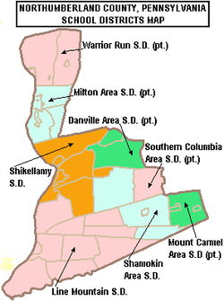
The local public school system, Milton Area School District, serves just over 2000 students. Enrollment is projected by the Pennsylvania Department of Education to decline significantly over the next 10 years. In 2005, Standard & Poors reported the district's student to teacher ratio was 13.9 to 1.[10]
Milton High School has an 59.9% graduation rate according to the district report card 2005–2006. In 11th grade, 46.4% were proficient in math. For reading, 43.2% were proficient in 2005–2006. The high school is ranked 600th out of 606 public high schools in Pennsylvania.
In 2007, the Pittsburgh Business Times ranked the district 356th out of 499 Pennsylvania school districts based on three years of Pennsylvania System of Student Assessment test scores.[11]
The Montandon Elementary School earned a No Child Left Behind Blue Ribbon Award for outstanding performance on the Pennsylvania System of School Assessment for 2004. The students scored 97.7% proficient or better in mathematics and 72.4% proficient in reading.[12]
The Milton Area School Board set the budget at $24.8 million for 2011–2013. The board levies a variety of taxes to support its programs. Taxes include 48.39 mills real estate tax in 2007 for district properties located in Northumberland County. For properties located in White Deer Township, Union County, the real estate property tax was set at 10.10 mills.[13]
By law, the local public school must provide transportation to schools within 10 mi (16 km) of the borders of the school district at no charge to the student.[14]
Several alternative schools, including parochial and charter, are available in the region.
Crime
2006
In 2006, these crime statistics were reported to the Pennsylvania Uniform Crime Reporting System by the city police department:
Criminal homicide – 1
Sex-related offenses – 12
Robbery – 1
Assaults – 69
Property offenses – 218
Arson – 2
Drug violations – 15
Total alcohol-related crimes – 61[15]
2007
In 2007, these crime statistics were reported to the Pennsylvania Uniform Crime Reporting System by the city police department:
Criminal homicide – 0
Sex-related offenses – 2
Robbery – 0
Assaults – 56
Property offenses – 194
Arson – 2
Drug violations – 14
Total alcohol-related crimes – 89[[16]
References
- ↑ National Park Service (2010-07-09). "National Register Information System". National Register of Historic Places. National Park Service.
- ↑ Venios, George S. (2003). Chronicles and Legends of Milton II, p. 24. Reed Hann Litho. Williamsport, Pennsylvania
- ↑ "US Gazetteer files: 2010, 2000, and 1990". United States Census Bureau. 2011-02-12. Retrieved 2011-04-23.
- ↑ Milton, PA – Google Maps
- ↑ "Annual Estimates of the Resident Population for Incorporated Places: April 1, 2010 to July 1, 2015". Retrieved July 2, 2016.
- ↑ "Census of Population and Housing". U.S. Census Bureau. Retrieved 11 December 2013.
- 1 2 "American FactFinder". United States Census Bureau. Retrieved 2008-01-31.
- ↑ "Incorporated Places and Minor Civil Divisions Datasets: Subcounty Resident Population Estimates: April 1, 2010 to July 1, 2012". Population Estimates. U.S. Census Bureau. Retrieved 11 December 2013.
- ↑ POLLOCK, James – Biographical Information
- ↑ http://www.schoolmatters.com/app/data/q/stid=39/llid=116/stllid=151/locid=953558/catid=812/secid=3150/compid=771/site=pes School Matters, Standard & Poors.
- ↑ Valley schools all over the chart, Daily Item June 6, 2007 http://www.dailyitem.com/archivesearch/local_story_163000144.html
- ↑ http://www.pde.state.pa.us/k12/cwp/view.asp?Q=85585&A=228 NCLB – Blue Ribbon Schools, PDE web site.
- ↑ School board adopts $24.8M budget, Daily Item, June 22, 2007 http://www.dailyitem.com/archivesearch/local_story_173001607.html
- ↑ 24 PS 17-1726-A Transportation to charter schools http://www.pde.state.pa.us/transportation/lib/transportation/SchoolCode_Transportation_7-17-06.pdf
- ↑ Are You Aware? Pennsylvania State Police Focus Report 2006.
- ↑ http://ucr.psp.state.pa.us Are You Aware?] Pennsylvania State Police Focus Report 2007.
External links
| Wikimedia Commons has media related to Milton, Pennsylvania. |
 Texts on Wikisource:
- "Milton (Pennsylvania)". New International Encyclopedia. 1905.
- "Milton (Pennsylvania)". Encyclopædia Britannica (11th ed.). 1911.


