Massaemett Mountain
Coordinates: 42°36′24″N 72°43′00″W / 42.60667°N 72.71667°W
| Massaemett Mountain | |
|---|---|
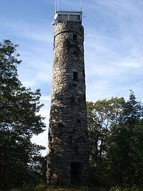
 The rock fire tower on top of Massaemett Mountain | |
| Highest point | |
| Elevation | 1,588 ft (484 m) |
| Geography | |
| Location | Shelburne, Massachusetts, U.S. |
Massaemett Mountain is a mountain in Shelburne, Massachusetts, USA. It is located east of the village of Shelburne Falls.
The summit features a historic rock fire tower. Though the top cab is locked, the stairway is open to the public as an observation tower and features multiple view points of western Massachusetts, southwestern New Hampshire, and southern Vermont.
The High Ledges Wildlife Sanctuary is located on the northern portion of the mountain.
External links
This article is issued from Wikipedia - version of the 10/23/2014. The text is available under the Creative Commons Attribution/Share Alike but additional terms may apply for the media files.