List of municipalities in Hordaland, Norway
This is a list of municipalities in the county of Hordaland, Norway. Hordaland, until 1919 known as Søndre Bergenhus amt, is divided into 33 municipalities. Traditionally, the county was divided into five districts: Hardanger, Voss, Sunnhordland, Midhordland, and Nordhordland. These districts do not have separate administrations and have no political powers. The municipality and city of Bergen, a separate county until 1972, is the county capital of Hordaland.
| Municipality |
Notes |
District |
Area in km2[1] |
Population (2009)[2] |
Map |
|---|---|---|---|---|---|
 Askøy | Askøy was established as a municipality 1 January 1838. Laksevåg was separated from Askøy in 1918. Most of Herdla was merged with Askøy in 1964. | Midthordland | 100 km² | 24,432 |  |
 Austevoll | Austevoll was separated from Sund in 1886. | Midthordland | 117 km² | 4,417 |  |
 Austrheim | Austrheim was separated from Lindås on 1 January 1910. Fedje was separated from Austrheim in 1947. | Nordhordland | 57 km² | 2,576 |  |
 Bergen | County capital, is divided into eight boroughs, the only administrative subdivision within a municipality in the county. Established as a municipality 1 January 1838. Bergen landdistrikt was merged into Bergen in 1877, Årstad in 1915, and Åsane, Arna, Fana and Laksevåg in 1972. | Midthordland | 465 km² | 252,051 |  |
 Bømlo | The municipality of Finnås was divided into Bømlo, Bremnes, and Moster 1 July 1916. The latter two were merged with Bømlo in 1963. | Sunnhordland | 246 km² | 11,085 |  |
 Eidfjord | Eidfjord was separated from Ulvik 1 May 1891. Eidfjord was a part of Ullensvang from 1964 until 1977. | Hardanger | 1,493 km² | 945 |  |
 Etne | Etne was established as a municipality 1 January 1838. Most of Skånevik was merged with Etne in 1965. | Sunnhordland/ Haugalandet | 735 km² | 3,854 |  |
 Fedje | Fedje was separated from Austrheim in 1947. | Nordhordland | 9 km² | 596 |  |
 Fitjar | Fitjar was separated from Stord in 1860. | Sunnhordland | 143 km² | 2,908 |  |
 Fjell | Fjell was established as a municipality 1 January 1838. | Midthordland | 148 km² | 21,507 |  |
 Fusa | Fusa was separated from Os in 1856. Hålandsdal and Strandvik were separated from Fusa in 1903, but merged into Fusa again in 1964. | Midthordland | 379 km² | 3,791 | 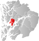 |
 Granvin | Granvin was established as a municipality 1 January 1838. In 1858, Ulvik, which used to be an annex to Granvin, became the main parish, and Granvin an annex to Ulvik. Granvin was separated from Ulvik as a municipality of its own 1 May 1891. | Hardanger | 213 km² | 950 |  |
 Jondal | Jondal was separated from Strandebarm in 1846. | Hardanger | 210 km² | 1,022 |  |
 Kvam | Kvam, until 1912 named Vikør, was established as a municipality 1 January 1838. Strandebarm was merged with Kvam in 1965. | Hardanger | 616 km² | 8,338 |  |
 Kvinnherad | Kvinnherad was established as a municipality 1 January 1838. Fjelberg, most of Varaldsøy and parts of Skånevik, were merged with Kvinnherad in 1965. | Sunnhordland | 1,135 km² | 13,112 | 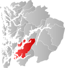 |
 Lindås | Lindås was established as a municipality 1 January 1838. Masfjorden was separated from Lindås 1 March 1879. Austrheim was separated from Lindås in 1910. Alversund, and parts of Hamre and Hosanger, were merged with Lindås in 1964. | Nordhordland | 476 km² | 14,036 |  |
 Masfjorden | Masfjorden was separated from Lindås on 1 January 1879. | Nordhordland | 556 km² | 1,652 | 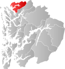 |
 Meland | Meland was separated from Alversund in 1923. The northern part of Holsnøy was transferred from Herdla to Meland in 1964. | Nordhordland | 93 km² | 6,478 |  |
 Modalen | Modalen was separated from Hosanger in 1910. The middle part of Eksingedalen was transferred from Modalen to Vaksdal in 1964. | Midthordland | 412 km² | 351 |  |
 Os | Os was established as a municipality 1 January 1838. Fusa was separated from Os in 1856. Samnanger was separated from Os in 1907. | Midthordland | 140 km² | 16,437 |  |
 Osterøy | Osterøy was established as a new municipality 1 January 1964, after the merger of large parts of Bruvik, Hamre, Haus and Hosanger. | Midthordland | 93 km² | 7,352 | 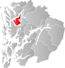 |
 Radøy | Radøy was created as a new municipality on 1 January 1964, after the merger of large parts of Hordabø, Manger and Sæbø, and smaller parts of Austrheim and Lindås. | Nordhordland | 112 km² | 4,825 |  |
 Samnanger | Samnanger was separated from Os in 1907. | Midthordland | 269 km² | 2,379 |  |
 Stord | Stord was established as a municipality 1 January 1838. Fitjar was separated from Stord in 1860. Valestrand was separated from Stord in 1868. | Sunnhordland | 144 km² | 17,289 |  |
 Sund | Sund was established as a municipality 1 January 1838. Austevoll was separated from Sund in 1886. | Midthordland | 100 km² | 5,899 |  |
 Sveio | Sveio was separated from Finnås in 1861. Vikebygd was separated from Sveio in 1902. Valestrand and the western part of Vikebygd were merged with Sveio in 1964. | Sunnhordland/ Haugalandet | 246 km² | 4,906 |  |
 Tysnes | Tysnes was established as a municipality 1 January 1838. | Sunnhordland | 255 km² | 2,792 |  |
 Ullensvang | Ullensvang was an annex to Kinsarvik until 1869, when Ullensvang became the main parish, and Kinsarvik an annex to Ullensvang. Kinsarvik and Odda were separated from Ullensvang as municipalities of their own 1 July 1913. Most of Kinsarvik was again merged with Ullensvang in 1964. Eidfjord was merged with Ullensvang in 1964, but was separated from Ullensvang in 1977. | Hardanger | 1,399 km² | 3,351 |  |
 Ulvik | Ulvik was an annex to Granvin until 1858, when Granvin became an annex to Ulvik. Granvin and Eidfjord were separated from Ulvik in 1891. | Hardanger | 721 km² | 1,095 | 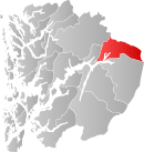 |
 Vaksdal | Vaksdal was created as a municipality 1 January 1964, after the merger of parts of Bruvik, Evanger, and Modalen. | Midthordland | 716 km² | 4,110 |  |
 Voss | Voss was established as a municipality 1 January 1838. Vossestrand was separated from Voss in 1868. Evanger was separated from Voss in 1885. Vossestrand and most of Evanger were merged with Voss in 1964. | Voss | 1,806 km² | 13,868 |  |
 Øygarden | Øygarden was created as a municipality 1 January 1964, after the merger of Hjelme and parts of Herdla. | Midthordland | 67 km² | 4,223 |  |
| Total | 15,460 km² | 469,681 |
References
- ↑ Emne: 01 Naturressurser og naturmiljø Tabell: 01402: Areal av land og ferskvatn (km²). (K) Statistics Norway (2007). Retrieved on 2007-12-21
- ↑ "Population. Hordaland. 1 January 2007". Statistics Norway. 2007. Retrieved 2007-10-15.
This article is issued from Wikipedia - version of the 1/23/2016. The text is available under the Creative Commons Attribution/Share Alike but additional terms may apply for the media files.