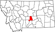
List of mountains in Golden Valley County, Montana
This list is incomplete; you can help by expanding it.
There are at least 9 named mountains in Golden Valley County, Montana.
- Antelope Butte, 46°12′37″N 109°01′46″W / 46.21028°N 109.02944°W, el. 3,993 feet (1,217 m)[1]
- Chinamans Hat, 46°12′52″N 109°31′44″W / 46.21444°N 109.52889°W, el. 4,068 feet (1,240 m)[2]
- Haystack Butte, 46°12′37″N 109°07′23″W / 46.21028°N 109.12306°W, el. 3,901 feet (1,189 m)[3]
- Lost Peak, 46°43′48″N 109°15′42″W / 46.73000°N 109.26167°W, el. 8,192 feet (2,497 m)[4]
- Mount Sinai, 46°10′25″N 109°14′17″W / 46.17361°N 109.23806°W, el. 4,386 feet (1,337 m)[5]
- O'Brien Hill, 46°10′15″N 109°26′12″W / 46.17083°N 109.43667°W, el. 4,642 feet (1,415 m)[6]
- Red Hill, 46°43′55″N 109°11′12″W / 46.73194°N 109.18667°W, el. 6,155 feet (1,876 m)[7]
- Sahara Hill, 46°40′39″N 109°05′08″W / 46.67750°N 109.08556°W, el. 5,341 feet (1,628 m)[8]
- Tepee Point, 46°44′56″N 109°22′17″W / 46.74889°N 109.37139°W, el. 8,399 feet (2,560 m)[9]
See also
Notes
- ↑ "Antelope Butte". Geographic Names Information System. United States Geological Survey.
- ↑ "Chinamans Hat". Geographic Names Information System. United States Geological Survey.
- ↑ "Haystack Butte". Geographic Names Information System. United States Geological Survey.
- ↑ "Lost Peak". Geographic Names Information System. United States Geological Survey.
- ↑ "Mount Sinai". Geographic Names Information System. United States Geological Survey.
- ↑ "O'Brien Hill". Geographic Names Information System. United States Geological Survey.
- ↑ "Red Hill". Geographic Names Information System. United States Geological Survey.
- ↑ "Sahara Hill". Geographic Names Information System. United States Geological Survey.
- ↑ "Tepee Point". Geographic Names Information System. United States Geological Survey.
This article is issued from Wikipedia - version of the 6/23/2011. The text is available under the Creative Commons Attribution/Share Alike but additional terms may apply for the media files.
