List of listed buildings in Glasgow/13
This is a list of listed buildings in Glasgow, Scotland.
List
| Name | Location | Date Listed | Grid Ref. [note 1] | Geo-coordinates | Notes | HB Number [note 2] | Image |
|---|---|---|---|---|---|---|---|
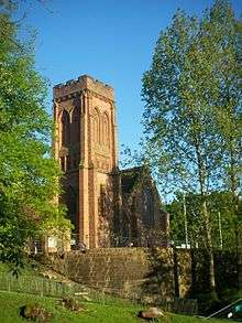
| 178 Royston Hill Townhead Blochairn Parish Church (Church Of Scotland) | 55°52′05″N 4°13′38″W / 55.868°N 4.227322°W | Category A | 32828 | 
| |||
| 205-217 (Odd Nos) Ingram Street With 94-104 (Even Nos) Miller Street | 55°51′35″N 4°15′02″W / 55.859752°N 4.25042°W | Category B | 32736 | 
| |||
| 108-112 (Even Nos) Ingram Street And 10-12 (Even Nos) Montrose Street | 55°51′36″N 4°14′44″W / 55.859942°N 4.245461°W | Category B | 32741 | 
| |||
| 16 Mcphater Street, And Return Elevation To Dunblane Street (Ozalid's) | 55°52′02″N 4°15′19″W / 55.867197°N 4.255166°W | Category A | 32754 | 
| |||
| 90 Maxwell Street | 55°51′22″N 4°15′15″W / 55.856244°N 4.254036°W | Category B | 32756 | 
| |||
| 53-59 (Odd Nos) Miller Street | 55°51′32″N 4°15′05″W / 55.858989°N 4.251335°W | Category B | 32757 | 
| |||
| 260 Clyde Street | 55°51′22″N 4°15′19″W / 55.856005°N 4.255269°W | Category C(S) | 32670 | 
| |||
| 32 Fox Street | 55°51′23″N 4°15′17″W / 55.856385°N 4.254683°W | Category B | 32680 | 
| |||
| 9 George Square, 5 Hanover Street, Lomond House | 55°51′38″N 4°15′03″W / 55.860445°N 4.250844°W | Category B | 32686 | 
| |||
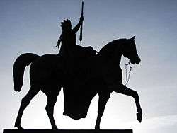
| George Square, Queen Victoria Statue | 55°51′41″N 4°15′04″W / 55.86152°N 4.251034°W | Category A | 32702 | 
| |||
| 151-59 (Odd Nos) George Street, University Of Strathclyde Alexander Turnbull Building | 55°51′39″N 4°14′40″W / 55.860697°N 4.244434°W | Category C(S) | 32706 | 
| |||
| 266 George Street | 55°51′42″N 4°14′53″W / 55.861612°N 4.247987°W | Category A | 32709 | 
| |||
| 57-59 (Odd Nos) Glassford Street And 83-85 (Odd Nos) Wilson Street With Entrance To Glassford Court | 55°51′31″N 4°14′58″W / 55.858684°N 4.249336°W | Category B | 32711 | 
| |||
| 16, 18, 28, 30 And 32 Argyle Street With Return Elevation To Virginia Street | 55°51′28″N 4°15′02″W / 55.857819°N 4.250436°W | Category B | 32610 | 
| |||
| 116-120 (Even Nos) Argyle Street | 55°51′30″N 4°15′16″W / 55.858295°N 4.254395°W | Category B | 32617 | 
| |||
| 18 Blackfriars Street, The Babbity Bowster | 55°51′31″N 4°14′34″W / 55.858615°N 4.242812°W | Category B | 32625 | 
| |||
| 3 Victoria Circus, (Cairndowan), And Gatepiers | 55°52′44″N 4°18′00″W / 55.878897°N 4.299908°W | Category B | 32589 | 
| |||
| 69 Hyndland Road, St Brides Episcopal Church | 55°52′48″N 4°18′17″W / 55.879911°N 4.304781°W | Category B | 32531 | 
| |||
| 1, 3 Kingsborough Gardens | 55°52′45″N 4°18′18″W / 55.879144°N 4.304959°W | Category B | 32540 | 
| |||
| 730 Great Western Road; Botanic Gardens, Gates At Queen Margaret Drive, Gates At Kirklee Quadrant And Boundary Railings | 55°52′41″N 4°17′23″W / 55.878063°N 4.289691°W | Category B | 32511 | 
| |||
| 183 Prospecthill Road, Mount Florida Clinic | 55°49′41″N 4°15′36″W / 55.828139°N 4.259978°W | Category B | 32437 | 
| |||
| 2-8 (Even Nos) Queen Mary Avenue | 55°50′00″N 4°15′49″W / 55.833195°N 4.263577°W | Category C(S) | 32440 | 
| |||
| Queen's Park Glass Houses | 55°49′44″N 4°16′15″W / 55.828786°N 4.270698°W | Category B | 32409 | 
| |||
| 34 Cathkin Road Including Gatepiers | 55°49′30″N 4°16′21″W / 55.825057°N 4.27262°W | Category B | 32367 | 
| |||
| Marywood Square Lamp Standard In Front Of No 55 | 55°50′10″N 4°16′35″W / 55.836133°N 4.276317°W | Category B | 32380 | 
| |||
| Nithsdale Drive And Nithsdale Street, K6 Telephone Kiosk | 55°50′15″N 4°16′20″W / 55.837449°N 4.272193°W | Category B | 32392 | 
| |||
| 16-22 (Even Nos) Beaconsfield Road, St John's Renfield Church, Church Of Scotland, Halls And Church Officer's House | 55°53′10″N 4°18′22″W / 55.88605°N 4.3062°W | Category B | 32301 | ||||
| 1 Cleveden Crescent And Cleveden Crescent Lane, Gatepiers, Boundary And Retaining Walls | 55°53′03″N 4°18′12″W / 55.884099°N 4.303382°W | Category B | 32304 | 
| |||
| 5 Cleveden Road, Boundary Walls And Gatepiers | 55°53′00″N 4°18′11″W / 55.883339°N 4.303161°W | Category B | 32314 | 
| |||
| 1093 Great Western Road, 3 Whittingehame Gardens | 55°53′10″N 4°18′56″W / 55.886155°N 4.315465°W | Category C(S) | 32324 | 
| |||
| 76 Southbrae Drive, Jordanhill College Of Education | 55°53′05″N 4°20′24″W / 55.884593°N 4.340062°W | Category B | 32339 | 
| |||
| 1996 Great Western Road, Knightswood Cross, Knightswood Road, St Margaret's Church (Church Of Scotland) | 55°53′43″N 4°20′30″W / 55.895328°N 4.341764°W | Category B | 32274 | 
| |||
| 739 South Street, North British Engine Works | 55°52′23″N 4°20′40″W / 55.873033°N 4.344402°W | Category A | 32280 | 
| |||
| 21 Westland Drive | 55°52′40″N 4°20′23″W / 55.877662°N 4.339645°W | Category B | 32285 | 
| |||
| 9 University Avenue Gilmorehill Hall | 55°52′20″N 4°17′04″W / 55.872185°N 4.284373°W | Category B | 32251 | 
| |||
| 32, 34, 36, 44, 46, 48, 50 Woodlands Road | 55°52′06″N 4°16′20″W / 55.868224°N 4.272121°W | Category B | 32264 | 
| |||
| 8-12 Even Nos Glasgow Street And 18 Bank Street | 55°52′29″N 4°17′00″W / 55.874714°N 4.283195°W | Category B | 32194 | 
| |||
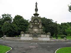
| Kelvingrove Park, Stewart Memorial Fountain | 55°52′05″N 4°17′02″W / 55.86806°N 4.283859°W | Category A | 32213 | 
| |||
| 29 And 30 Lansdowne Crescent And 393 North Woodside Road | 55°52′31″N 4°16′37″W / 55.875254°N 4.27688°W | Category C(S) | 32216 | 
| |||
| Dumbarton Road, Whiteinch, St Paul's Roman Catholic Church Including Boundary Walls, Gatepiers, Gates And Railings | 55°52′26″N 4°20′18″W / 55.873942°N 4.338222°W | Category B | 48412 | 
| |||
| 300 Cathedral Street, Charles Oakley Campus, Central College Of Commerce | 55°51′48″N 4°14′51″W / 55.86322°N 4.247536°W | Category B | 48413 | 
| |||
| Willowbank Street, Willowbank Primary School Including Boundary Wall, Gatepiers, Railings And Gates | 55°52′17″N 4°16′30″W / 55.871323°N 4.275099°W | Category C(S) | 48628 | 
| |||
| 52-62 (Even Nos) Renfield Street, Odeon Cinema And Shops | 55°51′46″N 4°15′21″W / 55.862791°N 4.255742°W | Category B | 49233 | 
| |||
| 101 Carstairs Street, Laird Business Park (Former Glasgow Cotton Spinning Co Mill) | 55°50′22″N 4°13′13″W / 55.839402°N 4.220399°W | Category B | 49924 | 
| |||
| 143 Oxford Street | 55°51′13″N 4°15′29″W / 55.853501°N 4.258015°W | Category C(S) | 49933 | 
| |||
| 722 Cumbernauld Road, Nb Leisure Bingo, Former Riddrie Picture House Including Sweet Shop And Power House | 55°51′51″N 4°11′47″W / 55.864253°N 4.196326°W | Category B | 51104 | 
|
Key
The scheme for classifying buildings in Scotland is:
- Category A: "buildings of national or international importance, either architectural or historic, or fine little-altered examples of some particular period, style or building type."[1]
- Category B: "buildings of regional or more than local importance, or major examples of some particular period, style or building type which may have been altered."[1]
- Category C(S): "buildings of local importance, lesser examples of any period, style, or building type, as originally constructed or moderately altered; and simple traditional buildings which group well with others in categories A and B."[1]
There are approximately 47,400 listed buildings in Scotland. Of these, around 8 per cent (some 3,800) are Category A, and 51 per cent (24,000) are Category B, with the rest listed at Category C(s).[2]
See also
Notes
- ↑ Sometimes known as OSGB36, the grid reference (where provided) is based on the British national grid reference system used by the Ordnance Survey.
• "Guide to National Grid". Ordnance Survey. Retrieved 2007-12-12.
• "Get-a-map". Ordnance Survey. Retrieved 2007-12-17. - ↑ The "HB Number" is a unique number assigned to each listed building by Historic Scotland.
References
- All entries, addresses and coordinates are based on data from Historic Scotland. This data falls under the Open Government Licence
- 1 2 3 "What is Listing?". Historic Scotland. Retrieved 2010-07-06.
- ↑ Guide to the Protection of Scotland’s Listed Buildings (PDF). Historic Scotland. 2009. p. 17. ISBN 978-1-84917-013-0. Retrieved 2010-07-06.
This article is issued from Wikipedia - version of the 10/15/2016. The text is available under the Creative Commons Attribution/Share Alike but additional terms may apply for the media files.