| [5] |
Name on the Register |
Image |
Date listed[6] |
Location |
City or town |
Description |
|---|
| 1 |
Alpha Phi Sorority House |
|
000000001991-10-24-0000October 24, 1991
(#91001564) |
1050 Hilyard St.
44°02′53″N 123°04′52″W / 44.048056°N 123.081111°W / 44.048056; -123.081111 (Alpha Phi Sorority House) |
Eugene |
|
| 2 |
Alpha Tau Omega Fraternity House (Old) |
|
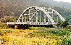
000000001983-09-01-0000September 1, 1983
(#83002158) |
1143 Oak St.
44°02′50″N 123°05′23″W / 44.047222°N 123.089722°W / 44.047222; -123.089722 (Alpha Tau Omega Fraternity House (Old)) |
Eugene |
|
| 3 |
Archeological site 35LA1 |
Upload image |
000000001997-09-10-0000September 10, 1997
(#97001014) |
Address restricted[7]
|
Searose Beach |
|
| 4 |
Archeological site 35LA2 |
Upload image |
000000001997-09-10-0000September 10, 1997
(#97001016) |
Address restricted[7]
|
Searose Beach |
|
| 5 |
Archeological site 35LA4 |
Upload image |
000000001997-09-10-0000September 10, 1997
(#97001018) |
Address restricted[7]
|
Searose Beach |
|
| 6 |
Archeological site 35LA5 |
Upload image |
000000001997-09-10-0000September 10, 1997
(#97001019) |
Address restricted[7]
|
Searose Beach |
|
| 7 |
Archeological site 35LA6 |
Upload image |
000000001997-09-10-0000September 10, 1997
(#97001020) |
Address restricted[7]
|
Searose Beach |
|
| 8 |
Archeological site 35LA7 |
Upload image |
000000001997-09-10-0000September 10, 1997
(#97001021) |
Address restricted[7]
|
Searose Beach |
|
| 9 |
Archeological Site 35LA11 |
Upload image |
000000001997-09-10-0000September 10, 1997
(#97001025) |
Address restricted[7]
|
Searose Beach |
|
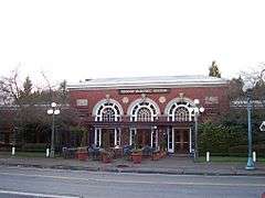
| 10 |
Archeological Site 35LA13 |
Upload image |
000000001997-09-10-0000September 10, 1997
(#97001026) |
Address restricted[7]
|
Searose Beach |
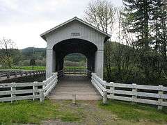
|
| 11 |
Archeological Site 35LA16 |
Upload image |
000000001997-09-10-0000September 10, 1997
(#97001027) |
Address restricted[7]
|
Searose Beach |
|
| 12 |
Archeological Site 35LA227 |
Upload image |
000000001997-09-10-0000September 10, 1997
(#97001024) |
Address restricted[7]
|
Searose Beach |
|
| 13 |
Archeological site 35LA228 |
Upload image |
000000001997-09-10-0000September 10, 1997
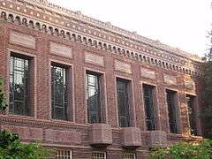
(#97001015) |
Address restricted[7]
|
Searose Beach |
|
| 14 |
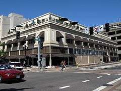
Ax Billy Department Store |
|
000000001982-08-26-0000August 26, 1982
(#82003731) |
E. 10th Ave. and Willamette St.
44°02′56″N 123°05′28″W / 44.048889°N 123.091111°W / 44.048889; -123.091111 (Ax Billy Department Store) |
Eugene |
Occupied by the Downtown Athletic Club, Conference Center, and the Ax Billy Grill & Sports Bar[8]
|
| 15 |
Baldwin Market |
|
000000001996-05-29-0000May 29, 1996
(#96000619) |
765–781 Monroe St.
44°03′05″N 123°06′17″W / 44.051358°N 123.104732°W / 44.051358; -123.104732 (Baldwin Market) |
Eugene |
|
| 16 |
Abraham and Phoebe Ball House |
|
000000002003-11-21-0000November 21, 2003
(#03001181) |
1312 Lincoln St.
44°02′44″N 123°05′46″W / 44.045556°N 123.096111°W / 44.045556; -123.096111 (Abraham and Phoebe Ball House) |
Eugene |
|
| 17 |
Belknap Bridge |
|
000000001979-11-29-0000November 29, 1979
(#79002097) |
Off SR 126
44°10′06″N 122°13′37″W / 44.168333°N 122.226944°W / 44.168333; -122.226944 (Belknap Bridge) |
Rainbow |
|
| 18 |
Edwin E. Benedict House |
|
000000001979-10-18-0000October 18, 1979
(#79002090) |
East of Florence on Cox Island
43°58′31″N 124°04′01″W / 43.975279°N 124.067069°W / 43.975279; -124.067069 (Edwin E. Benedict House) |
Florence |
|
| 19 |
Beta Theta Pi Fraternity House, Old |
|
000000001989-10-30-0000October 30, 1989
(#89001858) |
379–381 E. 12th Ave.
44°02′49″N 123°05′08″W / 44.046944°N 123.085556°W / 44.046944; -123.085556 (Beta Theta Pi Fraternity House, Old) |
Eugene |
|
| 20 |
Big Creek Bridge No. 01180 |
|
000000002005-08-05-0000August 5, 2005
(#05000819) |
OR Coast 9, US 101, MP175.02
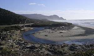
44°10′28″N 124°06′51″W / 44.174444°N 124.114167°W / 44.174444; -124.114167 (Big Creek Bridge No. 01180) |
Heceta Head |
|
| 21 |
The Big "O" |
|
000000002010-09-23-0000September 23, 2010
(#10000800) |
Skinner Butte
44°03′28″N 123°05′34″W / 44.057778°N 123.092778°W / 44.057778; -123.092778 (The Big "O") |
Eugene |
|
| 22 |
Bob Creek Site 35LA10 |
Upload image |
000000001997-09-10-0000September 10, 1997
(#97001023) |
Address restricted[7]
|
Searose Beach |
|
| 23 |
Clarence and Ethel Boyer House |
|
000000002009-02-25-0000February 25, 2009
(#09000061) |
1138 E. 22nd Ave.
44°02′07″N 123°04′32″W / 44.035278°N 123.075556°W / 44.035278; -123.075556 (Clarence and Ethel Boyer House) |
Eugene |
|
| 24 |
Windsor W. Calkins House |
|
000000001981-12-09-0000December 9, 1981
(#81000498) |
588 E. 11th Ave.
44°02′51″N 123°04′58″W / 44.0475°N 123.082778°W / 44.0475; -123.082778 (Windsor W. Calkins House) |
Eugene |
|
| 25 |
Robert E. Campbell House |
|
000000001979-11-01-0000November 1, 1979
(#79002088) |
890 Aspen Dr.
44°03′14″N 123°02′31″W / 44.053889°N 123.041944°W / 44.053889; -123.041944 (Robert E. Campbell House) |
Springfield |
|
| 26 |
Cape Creek Bridge No. 01113 |
|
000000002005-08-05-0000August 5, 2005
(#05000820) |
OR Coast 9, US101, MP178.35
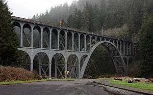
44°08′01″N 124°07′14″W / 44.133611°N 124.120556°W / 44.133611; -124.120556 (Cape Creek Bridge No. 01113) |
Heceta Head |
|
| 27 |
Chambers Bridge |
|
000000001979-11-29-0000November 29, 1979
(#79002081) |
S. River Rd.
43°47′34″N 123°04′07″W / 43.792778°N 123.068611°W / 43.792778; -123.068611 (Chambers Bridge) |
Cottage Grove |
|
| 28 |
Frank L. and Ida H. Chambers House |
|
000000001987-09-14-0000September 14, 1987
(#87001537) |
1006 Taylor St.
44°02′56″N 123°06′47″W / 44.048889°N 123.113056°W / 44.048889; -123.113056 (Frank L. and Ida H. Chambers House) |
Eugene |
|
| 29 |
Fred E. Chambers House and Grounds |
|
000000001996-09-27-0000September 27, 1996
(#96001047) |
1151 Irving Rd.
44°06′14″N 123°09′10″W / 44.103889°N 123.152778°W / 44.103889; -123.152778 (Fred E. Chambers House and Grounds) |
Eugene |
|
| 30 |
Chase Gardens Residential Grouping |
|
000000001999-08-05-0000August 5, 1999
(#99000943) |
274 S. Garden Way
44°03′32″N 123°03′06″W / 44.058889°N 123.051667°W / 44.058889; -123.051667 (Chase Gardens Residential Grouping) |
Eugene |
|
| 31 |
Chi Psi Fraternity House |
|
000000001993-03-18-0000March 18, 1993
(#91001563) |
1018 Hilyard St.
44°02′55″N 123°04′52″W / 44.048611°N 123.081111°W / 44.048611; -123.081111 (Chi Psi Fraternity House) |
Eugene |
|
| 32 |
Daniel and Catherine Christian House† |
|
000000002008-01-29-0000January 29, 2008
(#07001507) |
170 E. 12th Ave.
44°02′47″N 123°05′20″W / 44.046389°N 123.088889°W / 44.046389; -123.088889 (Daniel and Catherine Christian House) |
Eugene |
|
| 33 |
Christian-Patterson Rental Property |
|
000000001991-10-24-0000October 24, 1991
(#91001567) |
244 E. 16th Ave.
44°02′32″N 123°05′16″W / 44.042222°N 123.087778°W / 44.042222; -123.087778 (Christian-Patterson Rental Property) |
Eugene |
|
| 34 |
Coburg Historic District |
|
000000001986-01-07-0000January 7, 1986
(#86000036) |
Roughly bounded by Van Duyn Rd., Diamond and Miller Sts., Dixon St. and Tax lots 1700 and 201, and Bottom Loop Rd.
44°08′22″N 123°03′57″W / 44.139444°N 123.065833°W / 44.139444; -123.065833 (Coburg Historic District) |
Coburg |
|
| 35 |
Cochran-Rice Farm Complex |
|
000000001991-10-17-0000October 17, 1991
(#91001558) |
993 N. Lane St.
43°48′19″N 123°03′09″W / 43.805278°N 123.0525°W / 43.805278; -123.0525 (Cochran-Rice Farm Complex) |
Cottage Grove |
Dismantled in 2012.[9]
|
| 36 |
Cottage Grove Armory |
|
000000002012-03-07-0000March 7, 2012
(#12000081) |
628 E. Washington Avenue
43°47′48″N 123°03′41″W / 43.796717°N 123.061341°W / 43.796717; -123.061341 (Cottage Grove Armory) |
Cottage Grove |
|
| 37 |
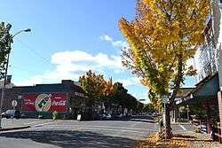
Cottage Grove Downtown Commercial Historic District |
|
000000001994-01-28-0000January 28, 1994
(#93001568) |
Area surrounding Main St. between Coast Fork Willamette R. and Ninth St.
43°47′51″N 123°03′38″W / 43.7975°N 123.060556°W / 43.7975; -123.060556 (Cottage Grove Downtown Commercial Historic District) |
Cottage Grove |
|
| 38 |
Coyote Creek Bridge |
|
000000001979-11-29-0000November 29, 1979
(#79002084) |
Southeast of Crow
43°58′12″N 123°19′08″W / 43.97°N 123.318889°W / 43.97; -123.318889 (Coyote Creek Bridge) |
Crow |
|
| 39 |
Creswell Public Library and Civic Improvement Club Clubhouse |
|
000000002008-01-29-0000January 29, 2008
(#07001508) |
195 S. 2nd St.
43°54′59″N 123°01′13″W / 43.916389°N 123.020278°W / 43.916389; -123.020278 (Creswell Public Library and Civic Improvement Club Clubhouse) |
Creswell |
|
| 40 |
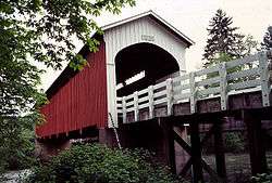
Currin Bridge |
|
000000001979-11-29-0000November 29, 1979
(#79002082) |
East of Cottage Grove
43°47′37″N 122°59′43″W / 43.793611°N 122.995278°W / 43.793611; -122.995278 (Currin Bridge) |
Cottage Grove |
|
| 41 |
Dads' Gates |
|
000000002004-08-11-0000August 11, 2004
(#04000829) |
11th Ave. E. bet. Kincaid St. and Franklin Blvd.
44°02′52″N 123°04′35″W / 44.047778°N 123.076389°W / 44.047778; -123.076389 (Dads' Gates) |
Eugene |
|
| 42 |
Deadwood Creek Bridge |
|
000000001979-11-29-0000November 29, 1979
(#79002099) |
Northeast of Swisshome
44°08′37″N 123°43′13″W / 44.14361°N 123.720414°W / 44.14361; -123.720414 (Deadwood Creek Bridge) |
Swisshome |
|
| 43 |
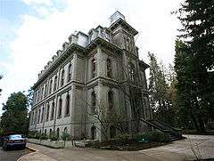
Deady Hall |
|
000000001972-04-11-0000April 11, 1972
(#72001082) |
University of Oregon campus
44°02′48″N 123°04′31″W / 44.046667°N 123.075278°W / 44.046667; -123.075278 (Deady Hall) |
Eugene |
|
| 44 |
Devil's Elbow Site (35LA17) |
Upload image |
000000001997-09-10-0000September 10, 1997
(#97001028) |
Address restricted[7]
|
Searose Beach |
|
| 45 |
Dorena Bridge |
|
000000001979-11-29-0000November 29, 1979
(#79002086) |
Northwest of Dorena
43°44′14″N 122°53′01″W / 43.737222°N 122.883611°W / 43.737222; -122.883611 (Dorena Bridge) |
Dorena |
|
| 46 |
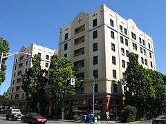
Dorris Apartments |
|
000000001991-10-24-0000October 24, 1991
(#91001565) |
963 Ferry Ln.
44°02′57″N 123°05′00″W / 44.049167°N 123.083333°W / 44.049167; -123.083333 (Dorris Apartments) |
Eugene |
|
| 47 |
Dorris Ranch |
|
000000001988-06-22-0000June 22, 1988
(#88000724) |
S. Second St. at Dorris Ave.
44°01′41″N 123°01′02″W / 44.028056°N 123.017222°W / 44.028056; -123.017222 (Dorris Ranch) |
Springfield |
|
| 48 |
Benjamin Franklin Dorris House |
|
000000001996-02-23-0000February 23, 1996
(#96000171) |
707 E. 17th Ave.
44°02′29″N 123°04′51″W / 44.041389°N 123.080833°W / 44.041389; -123.080833 (Benjamin Franklin Dorris House) |
Eugene |
|
| 49 |
East Skinner Butte Historic District |
|
000000001982-09-23-0000September 23, 1982
(#82003732) |
Pearl and High Sts., and 2nd and 3rd Aves.
44°03′25″N 123°05′17″W / 44.056944°N 123.088056°W / 44.056944; -123.088056 (East Skinner Butte Historic District) |
Eugene |
|
| 50 |
Ernest Bridge |
|
000000001979-11-29-0000November 29, 1979
(#79002094) |
Northeast of Marcola
44°12′04″N 122°50′10″W / 44.201111°N 122.836111°W / 44.201111; -122.836111 (Ernest Bridge) |
Marcola |
|
| 51 |
Eugene Blair Boulevard Commercial Historic District |
|
000000001993-09-21-0000September 21, 1993
(#93000928) |
Blair Blvd. between W. 3rd and W. 5th Aves., including Van Buren St. between Blair and W. 3rd
44°03′20″N 123°06′30″W / 44.055556°N 123.108333°W / 44.055556; -123.108333 (Eugene Blair Boulevard Commercial Historic District) |
Eugene |
|
| 52 |
Eugene Hotel |
|
000000001982-10-07-0000October 7, 1982
(#82001508) |
222 E. Broadway
44°02′59″N 123°05′21″W / 44.049711°N 123.089253°W / 44.049711; -123.089253 (Eugene Hotel) |
Eugene |
Built in 1925; Americanized-Spanish architecture.[10]
|
| 53 |
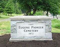
Eugene Pioneer Cemetery |
|
000000001997-08-01-0000August 1, 1997
(#97000850) |
Jct. of E. Eighteenth Ave. and University St.
44°02′30″N 123°04′30″W / 44.041667°N 123.075°W / 44.041667; -123.075 (Eugene Pioneer Cemetery) |
Eugene |
|
| 54 |
First Congregational Church |
|
000000001980-02-12-0000February 12, 1980
(#80003333) |
492 E. 13th Ave.
44°02′43″N 123°05′08″W / 44.04525°N 123.085472°W / 44.04525; -123.085472 (First Congregational Church) |
Eugene |
|
| 55 |
First Presbyterian Church |
|
000000001974-12-31-0000December 31, 1974
(#74001690) |
216 S. 3rd St.
43°47′42″N 123°03′48″W / 43.795°N 123.063333°W / 43.795; -123.063333 (First Presbyterian Church) |
Cottage Grove |
|
| 56 |
Charles C. Fitch Farmstead |
|
000000001989-06-16-0000June 16, 1989
(#89000510) |
26689 Pickens Rd.
44°01′47″N 123°16′51″W / 44.029722°N 123.280833°W / 44.029722; -123.280833 (Charles C. Fitch Farmstead) |
Eugene |
|
| 57 |
Flanagan Site (35 LA 218) |
Upload image |
000000001977-07-20-0000July 20, 1977
(#77001106) |
Address restricted[7]
|
Eugene |
|
| 58 |
Gamma Phi Beta Sorority House |
|
000000001991-10-24-0000October 24, 1991
(#91001566) |
1021 Hilyard St.
44°02′55″N 123°04′50″W / 44.048611°N 123.080556°W / 44.048611; -123.080556 (Gamma Phi Beta Sorority House) |
Eugene |
|
| 59 |
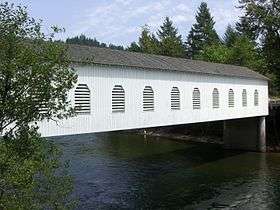
Goodpasture Bridge |
|
000000001979-11-29-0000November 29, 1979
(#79002100) |
West of Vida
44°08′54″N 122°35′10″W / 44.148333°N 122.586111°W / 44.148333; -122.586111 (Goodpasture Bridge) |
Vida |
|
| 60 |
Howard A. Hall House |
|
000000001988-07-14-0000July 14, 1988
(#88001036) |
1991 Garden Ave.
44°02′48″N 123°03′41″W / 44.046667°N 123.061389°W / 44.046667; -123.061389 (Howard A. Hall House) |
Eugene |
|
| 61 |
Elmer Harlow House |
|
000000001980-02-12-0000February 12, 1980
(#80003334) |
2991 Harlow Rd.
44°04′12″N 123°03′49″W / 44.069880°N 123.063675°W / 44.069880; -123.063675 (Elmer Harlow House) |
Eugene |
Built in 1922, this bungalow is a representative example of the style promoted by The Craftsman magazine. It is especially notable for fine detailing, including in woodwork and windows. The use of two-tone brickwork emphasizes the refined and careful construction.[11]
|
| 62 |
Hayse Blacksmith Shop |
|
000000001980-11-07-0000November 7, 1980
(#80003335) |
357 Van Buren St.
44°03′21″N 123°06′29″W / 44.055833°N 123.108056°W / 44.055833; -123.108056 (Hayse Blacksmith Shop) |
Eugene |
|
| 63 |
Heceta Head Lighthouse and Keepers Quarters |
|
000000001978-11-28-0000November 28, 1978
(#78002296) |
North of Florence on U.S. 101
44°08′15″N 124°07′37″W / 44.1375°N 124.126944°W / 44.1375; -124.126944 (Heceta Head Lighthouse and Keepers Quarters) |
Florence |
|
| 64 |
Jessie M. Honeyman Memorial State Park Historic District |
|
000000001984-11-28-0000November 28, 1984
(#84000473) |
U.S. 101
43°55′48″N 124°06′26″W / 43.930092°N 124.107206°W / 43.930092; -124.107206 (Jessie M. Honeyman Memorial State Park Historic District) |
Dunes City |
|
| 65 |
Johnson Hall |
|
000000001985-06-20-0000June 20, 1985
(#85001351) |
E. 13th between University and Kincaid Sts.
44°02′43″N 123°04′29″W / 44.045278°N 123.074722°W / 44.045278; -123.074722 (Johnson Hall) |
Eugene |
|
| 66 |
William Kyle and Sons Building |
|
000000001981-12-02-0000December 2, 1981
(#81000499) |
1297 Bay St.
43°58′00″N 124°06′19″W / 43.966667°N 124.105278°W / 43.966667; -124.105278 (William Kyle and Sons Building) |
Florence |
|
| 67 |
Lake Creek Bridge |
|
000000001979-11-29-0000November 29, 1979
(#79002091) |
West of Greenleaf
44°06′16″N 123°40′25″W / 44.104356°N 123.673678°W / 44.104356; -123.673678 (Lake Creek Bridge) |
Greenleaf |
|
| 68 |
Lane County Clerk's Building |
|
000000001983-11-25-0000November 25, 1983
(#83004174) |
740 W. 13th Ave.
44°02′41″N 123°06′09″W / 44.044722°N 123.1025°W / 44.044722; -123.1025 (Lane County Clerk's Building) |
Eugene |
|
| 69 |
Lane County Farmers' Union Cooperative Wholesalers' Association Building |
|
000000001991-10-17-0000October 17, 1991
(#91001560) |
532 Olive St.
44°03′14″N 123°05′37″W / 44.053889°N 123.093611°W / 44.053889; -123.093611 (Lane County Farmers' Union Cooperative Wholesalers' Association Building) |
Eugene |
|
| 70 |
Leaburg Hydroelectric Project Historic District |
|
000000002015-06-29-0000June 29, 2015
(#15000375) |
14348 McKenzie River Highway
44°06′05″N 122°41′20″W / 44.101433°N 122.688779°W / 44.101433; -122.688779 (Leaburg Hydroelectric Project Historic District) |
Leaburg vicinity |
|
| 71 |
Dr. Norman L. Lee House |
|
000000001977-11-02-0000November 2, 1977
(#77001108) |
655 Holly St.
44°13′12″N 123°12′09″W / 44.22°N 123.2025°W / 44.22; -123.2025 (Dr. Norman L. Lee House) |
Junction City |
|
| 72 |
Log Cabin Inn Ensemble |
|
000000002002-12-04-0000December 4, 2002
(#02001486) |
56483 McKenzie Highway
44°10′27″N 122°09′33″W / 44.174167°N 122.159167°W / 44.174167; -122.159167 (Log Cabin Inn Ensemble) |
McKenzie Bridge |
|
| 73 |
Lowell Bridge |
|
000000001979-11-29-0000November 29, 1979
(#79002085) |
East of Dexter
43°54′33″N 122°46′42″W / 43.909167°N 122.778333°W / 43.909167; -122.778333 (Lowell Bridge) |
Lowell |
|
| 74 |
Lowell Grange |
|
000000002005-08-10-0000August 10, 2005
(#05000849) |
51 E 2nd St.
43°55′17″N 122°46′54″W / 43.921389°N 122.781667°W / 43.921389; -122.781667 (Lowell Grange) |
Lowell |
|
| 75 |
Marx-Schaefers House† |
|
000000002006-08-02-0000August 2, 2006
(#06000662) |
1718 Lincoln St.
44°02′28″N 123°05′45″W / 44.041111°N 123.095833°W / 44.041111; -123.095833 (Marx-Schaefers House) |
Eugene |
|
| 76 |
Masonic Cemetery and Hope Abbey Mausoleum |
|
000000001980-09-15-0000September 15, 1980
(#80003336) |
25th and University Sts.
44°01′53″N 123°04′24″W / 44.031389°N 123.073333°W / 44.031389; -123.073333 (Masonic Cemetery and Hope Abbey Mausoleum) |
Eugene |
|
| 77 |
Nelson and Margret Mathews House |
|
000000001984-06-14-0000June 14, 1984
(#84003025) |
231 E. Pearl St.
44°08′13″N 123°03′50″W / 44.136944°N 123.063889°W / 44.136944; -123.063889 (Nelson and Margret Mathews House) |
Coburg |
|
| 78 |
McCracken Brothers Motor Freight Building |
|
000000002005-09-21-0000September 21, 2005
(#05001055) |
375 W. 4th St.
44°03′21″N 123°05′50″W / 44.055833°N 123.097222°W / 44.055833; -123.097222 (McCracken Brothers Motor Freight Building) |
Eugene |
|
| 79 |
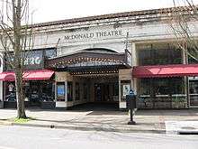
McDonald Theater Building |
|
000000001982-08-26-0000August 26, 1982
(#82003733) |
1004–1044 Willamette St.
44°02′55″N 123°05′30″W / 44.048611°N 123.091667°W / 44.048611; -123.091667 (McDonald Theater Building) |
Eugene |
|
| 80 |
Old McKenzie Fish Hatchery |
|
000000001996-02-23-0000February 23, 1996
(#96000142) |
44645 McKenzie Hwy.
44°08′31″N 122°36′31″W / 44.141944°N 122.608611°W / 44.141944; -122.608611 (Old McKenzie Fish Hatchery) |
Leaburg |
|
| 81 |
McKenzie Highway Historic District |
|
000000002011-02-07-0000February 7, 2011
(#10001215) |
OR 242
44°14′55″N 121°50′18″W / 44.248611°N 121.838333°W / 44.248611; -121.838333 (McKenzie Highway Historic District) |
Belknap Springs vicinity |
Extends into Linn and Deschutes counties.
|
| 82 |
McMorran and Washburne Department Store Building |
|
000000001989-03-02-0000March 2, 1989
(#89000125) |
795 Willamette St.
44°03′05″N 123°05′29″W / 44.051389°N 123.091389°W / 44.051389; -123.091389 (McMorran and Washburne Department Store Building) |
Eugene |
|
| 83 |
Methodist Episcopal Church of Goshen |
|
000000001991-10-17-0000October 17, 1991
(#91001559) |
85896 First St.
43°59′45″N 123°00′37″W / 43.995833°N 123.010278°W / 43.995833; -123.010278 (Methodist Episcopal Church of Goshen) |
Goshen |
|
| 84 |
Wayne Morse Farm |
|
000000001999-02-12-0000February 12, 1999
(#99000066) |
595 Crest Dr.
44°01′23″N 123°05′55″W / 44.023056°N 123.098611°W / 44.023056; -123.098611 (Wayne Morse Farm) |
Eugene |
|
| 85 |
Mosby Creek Bridge |
|
000000001979-11-29-0000November 29, 1979
(#79002083) |
East of Cottage Grove
43°46′41″N 123°00′13″W / 43.778056°N 123.003611°W / 43.778056; -123.003611 (Mosby Creek Bridge) |
Cottage Grove |
|
| 86 |
Musick Guard Station |
|
000000001991-03-06-0000March 6, 1991
(#91000170) |
Northeast of Bohemia Mtn., Umpqua NF
43°34′51″N 122°38′25″W / 43.580833°N 122.640278°W / 43.580833; -122.640278 (Musick Guard Station) |
Cottage Grove |
|
| 87 |
The Neptune Site (35LA3) |
Upload image |
000000001997-09-10-0000September 10, 1997
(#97001017) |
Address restricted[7]
|
Searose Beach |
|
| 88 |
Office Bridge |
|
000000001979-11-29-0000November 29, 1979
(#79003768) |
Crosses N. Fork Middle Fork Willamette River
43°46′04″N 122°29′40″W / 43.767778°N 122.494444°W / 43.767778; -122.494444 (Office Bridge) |
Westfir |
|
| 89 |
Oregon Electric Railway Passenger Station |
|
000000001979-03-13-0000March 13, 1979
(#79002087) |
27 E. 5th St.
44°03′17″N 123°05′28″W / 44.054722°N 123.091111°W / 44.054722; -123.091111 (Oregon Electric Railway Passenger Station) |
Eugene |
|
| 90 |
Oregon Power Company's Springfield Substation |
|
000000001996-02-23-0000February 23, 1996
(#96000170) |
590 Main St.
44°02′47″N 123°01′02″W / 44.046389°N 123.017222°W / 44.046389; -123.017222 (Oregon Power Company's Springfield Substation) |
Springfield |
|
| 91 |
Oregon Railway and Navigation Company Bridge |
|
000000001980-03-13-0000March 13, 1980
(#80003332) |
Southeast of Coburg
44°06′45″N 123°02′44″W / 44.1125°N 123.045556°W / 44.1125; -123.045556 (Oregon Railway and Navigation Company Bridge) |
Coburg |
|
| 92 |
Our Lady of Perpetual Help Roman Catholic Church |
|
000000001997-02-21-0000February 21, 1997
(#97000127) |
147 N. H St.
43°47′57″N 123°03′54″W / 43.799083°N 123.065°W / 43.799083; -123.065 (Our Lady of Perpetual Help Roman Catholic Church) |
Cottage Grove |
|
| 93 |
Pacific Cooperative Poultry Producers Egg-Taking Station |
|
000000001988-09-08-0000September 8, 1988
(#88001523) |
506 Olive St.
44°03′12″N 123°05′37″W / 44.053333°N 123.093611°W / 44.053333; -123.093611 (Pacific Cooperative Poultry Producers Egg-Taking Station) |
Eugene |
|
| 94 |
Palace Hotel |
|
000000001977-12-23-0000December 23, 1977
(#77001105) |
488 Willamette St.
44°03′16″N 123°05′35″W / 44.054537°N 123.093042°W / 44.054537; -123.093042 (Palace Hotel) |
Eugene |
|
| 95 |
Parvin Bridge |
|
000000001979-11-29-0000November 29, 1979
(#79003767) |
South of Dexter off Lost Creek Rd.
43°53′59″N 122°49′17″W / 43.899722°N 122.821389°W / 43.899722; -122.821389 (Parvin Bridge) |
Dexter |
|
| 96 |
Patterson-Stratton House |
|
000000001992-09-29-0000September 29, 1992
(#92001262) |
1605 Pearl St.
44°02′32″N 123°05′18″W / 44.042222°N 123.088333°W / 44.042222; -123.088333 (Patterson-Stratton House) |
Eugene |
|
| 97 |
Pengra Bridge |
|
000000001979-11-29-0000November 29, 1979
(#79002092) |
Spanning Fall Creek on Place Road[12]
43°57′58″N 122°50′43″W / 43.966056°N 122.845404°W / 43.966056; -122.845404 (Pengra Bridge) |
Jasper vicinity |
|
| 98 |
A. V. Peters House |
|
000000001990-10-25-0000October 25, 1990
(#90001597) |
1611 Lincoln St.
44°02′32″N 123°05′44″W / 44.042222°N 123.095556°W / 44.042222; -123.095556 (A. V. Peters House) |
Eugene |
|
| 99 |
Petersen Apartments† |
|
000000002005-12-16-0000December 16, 2005
(#05001420) |
1263 Oak St.
44°02′46″N 123°05′23″W / 44.046111°N 123.089722°W / 44.046111; -123.089722 (Petersen Apartments) |
Eugene |
|
| 100 |
Wallace and Glenn Potter House |
|
000000002007-04-24-0000April 24, 2007
(#07000360) |
120 Fir Ln.
44°03′56″N 123°06′54″W / 44.065556°N 123.115°W / 44.065556; -123.115 (Wallace and Glenn Potter House) |
Eugene |
|
| 101 |
Psi Alpha Chapter, Chi Omega House |
|
000000002001-12-28-0000December 28, 2001
(#01001402) |
1461 Alder St.
44°02′37″N 123°04′50″W / 44.043611°N 123.080556°W / 44.043611; -123.080556 (Psi Alpha Chapter, Chi Omega House) |
Eugene |
|
| 102 |
Quackenbush Hardware Store |
|
000000001982-09-23-0000September 23, 1982
(#82003734) |
160 E. Broadway
44°02′56″N 123°05′20″W / 44.048889°N 123.088889°W / 44.048889; -123.088889 (Quackenbush Hardware Store) |
Eugene |
|
| 103 |
Rice Apartments† |
|
000000002006-11-15-0000November 15, 2006
(#06001031) |
360 W. 13th Ave.
44°02′43″N 123°05′52″W / 44.045322°N 123.097889°W / 44.045322; -123.097889 (Rice Apartments) |
Eugene |
|
| 104 |
Schaefers Building |
|
000000001979-10-30-0000October 30, 1979
(#79003735) |
1001 Willamette St.
44°02′55″N 123°05′28″W / 44.048611°N 123.091111°W / 44.048611; -123.091111 (Schaefers Building) |
Eugene |
|
| 105 |
Shelton-McMurphey House and Grounds |
|
000000001984-06-14-0000June 14, 1984
(#84003028) |
303 Willamette St.
44°03′28″N 123°05′25″W / 44.057778°N 123.090278°W / 44.057778; -123.090278 (Shelton-McMurphey House and Grounds) |
Eugene |
|
| 106 |
Horace J. and Ann S. Shinn Cottage |
|
000000001998-03-05-0000March 5, 1998
(#98000206) |
1308 Ash Ave.
43°47′56″N 123°04′10″W / 43.798889°N 123.069444°W / 43.798889; -123.069444 (Horace J. and Ann S. Shinn Cottage) |
Cottage Grove |
|
| 107 |
Siuslaw River Bridge No. 01821 |
|
000000002005-08-05-0000August 5, 2005
(#05000816) |
OR Coast 9, US101, MP109.98
43°57′52″N 124°06′27″W / 43.964444°N 124.1075°W / 43.964444; -124.1075 (Siuslaw River Bridge No. 01821) |
Florence |
|
| 108 |
Smeede Hotel |
|
000000001974-01-17-0000January 17, 1974
(#74001691) |
767 Willamette St.
44°03′06″N 123°05′28″W / 44.051667°N 123.091111°W / 44.051667; -123.091111 (Smeede Hotel) |
Eugene |
|
| 109 |
Southern Pacific Passenger Depot |
|
000000002007-08-16-0000August 16, 2007
(#07000823) |
433 Willamette St.
44°03′18″N 123°05′29″W / 44.055°N 123.091389°W / 44.055; -123.091389 (Southern Pacific Passenger Depot) |
Eugene |
|
| 110 |
Southern Pacific Railroad Passenger Station and Freight House |
|
000000001993-02-24-0000February 24, 1993
(#82005088) |
101 S. A St.
44°02′41″N 123°00′56″W / 44.044722°N 123.015556°W / 44.044722; -123.015556 (Southern Pacific Railroad Passenger Station and Freight House) |
Springfield |
|
| 111 |
Springfield General Hospital |
|
000000001983-09-01-0000September 1, 1983
(#83002159) |
846 F St.
44°03′06″N 123°00′47″W / 44.051667°N 123.013056°W / 44.051667; -123.013056 (Springfield General Hospital) |
Springfield |
|
| 112 |
Springfield Motors Buick Dealership |
|
000000002011-06-01-0000June 1, 2011
(#11000328) |
702 North A St.
44°02′50″N 123°01′00″W / 44.047222°N 123.016667°W / 44.047222; -123.016667 (Springfield Motors Buick Dealership) |
Springfield |
|
| 113 |
Stewart Bridge |
|
000000001979-11-29-0000November 29, 1979
(#79002102) |
Southeast of Walden
43°45′59″N 122°59′35″W / 43.766389°N 122.993056°W / 43.766389; -122.993056 (Stewart Bridge) |
Walden |
|
| 114 |
LaSells D. Stewart House |
|
000000001994-01-28-0000January 28, 1994
(#93001569) |
1807 E. Main St.
43°47′50″N 123°02′50″W / 43.797222°N 123.047222°W / 43.797222; -123.047222 (LaSells D. Stewart House) |
Cottage Grove |
|
| 115 |
Strawberry Hill Site (35LA8) |
Upload image |
000000001997-09-10-0000September 10, 1997
(#97001022) |
Address restricted[7]
|
Searose Beach |
|
| 116 |
John Sutherland House |
|
000000001995-02-02-0000February 2, 1995
(#94001631) |
83246 Lorane Hwy.
43°55′06″N 123°14′19″W / 43.918333°N 123.238611°W / 43.918333; -123.238611 (John Sutherland House) |
Eugene |
|
| 117 |
Ten Mile Creek Bridge No. 01181 |
|
000000002005-08-05-0000August 5, 2005
(#05000818) |
OR Coast 9, US101, MP171.44
44°13′27″N 124°06′35″W / 44.22410°N 124.10959°W / 44.22410; -124.10959 (Ten Mile Creek Bridge No. 01181) |
Yachats vicinity |
|
| 118 |
Thompson-Roach Building |
|
000000002006-11-15-0000November 15, 2006
(#06001032) |
544–550 E. 13th Ave.
44°02′43″N 123°04′59″W / 44.045278°N 123.083056°W / 44.045278; -123.083056 (Thompson-Roach Building) |
Eugene |
Included in Eugene West University Neighborhood MPS
|
| 119 |
Unity Bridge |
|
000000001979-11-29-0000November 29, 1979
(#79002093) |
North of Lowell
43°56′43″N 122°46′26″W / 43.945278°N 122.773889°W / 43.945278; -122.773889 (Unity Bridge) |
Lowell |
|
| 120 |
University of Oregon Library and Memorial Quadrangle |
|
000000001990-03-09-0000March 9, 1990
(#90000370) |
Kincaid St. at E. Fifteenth Ave.
44°02′37″N 123°04′35″W / 44.043611°N 123.076389°W / 44.043611; -123.076389 (University of Oregon Library and Memorial Quadrangle) |
Eugene |
Includes the Knight Library
|
| 121 |
University of Oregon Museum of Art |
|
000000001986-06-05-0000June 5, 1986
(#86001224) |
1430 Johnson Lane
44°02′39″N 123°04′37″W / 44.044289°N 123.077004°W / 44.044289; -123.077004 (University of Oregon Museum of Art) |
Eugene |
Also known as the "Jordan Schnitzer Museum of Art"
|
| 122 |
U.S. Post Office |
|
000000001985-08-14-0000August 14, 1985
(#85001805) |
520 Willamette St.
44°03′14″N 123°05′33″W / 44.053889°N 123.0925°W / 44.053889; -123.0925 (U.S. Post Office) |
Eugene |
|
| 123 |
Villard Hall |
|
000000001972-04-11-0000April 11, 1972
(#72001083) |
University of Oregon
44°02′50″N 123°04′35″W / 44.047222°N 123.076389°W / 44.047222; -123.076389 (Villard Hall) |
Eugene |
|
| 124 |
Washburne Historic District |
|
000000001987-02-10-0000February 10, 1987
(#87000042) |
Roughly bounded by G, N. Tenth, A, and N. Second Sts.
44°03′01″N 123°01′00″W / 44.050278°N 123.016667°W / 44.050278; -123.016667 (Washburne Historic District) |
Springfield |
|
| 125 |
Wendling Bridge |
|
000000001979-11-29-0000November 29, 1979
(#79002095) |
Northeast of Marcola
44°11′29″N 122°47′56″W / 44.191389°N 122.798889°W / 44.191389; -122.798889 (Wendling Bridge) |
Wendling |
|
| 126 |
Wildcat Creek Bridge |
|
000000001979-11-29-0000November 29, 1979
(#79002089) |
West of Eugene
44°00′13″N 123°39′09″W / 44.003611°N 123.6525°W / 44.003611; -123.6525 (Wildcat Creek Bridge) |
Walton |
|
| 127 |
Wilder Apartments† |
|
000000002006-08-23-0000August 23, 2006
(#06000727) |
259 E. 13th Ave.
44°02′45″N 123°05′15″W / 44.045833°N 123.0875°W / 44.045833; -123.0875 (Wilder Apartments) |
Eugene |
|
| 128 |
Willakenzie Grange Hall |
|
000000002009-01-22-0000January 22, 2009
(#08001368) |
3055 Willakenzie Rd.
44°04′55″N 123°03′47″W / 44.081825°N 123.063074°W / 44.081825; -123.063074 (Willakenzie Grange Hall) |
Eugene |
|
| 129 |
C. S. Williams House |
|
000000001988-07-14-0000July 14, 1988
(#88001037) |
1973 Garden Ave.
44°02′48″N 123°03′42″W / 44.046667°N 123.061667°W / 44.046667; -123.061667 (C. S. Williams House) |
Eugene |
|
| 130 |
Lew Williams Chevrolet Dealership |
|
000000002011-06-01-0000June 1, 2011
(#11000329) |
2020 Franklin Blvd.
44°02′39″N 123°03′44″W / 44.044167°N 123.062222°W / 44.044167; -123.062222 (Lew Williams Chevrolet Dealership) |
Eugene |
|
| 131 |
Woodrow Wilson Junior High School |
|
000000001990-10-25-0000October 25, 1990
(#90001602) |
650 W. Twelfth Ave.
44°02′47″N 123°06′04″W / 44.046389°N 123.101111°W / 44.046389; -123.101111 (Woodrow Wilson Junior High School) |
Eugene |
|
| 132 |
Women's Memorial Quadrangle Ensemble |
|
000000001992-10-02-0000October 2, 1992
(#92001320) |
Bounded by University St., Johnson Ln. and Pioneer Cemetery on the University of Oregon campus
44°02′38″N 123°04′28″W / 44.043889°N 123.074444°W / 44.043889; -123.074444 (Women's Memorial Quadrangle Ensemble) |
Eugene |
|
| 133 |
Woodmen of the World Hall |
|
000000001996-06-03-0000June 3, 1996
(#96000618) |
291 W. 8th Ave.
44°03′04″N 123°05′50″W / 44.051178°N 123.097108°W / 44.051178; -123.097108 (Woodmen of the World Hall) |
Eugene |
|
| 134 |
James W. Working Flats |
|
000000001994-08-26-0000August 26, 1994
(#94001024) |
614 Lawrence St.
44°03′12″N 123°05′52″W / 44.053333°N 123.097778°W / 44.053333; -123.097778 (James W. Working Flats) |
Eugene |
|

.jpg)

 Media related to National Register of Historic Places in Lane County, Oregon at Wikimedia Commons
.jpg)
.jpg)
.jpg)
.jpg)
.jpg)
.jpg)
.jpg)
.jpg)

.jpg)
.jpg)
.jpg)
.jpg)
.jpg)
.jpg)
.jpg)
.jpg)
.jpg)
.jpg)

.jpg)
.jpg)

.jpg)
_(Eugene%2C_Oregon).jpg)
.jpg)
.jpg)

_4.jpg)
.jpg)
.jpg)
.jpg)
.jpg)
.jpg)
.jpg)
.jpg)


.jpg)
.jpg)
.jpg)
.jpg)
.jpg)
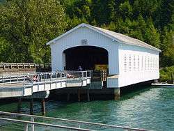
.jpg)
.jpg)
.jpg)
.jpg)
_(lanD0021).jpg)

.jpg)

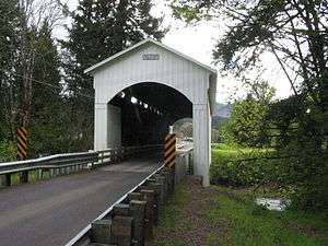
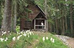


.jpg)
.jpg)
.jpg)
.jpg)
.jpg)
%2C_Jasper_vicinity_(Lane_County%2C_Oregon).jpg)
.jpg)
.jpg)
.jpg)
.jpg)
.jpg)
.jpg)

.jpg)
.jpg)
.jpg)
.jpg)
.jpg)
.jpg)
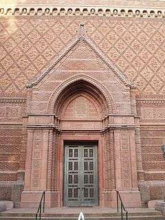
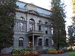
.jpg)
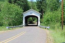
.jpg)
.jpg)
.jpg)
.jpg)
.jpg)

.jpg)

