Jeppes Reef
| Jeppes Reef | |
|---|---|
 | |
 Jeppes Reef  Jeppes Reef  Jeppes Reef
| |
| Coordinates: 25°43′12″S 31°28′37″E / 25.720°S 31.477°ECoordinates: 25°43′12″S 31°28′37″E / 25.720°S 31.477°E | |
| Country | South Africa |
| Province | Mpumalanga |
| District | Ehlanzeni |
| Municipality | Nkomazi |
| Area[1] | |
| • Total | 7.46 km2 (2.88 sq mi) |
| Population (2011)[1] | |
| • Total | 12,589 |
| • Density | 1,700/km2 (4,400/sq mi) |
| Racial makeup (2011)[1] | |
| • Black African | 99.7% |
| • Coloured | 0.2% |
| • Indian/Asian | 0.1% |
| First languages (2011)[1] | |
| • Swazi | 96.5% |
| • Other | 3.5% |
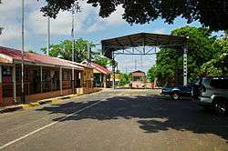
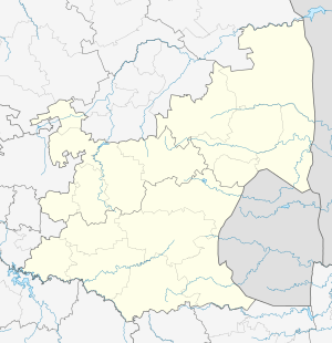
Jeppes Reef is a small rural town on the R40 road in Ehlanzeni District Municipality in the Mpumalanga province of South Africa, 25 kilometres (16 mi) south-southeast of Kaapmuiden, and just over 2 kilometres (1.2 mi) from the border with Swaziland.
A border control post operates between 07:00 and 20:00 between the two countries.[2] The Swaziland side of the border post is known as Matsomo.
| South Africa | Swaziland | |
|---|---|---|
| Region | Mpumalanga | |
| Nearest town | Baberton | |
| Road | R570 | |
| GPS Coordinates | 25°45′03″S 31°28′03″E / 25.7507°S 31.4676°E | 25°45′03″S 31°28′03″E / 25.7507°S 31.4676°E |
| Telephone number | +27 (0) 13 781 0382 | |
| Fax number | +27 (0) 13 781 0383 | |
| Business hours | 07:00 - 20:00 | 07:00 - 20:00 |
References
- 1 2 3 4 "Main Place Jeppes Reef". Census 2011.
- ↑ South African Ports of entry
This article is issued from Wikipedia - version of the 8/22/2015. The text is available under the Creative Commons Attribution/Share Alike but additional terms may apply for the media files.
.svg.png)