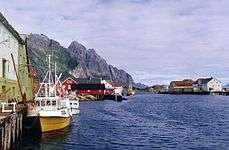
Henningsvær
| Henningsvær | |
|---|---|
| Village | |
|
Aerial view of the village | |
 Henningsvær  Henningsvær Location in Nordland | |
| Coordinates: 68°09′10″N 14°12′02″E / 68.15278°N 14.20056°ECoordinates: 68°09′10″N 14°12′02″E / 68.15278°N 14.20056°E | |
| Country | Norway |
| Region | Northern Norway |
| County | Nordland |
| District | Lofoten |
| Municipality | Vågan |
| Area[1] | |
| • Total | 0.3 km2 (0.1 sq mi) |
| Elevation[2] | 6 m (20 ft) |
| Population (2013)[1] | |
| • Total | 444 |
| • Density | 1,480/km2 (3,800/sq mi) |
| Time zone | CET (UTC+01:00) |
| • Summer (DST) | CEST (UTC+02:00) |
| Post Code | 8312 Henningsvær |
| Website | http://www.henningsvar.com |
Henningsvær is a fishing village located on several small islands off the southern coast of Austvågøya in the Lofoten archipelago in Norway. It is a part of the municipality of Vågan in Nordland county. The village is located about 20 kilometres (12 mi) southwest of the town of Svolvær. Henningsvær is connected to the rest of Vågan via the Henningsvær Bridges. The village is mostly located on the islands of Heimøya and Hellandsøya.
The 0.3-square-kilometre (74-acre) village has a population (2013) of 444. The population density is 1,480 inhabitants per square kilometre (3,800/sq mi).[1] Due to its traditional fishing village architecture, Henningsvær draws many tourists. Climbing and diving/snorkeling are also popular tourist activities. Henningsvær Church is located in the village, on the island of Heimøya.

References
- 1 2 3 Statistisk sentralbyrå (1 January 2013). "Urban settlements. Population and area, by municipality.".
- ↑ "Henningsvær" (in Norwegian). yr.no. Retrieved 2012-07-19.
External links
-
 Media related to Henningsvær at Wikimedia Commons
 - Official website - English version
- Henningsvær on VisitNorway website
- Henningsvær on Lofoten.com
