Heldrungen
| Heldrungen | ||
|---|---|---|
| ||
 Heldrungen | ||
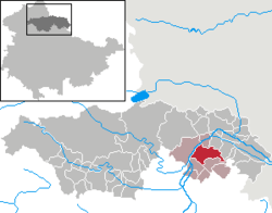
Location of Heldrungen within Kyffhäuserkreis district  | ||
| Coordinates: 51°18′5″N 11°13′0″E / 51.30139°N 11.21667°ECoordinates: 51°18′5″N 11°13′0″E / 51.30139°N 11.21667°E | ||
| Country | Germany | |
| State | Thuringia | |
| District | Kyffhäuserkreis | |
| Municipal assoc. | An der Schmücke | |
| Government | ||
| • Mayor | Norbert Enke (CDU) | |
| Area | ||
| • Total | 23.29 km2 (8.99 sq mi) | |
| Population (2015-12-31)[1] | ||
| • Total | 2,282 | |
| • Density | 98/km2 (250/sq mi) | |
| Time zone | CET/CEST (UTC+1/+2) | |
| Postal codes | 06577 | |
| Dialling codes | 034673 | |
| Vehicle registration | KYF | |
Heldrungen is a town in the Kyffhäuserkreis district, Thuringia, Germany.
Nearby rivers are the Unstrut and the Wipper.
It is known for its fortification with two water ditches, four vauban bastions and five rondells. In the center of the fortification is a renaissance castle, which was built within 1512 - 1518. Today, the castle is used as a youth hostel.
References
External links
- Official Homepage in German
This article is issued from Wikipedia - version of the 6/21/2015. The text is available under the Creative Commons Attribution/Share Alike but additional terms may apply for the media files.
