HarbourFront MRT Station
NE1 CC29 HarbourFront 港湾 துறைமுகம் HarbourFront | ||||||||||||||||
|---|---|---|---|---|---|---|---|---|---|---|---|---|---|---|---|---|
| Rapid transit | ||||||||||||||||
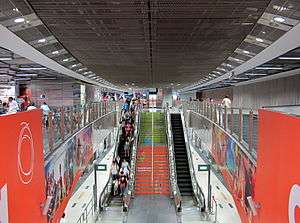
 North East Line platform of HarbourFront MRT station. | ||||||||||||||||
| Location |
81 Telok Blangah Road 83 Telok Blangah Road Singapore 098867 / 098886 | |||||||||||||||
| Coordinates | 1°15′55″N 103°49′20″E / 1.265297°N 103.82225°E | |||||||||||||||
| Operated by |
SBS Transit (ComfortDelGro) (North East Line) SMRT Trains (SMRT Corporation) (Circle Line) | |||||||||||||||
| Line(s) | ||||||||||||||||
| Platforms | Island | |||||||||||||||
| Tracks | 4 | |||||||||||||||
| Connections | Bus, Taxi | |||||||||||||||
| Construction | ||||||||||||||||
| Structure type | Underground | |||||||||||||||
| Platform levels | 3 | |||||||||||||||
| Parking | Yes (Vivocity) | |||||||||||||||
| Bicycle facilities | Yes | |||||||||||||||
| Disabled access | Yes | |||||||||||||||
| Other information | ||||||||||||||||
| Station code | NE1 CC29 | |||||||||||||||
| History | ||||||||||||||||
| Opened |
20 June 2003 (North East Line) 8 October 2011 (Circle Line) 2025 (Circle Line Stage 6) | |||||||||||||||
| Electrified | Yes | |||||||||||||||
| Previous names | World Trade Centre | |||||||||||||||
| Services | ||||||||||||||||
| ||||||||||||||||
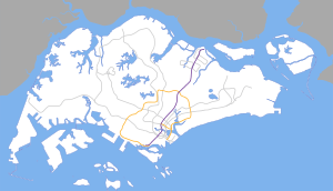
| Location | ||||||||||||||||
 | ||||||||||||||||
HarbourFront MRT Station (NE1/CC29) is an underground Mass Rapid Transit interchange and terminal station of the North East Line and the Circle Line in Bukit Merah planning area, Singapore. It is located next to the VivoCity and HarbourFront Centre, previously known as the Singapore World Trade Centre. It serves as a terminal station of the North East Line and the Circle Line. This station is one of the most convenient for transferring passengers as they do not have to walk long distances to interchange between lines.
.jpg)
.jpg)

Location
HarbourFront station serves the vicinity of HarbourFront, located at the southernmost point of mainland Bukit Merah. The station itself is located in close proximity to HarbourFront Centre and VivoCity. Buses to and from Sentosa originate from the HarbourFront Bus Interchange, located near the station. When the Sentosa Express monorail line to Sentosa began service on 15 January 2007 as a virtual interchange, Sentosa became more effectively linked with most of the towns of Singapore. The station also provides public transport to the prominent tourist destination of Mount Faber.
History
World Trade Centre station was constructed since 20 June 1997 and needed a road realignment along Telok Blangah Road, to allow the construction of the station. Later on, after 9/11 terrorist attacks, World Trade Centre exhibition halls were demolished and the station did a last-minute renaming in January 2002 to HarbourFront. HarbourFront station opened on 20 June 2003 with the rest of the North East Line. After VivoCity opened, weekend passenger traffic doubled to more than 60,000 passengers each day, surpassing Dhoby Ghaut, formerly the busiest station on the North East Line. Due to the sudden jump in passenger traffic, the number of faregates facing the linkway to VivoCity had to be increased from seven to nine. The Circle Line section of the station began revenue service on 8 October 2011, replacing Marymount as a terminal station for the Circle Line, thus making Habourfront station the first double-line terminus station in Singapore.
The North East Line's overrun tunnel at this station was extended by 50 metres for about S$8.2 million. Works were completed by the end of 2014. The station's operations were unaffected by the works as most of the enhancement works were done away from the station itself.[1]
On LTA's MasterPlan of 2013, its said that the Circle Line would extend from HarbourFront, travel through three new stations and then connect with Marina Bay Station, hence 'completing the Circle'.[2]
Art in Transit
The station features two sets of artwork under the Art in Transit programme. The interior of the North East Line station and walkways to station exits feature the artwork Enigmatic Appearances by Ian Woo. Abstract images on blue enamel panels evoke a sense of open seas, a reference to the station's proximity to the sea.[3] The second piece of artwork, Commuting Waves by Jason Ong, features in the Circle Line station. Using commuter traffic data of HarbourFront station on weekdays and weekends, the artist created two sets of two-dimensional glass waveforms resembling fishes, tying in with the station's water theme.[4]
Cultural references
The station was one of four stations featured in the Uniquely Singapore edition of Monopoly.
Station layout
| L2 | Overhead Bridge | |
| L1 | Street Level | Telok Blangah Road, VivoCity, HarbourFront Centre, HarbourFront Bus Interchange |
| B1 | Service Level | Vivocity |
| B2 | Concourse | Faregates, Ticketing Machines, Station Control, Transitlink Counter |
| B3 | ||
| Platform B | North East Line During peak hours only, towards NE17 PTC Punggol via NE3 EW16 Outram Park (→) | |
| Island platform, doors will open on the left, right | ||
| Platform A | North East Line alighting only (←) | |
| Platform A | Circle Line No Train service. Alighting only. (During peak hours only) | |
| Island platform, doors will open on the right | ||
| Platform B | Circle Line towards CC1 NS24 NE6 Dhoby Ghaut via CC28 Telok Blangah (←) | |
Exits
- A: HarbourFront Bus Interchange
- B: HarbourFront Centre
- C: VivoCity, Sentosa Express, Sentosa Boardwalk
- D: Mount Faber Park
- E: HarbourFront Centre, VivoCity
Transport connections
Rail
| Destination | First Train | Last Train | |||||
|---|---|---|---|---|---|---|---|
| Mon – Fri | Sat | Sunday & Public Holiday | Daily | ||||
| North East Line | |||||||
| to NE17 Punggol | 5.50am | 6.00am | 6.20am | 11.55pm | |||
| Circle Line | |||||||
| to CC1 Dhoby Ghaut | 5.30am | 5.30am | 5.51am | 11.03pm | |||
| to CC7 Mountbatten | – | – | – | 11.40pm | |||
| to CC12 Bartley | – | – | – | 12.04am | |||
References
- ↑ "Work on track to speed up NEL service". Channel News Asia. Retrieved 24 October 2012.
- ↑ Adrian Lim. "Three new stations to close loop for Circle Line". The Straits Times. Retrieved 2016-01-16.
- ↑ "Art in Transit on the North East Line". SBS Transit. Retrieved 11 October 2011.
- ↑ "Circle Line Art" (PDF). Land Transport Authority. Retrieved 19 April 2016.
External links
- SBS Transit's HarbourFront MRT station official website
- SMRT's HarbourFront MRT station official website
- Changi Airport to HarbourFront MRT station Route Map
| Wikimedia Commons has media related to HarbourFront MRT Station. |