Guishan Island (Yilan)
| Guishan Island | |
|---|---|
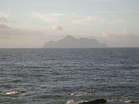
 View from Daxi Station | |
| Highest point | |
| Elevation | 401 m (1,316 ft) |
| Prominence | 401 m (1,316 ft) |
| Coordinates | 24°50′31″N 121°57′06″E / 24.84194°N 121.95167°ECoordinates: 24°50′31″N 121°57′06″E / 24.84194°N 121.95167°E |
| Geography | |
 Guishan Island East China Sea, off the NE coast of Yilan, Taiwan | |
| Geology | |
| Age of rock | Pleistocene |
| Mountain type | Stratovolcano |
| Last eruption | 1785 ± 10 years |
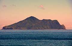
Guishan Island or Steep Island or Turtle Island (Chinese: 龜山島; Hanyu Pinyin: Guīshāndǎo; Tongyong Pinyin: Gueishandǎo; Wade–Giles: Kuei1-shan1-tao3; literally: "Turtle Mountain Island"), also known as Kueishan Island, is an island in the Pacific Ocean currently administered under Toucheng Township, Yilan County, Taiwan and located 9.1 km (5.7 mi) east of port of Gengfang Fishery Harbor. The island is the top of an andesite stratovolcano which rises from the seafloor. It is the only active volcano in Taiwan, displaying active fumaroles and solfataras. It has an area of 2.841 square kilometres (1.097 sq mi), and the highest point reaches 401 m (1,316 ft) above sea level.
The local population, consisting mainly of fishermen, was relocated in 1977 due to the hardships associated with living on the island. Between 1977 and 2000 it became the site of a military base, and currently it is managed as a tourist destination and natural conservation area. There are restrictions for visitors due to environmental protection.
Head Turning of the Turtle Mountain


It is interesting that from different views at different locations of Yilan County, the shape of Guishan Island is quite different. Also the shape of the turtle's head is different; from Northeast Coastal Areas of Toucheng Township such as Shicheng and Dasi, the shape is close to the head of a turtle, while from Luodong and Wujie Townships, the shape is triangular. The reason for this is the curvy shape of the seashore of Yilan, circling the very island. There is hence the term "Head Turning of the Turtle Mountain" (龜山轉頭).
Visiting the island
In 2000, the island was officially opened to tourists as a maritime ecological park.[1] Before going to the island, visitor numbers have to be reviewed to see which day is available for registration.
The application must be completed and shipping agreed with local ferry owners at least one week prior to the visiting date, there is also another application form for going to the highest point of the island, which is often restricted.
See also
References
- ↑ . Focus Taiwan News Channel. 2010-07-04 http://focustaiwan.tw/ShowNews/WebNews_Detail.aspx?ID=201007040024&Type=aIPL. Retrieved 2010-07-04. Missing or empty
|title=(help)
External links
| Wikimedia Commons has media related to Gueishan Island. |