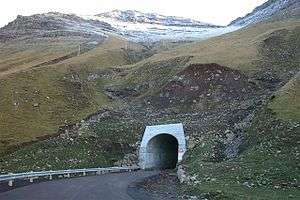
Gásadalstunnilin
|
The western entrance of the tunnel | |
| Overview | |
|---|---|
| Coordinates |
North West: 62°06′22″N 7°25′41″W / 62.106031°N 7.428131°W South East: 62°05′40″N 7°24′21″W / 62.094444°N 7.405772°W |
| Technical | |
| Length | 1400m |
The Gásadalur Tunnel, Gásadalstunnilin, is a 1.4 kilometer long,[1] single-lane tunnel in the west of the Faroe Islands. It connects the villages Bøur in the east with Gásadalur in the west, which are separated by the Knúkarnir mountain.[2]
The tunnel was initially open to pedestrians in 2003 but it was not until 2006[3] that it was officially open and available to vehicles.
See also
- List of tunnels of the Faroe Islands
-
 Geographic data related to Gásadalstunnilin at OpenStreetMap
References
- ↑ "The World's longest Tunnel Page: Tunnels in Faerö Islands". www.lotsberg.net.
- ↑ "OpenStreetMap | Node: Knúkarnir (302104878)". OpenStreetMap.
- ↑ "10 facts you didn't know about the Faroe Islands". blog.tripwolf.com.
This article is issued from Wikipedia - version of the 11/1/2016. The text is available under the Creative Commons Attribution/Share Alike but additional terms may apply for the media files.
