Flatraket
| Flatraket | |
|---|---|
| Village | |
|
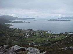
View of Flatraket | |
 Flatraket Location in Sogn og Fjordane | |
| Coordinates: 61°58′26″N 05°13′46″E / 61.97389°N 5.22944°ECoordinates: 61°58′26″N 05°13′46″E / 61.97389°N 5.22944°E | |
| Country | Norway |
| Region | Western Norway |
| County | Sogn og Fjordane |
| District | Nordfjord |
| Municipality | Selje Municipality |
| Population (2001) | |
| • Total | 306 |
| Time zone | CET (UTC+01) |
| • Summer (DST) | CEST (UTC+02) |
| Post Code | 6717 Flatraket |
Flatraket is a small village in the southwestern part of Selje Municipality in Sogn og Fjordane county, Norway. The village is located about 16 kilometres (9.9 mi) northeast of the town of Måløy (in Vågsøy Municipality), about 4 kilometres (2.5 mi) northwest of the village of Håvik, and about 30 kilometres (19 mi) southwest of the municipal centre of Selje. Flatraket has a good view of the island of Silda and the Stadlandet peninsula. The population (2001) of Flatraket was 306.[1]
Traditionally, fishing and agriculture have been important for this village, and the largest business there now is AS Fiskevegn. Flatraket has a school, a kindergarten, and a grocery store.
References
- ↑ Statistisk sentralbyrå (2001). "Folke- og boligtellingen 2001, kommune- og bydelshefter 1441 Selje" (PDF) (in Norwegian).
This article is issued from Wikipedia - version of the 11/27/2016. The text is available under the Creative Commons Attribution/Share Alike but additional terms may apply for the media files.
