Don Mills LRT
| Don Mills LRT | |||||||||||||||||||||||||||||||||||||||||||||||||||||||||||||||||||||||||||||||||||||||||||||||||||||||||||||||||||||||||||||||||||||||||||||||||||||||||||||||||||||||||||||||||||||||||||||||||||||||||||||||||||||||||||||||||||||||||||||||||||||||||||||||||||||||||||||
|---|---|---|---|---|---|---|---|---|---|---|---|---|---|---|---|---|---|---|---|---|---|---|---|---|---|---|---|---|---|---|---|---|---|---|---|---|---|---|---|---|---|---|---|---|---|---|---|---|---|---|---|---|---|---|---|---|---|---|---|---|---|---|---|---|---|---|---|---|---|---|---|---|---|---|---|---|---|---|---|---|---|---|---|---|---|---|---|---|---|---|---|---|---|---|---|---|---|---|---|---|---|---|---|---|---|---|---|---|---|---|---|---|---|---|---|---|---|---|---|---|---|---|---|---|---|---|---|---|---|---|---|---|---|---|---|---|---|---|---|---|---|---|---|---|---|---|---|---|---|---|---|---|---|---|---|---|---|---|---|---|---|---|---|---|---|---|---|---|---|---|---|---|---|---|---|---|---|---|---|---|---|---|---|---|---|---|---|---|---|---|---|---|---|---|---|---|---|---|---|---|---|---|---|---|---|---|---|---|---|---|---|---|---|---|---|---|---|---|---|---|---|---|---|---|---|---|---|---|---|---|---|---|---|---|---|---|---|---|---|---|---|---|---|---|---|---|---|---|---|---|---|---|---|---|---|---|---|---|---|---|---|---|---|---|---|---|---|---|---|
| Overview | |||||||||||||||||||||||||||||||||||||||||||||||||||||||||||||||||||||||||||||||||||||||||||||||||||||||||||||||||||||||||||||||||||||||||||||||||||||||||||||||||||||||||||||||||||||||||||||||||||||||||||||||||||||||||||||||||||||||||||||||||||||||||||||||||||||||||||||
| Type | Light rail | ||||||||||||||||||||||||||||||||||||||||||||||||||||||||||||||||||||||||||||||||||||||||||||||||||||||||||||||||||||||||||||||||||||||||||||||||||||||||||||||||||||||||||||||||||||||||||||||||||||||||||||||||||||||||||||||||||||||||||||||||||||||||||||||||||||||||||||
| System | Toronto subway and RT | ||||||||||||||||||||||||||||||||||||||||||||||||||||||||||||||||||||||||||||||||||||||||||||||||||||||||||||||||||||||||||||||||||||||||||||||||||||||||||||||||||||||||||||||||||||||||||||||||||||||||||||||||||||||||||||||||||||||||||||||||||||||||||||||||||||||||||||
| Status | Cancelled | ||||||||||||||||||||||||||||||||||||||||||||||||||||||||||||||||||||||||||||||||||||||||||||||||||||||||||||||||||||||||||||||||||||||||||||||||||||||||||||||||||||||||||||||||||||||||||||||||||||||||||||||||||||||||||||||||||||||||||||||||||||||||||||||||||||||||||||
| Locale | Toronto, Ontario | ||||||||||||||||||||||||||||||||||||||||||||||||||||||||||||||||||||||||||||||||||||||||||||||||||||||||||||||||||||||||||||||||||||||||||||||||||||||||||||||||||||||||||||||||||||||||||||||||||||||||||||||||||||||||||||||||||||||||||||||||||||||||||||||||||||||||||||
| Termini |
Pape Station Highway 7 | ||||||||||||||||||||||||||||||||||||||||||||||||||||||||||||||||||||||||||||||||||||||||||||||||||||||||||||||||||||||||||||||||||||||||||||||||||||||||||||||||||||||||||||||||||||||||||||||||||||||||||||||||||||||||||||||||||||||||||||||||||||||||||||||||||||||||||||
| Operation | |||||||||||||||||||||||||||||||||||||||||||||||||||||||||||||||||||||||||||||||||||||||||||||||||||||||||||||||||||||||||||||||||||||||||||||||||||||||||||||||||||||||||||||||||||||||||||||||||||||||||||||||||||||||||||||||||||||||||||||||||||||||||||||||||||||||||||||
| Operator(s) | Toronto Transit Commission | ||||||||||||||||||||||||||||||||||||||||||||||||||||||||||||||||||||||||||||||||||||||||||||||||||||||||||||||||||||||||||||||||||||||||||||||||||||||||||||||||||||||||||||||||||||||||||||||||||||||||||||||||||||||||||||||||||||||||||||||||||||||||||||||||||||||||||||
| Technical | |||||||||||||||||||||||||||||||||||||||||||||||||||||||||||||||||||||||||||||||||||||||||||||||||||||||||||||||||||||||||||||||||||||||||||||||||||||||||||||||||||||||||||||||||||||||||||||||||||||||||||||||||||||||||||||||||||||||||||||||||||||||||||||||||||||||||||||
| Line length | 17.6 kilometres (10.9 mi) | ||||||||||||||||||||||||||||||||||||||||||||||||||||||||||||||||||||||||||||||||||||||||||||||||||||||||||||||||||||||||||||||||||||||||||||||||||||||||||||||||||||||||||||||||||||||||||||||||||||||||||||||||||||||||||||||||||||||||||||||||||||||||||||||||||||||||||||
| Track gauge | 1,435 mm (4 ft 8 1⁄2 in) | ||||||||||||||||||||||||||||||||||||||||||||||||||||||||||||||||||||||||||||||||||||||||||||||||||||||||||||||||||||||||||||||||||||||||||||||||||||||||||||||||||||||||||||||||||||||||||||||||||||||||||||||||||||||||||||||||||||||||||||||||||||||||||||||||||||||||||||
| |||||||||||||||||||||||||||||||||||||||||||||||||||||||||||||||||||||||||||||||||||||||||||||||||||||||||||||||||||||||||||||||||||||||||||||||||||||||||||||||||||||||||||||||||||||||||||||||||||||||||||||||||||||||||||||||||||||||||||||||||||||||||||||||||||||||||||||
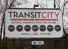
The Don Mills LRT was a proposed light rail line in Toronto, Ontario, Canada. It was part of the Transit City proposal announced March 16, 2007, to be operated by the Toronto Transit Commission (TTC). It was expected to cost approximately $675 million, with construction to begin in 2012, and an expected opening in 2016. It would've been the fifth of the seven Transit City lines to be complete after the Sheppard East LRT, Etobicoke-Finch West LRT, Waterfront West LRT, and Eglinton Crosstown lines. Ridership was estimated to be 21.2 million trips in 2021.
Mayor Rob Ford cancelled the line after taking office in December 2010.[1] While LRT lines on Sheppard East, Finch West, and Eglinton Crosstown were revived through a new agreement between the City of Toronto and Metrolinx, the Don Mills LRT was not included.[2]
The Don Mills LRT is still included in Metrolinx's regional transportation plan The Big Move under the 15-year horizon.[3] Metrolinx has also completed a detailed benefits case analysis for the Downtown Relief Line, exploring the potential of constructing a subway instead of the Don Mills LRT to Don Mills station.[4]
Route layout
According to initial Toronto Transit Commission planning, the Don Mills LRT line would run for 17.6 km between Steeles Avenue and Line 2 Bloor–Danforth. The LRT would operate via Don Mills Road from the north, and then turn east along Overlea Boulevard through the community of Thorncliffe Park. South of Thorncliffe Park, the TTC was examining three different alignments for the LRT to connect to the Line 2 subway, prior to cancellation of the project:[5]
- Pape Avenue, via the Leaside Bridge, to Pape station;
- Broadview Avenue, via the Leaside Bridge, to Broadview station;
- Bayview Avenue, via Millwood Road and Southdale Drive, to Castle Frank station.
The Big Move proposes for the Don Mills LRT to run along between Pape Avenue, to Pape station. It also proposes that the LRT stretch north past Steeles Avenue, along Leslie Street to Highway 7 in York Region.[3]
Proposed stops/stations
The TTC did not indicate specific stops at the time of planning.[5] The Big Move indicates that the line would intersect mobility hubs at Eglinton, Don Mills, Steeles, and Highway 407, and facilitate transfers to the Eglinton Crosstown line, Line 4 Sheppard, the Sheppard East LRT, an LRT or BRT line on Steeles, the 407 Transitway, and the Highway 7 Rapidway.[3]
Downtown Relief Line
The Don Mills LRT is proposed to connect to the Downtown Relief Line (DRL) at Line 2, which is proposed to help reduce current and projected congestion in downtown Toronto. Metrolinx, the City of Toronto, York Region and the TTC partnered on the Yonge Relief Network Study (YRNS) in 2015, which examined options for providing relief on the Yonge line. This included three different versions of the DRL, and a surface LRT similar to the Don Mills LRT. The YRNS found that a DRL between downtown and Sheppard Avenue would provide the most effective relief on the Yonge line. Pursuing this option would truncate the LRT south of Sheppard, and replace it with a subway.[6][3]
References
- ↑ Mayor Rob Ford: “Transit City is over” Toronto Life December 1, 2010
- ↑ Tess Kalinowski (28 November 2012). "TTC, Metrolinx finally sign off on LRTs". Toronto Star. Retrieved 28 November 2012.
- 1 2 3 4 "The Big Move" (PDF). Metrolinx. 2008. Retrieved 22 April 2015.
- ↑ "Yonge Relief Network Study (YRNS) - Report for June 25th Metrolinx Board Meeting" (PDF). Metrolinx. Retrieved 2015-07-28.
- 1 2 UrbanToronto forums - TTC: Jane LRT - Post #880309
- ↑ "TTC Report: Downtown Rapid Transit Expansion Study – Phase 1 Strategic Plan" (PDF). 2012-10-24. Retrieved 2015-12-08.
External links
- Official TTC site
- Transit City website
- Don Mills Road Transit Improvements Individual Environmental Assessment

_(14918534190).jpg)
