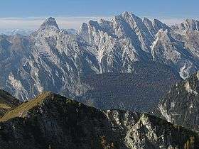
Cima dei Preti
| Cima dei Preti | |
|---|---|
 | |
| Highest point | |
| Elevation | 2,703 m (8,868 ft) |
| Prominence | 1,417 metres (4,649 ft) |
| Listing | Alpine mountains 2500-2999 m |
| Coordinates | 46°20′36″N 12°25′13″E / 46.34333°N 12.42028°ECoordinates: 46°20′36″N 12°25′13″E / 46.34333°N 12.42028°E |
| Geography | |
 Cima dei Preti Location in the Alps | |
| Location | Friuli-Venezia Giulia / Veneto, Italy |
| Parent range | Carnic Prealps |
| Climbing | |
| First ascent | 23 September 1874 by Santo Siorpaes and Maurice Holzmann |
Cima dei Preti (Italian: "Priests' Peak") is a mountain in the Carnic Prealps, the highest peak of the Friulian Dolomites, Italy. It is located at the boundaries between the provinces of Pordenone and Belluno.
SOIUSA classification
According to the SOIUSA (International Standardized Mountain Subdivision of the Alps) the mountain can be classified in the following way:[1]
- main part = Eastern Alps
- major sector = Southern Limestone Alps
- section = Carnic and Gailtal Alps
- subsection = Carnic Prealps
- supergroup =Catena Duranno-Monfalconi-Pramaggiore
- group = Gruppo del Duranno
- code = II/C-33.III-A.3
References
This article is issued from Wikipedia - version of the 9/28/2015. The text is available under the Creative Commons Attribution/Share Alike but additional terms may apply for the media files.