Roeselare-Leie Canal

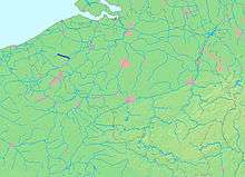
The Roeselare-Leie Canal is an artificial waterway between the town Roeselare and the river Leie.
It can handle barges up to 1350 tonnes.
The port in Roeselare, at the start of the Roeselare-Leie Canal, is mainly characterized by a thriving industrial activity. Well-known companies that are located there include Debaillié and Hanekop, both producers of animal food. Soubry, the well-known dough manufacturer, also has an establishment there.
The Roeselare port covers an area of 40 hectares and is easily accessible by road. Nearby is the A17/E403 highway Bruges-Kortrijk with many opportunities to explore the coast, the inland of the Belgian-French and Belgian-Dutch border regions. The disclosure in Roeselare is also good with the Mandel Avenue that can be used to access the industrial zone in Beveren. It is also easy to choose driving through the King Albert I Avenue until the Inner Ring road to the Great Ring N36/R32. The canal connects Roeselare with the ports of Dunkirk, Ghent, Antwerp, Brussels and Liege, via the Leie.
Following the canal from Roeselare City, one passes first the town of Izegem where the food company Vandemoortele Groep is located, then Ingelmunster and Oostrozebeke, and finally Ooigem, a municipality of Wielsbeke where the canal joins the Leie. There is a lock to overcome a height of 7.50 meters. The Kortrijk-Bruges railway line runs a few kilometers parallel to the canal. There is a proposal to build a container terminal for temporary container storage alongside the canal.
The Leiestreek tourist office and the municipality are working on a project to give the canal and the green area around it a recreational function. For example, during the summer there are already boat cruises. The banks of the canal are also frequented by fishermen.
The piece of the canal between Roeselare port and the town is an ideal backdrop for street theater and cultural events, such as the annual happening "De Groote Stooringe".
| Wikimedia Commons has media related to Roeselare-Leie canal. |
Coordinates: 50°54′47″N 3°17′02″E / 50.913°N 3.284°E