Bolgatanga Municipal District
| Bolgatanga Municipal District | ||
|---|---|---|
| Municipal | ||
|
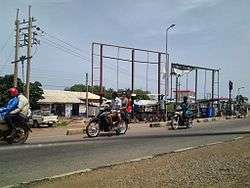
View of street in Bolgatanga Municipal District | ||
| ||
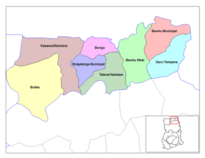
 Districts of Upper East region | ||
 Bolgatanga Municipal District Bolgatanga Municipal in Upper East region | ||
| Coordinates: 10°47′N 0°51′W / 10.783°N 0.850°W | ||
| Region | Upper East Region | |
| Capital | Bolgatanga | |
| Government | ||
| • District executive | Harry Ayamga Epsona | |
| Area | ||
| • Total | 729 km2 (281 sq mi) | |
| Population (2013) | ||
| • Total | — | |
| Time zone | GMT (UTC+0) | |
| ISO 3166 code | GH-UE-BO | |
The Bolgatanga Municipal District is one of the nine (9) districts in the Upper East Region of north Ghana. The capital is the town Bolgatanga, which also serves as the capital of the Upper East Region.
Climate
The climate is tropical with a rainy season from May to October and a long dry season with virtually no rainfall from October to April. Temperatures range between a maximum of 40 degrees in March / April and at least 12 °C in December.
The natural vegetation of the district consists of tree savanna, with baobab, and acacia trees. The low vegetation is burned by fire during the dry season or dried by the sun.
Demographics
The inhabitants of the district belong predominantly to different peoples of Northern Ghana. The town of Bolgatanga, however, has a cosmopolitan character. Here are mixed not only different peoples of the north, but also members of the major ethnic groups including the Grune, sisala, and kanjegah peoples.
Economy
The majority of the population in the 1990s lived, in spite of the urban structure of the district, from agriculture, 19% commercial, 12% industry, mainly handicrafts, and just 7.4% were employed in public services. There are some jobs in the mining and construction and in the form of some metal-working companies, repair shops, painting companies etc. but these represent a very small minority.
Villages
The capital in the district is Bolgatanga.Some Towns and Villages in the district include:
- Tindonsobulugu
- Tindonmolgo
- Daporetindongo
- Yarigabisi
- Zuarungu Dachio
- Gambibigo-Azuabisi
- Kumbosigo
- Sherigu Dorungu-Agobgabis
- Pobaga
- Atulbabisi
- Tanzui
- Kumbangre
- Bolga-Soe
- Bukere
- Sokabisi
- Yikine
- Sumbrungu
- Zaare
Sources
Coordinates: 10°47′N 0°51′W / 10.783°N 0.850°W
