Batalha, Portugal
| Batalha | |||
|---|---|---|---|
| Municipality | |||
|
Batalha Monastery | |||
| |||
 | |||
| Coordinates: 39°39′N 8°48′W / 39.650°N 8.800°WCoordinates: 39°39′N 8°48′W / 39.650°N 8.800°W | |||
| Country |
| ||
| Region | Centro | ||
| Subregion | Pinhal Litoral | ||
| Intermunic. comm. | Região de Leiria | ||
| District | Leiria | ||
| Parishes | 4 | ||
| Area | |||
| • Total | 103.42 km2 (39.93 sq mi) | ||
| Population (2011) | |||
| • Total | 15,805 | ||
| • Density | 150/km2 (400/sq mi) | ||
| Time zone | WET/WEST (UTC+0/+1) | ||
| Website |
www | ||

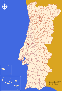
Batalha (Portuguese pronunciation: [bɐˈtaʎɐ]) is a town and a municipality in Leiria District, Pinhal Litoral Subregion, Centro Region, Portugal. The town's name means battle. The municipality population in 2011 was 15,805,[1] in an area of 103.42 square kilometres (39.93 sq mi).[2] The town proper has about 7,500 inhabitants. The municipality is limited to the North and West by the municipality of Leiria, to the East by Ourém, to the Southeast by Alcanena and to the Southwest by Porto de Mós.
The town was founded by King D. João I of Portugal, jointly with the Monastery of Santa Maria da Vitória na Batalha, to pay homage to the Portuguese victory at the Battle of Aljubarrota (August 14, 1385) that put an end to the 1383–1385 Crisis.
The Portuguese professor and sociologist Moisés Espírito Santo was born there.
Demography
| Population of the municipality of Batalha (1801–2011) | |||||||||
|---|---|---|---|---|---|---|---|---|---|
| 1801 | 1849 | 1900 | 1930 | 1960 | 1981 | 1991 | 2001 | 2004 | 2011 |
| 2510 | 2445 | 7107 | 9634 | 13 811 | 12 588 | 13 329 | 15 002 | 15 542 | 15 805 |
Monuments
- Batalha Monastery
- Estátua Equestre de Sao Nuno de Santa Maria (1966 - 1968)
- Igreja Matriz de Exaltaçao de Santa Cruz (1514 - 1532)
- Capela da Santa Casa da Misericórdia (18th century)
- Ponte da Boutaca (1862)
- Pelourinho (2000 - reconstrucao do pelourinho original)
- Edifício Mouzinho de Albuquerque - Galeria de Exposiçoes
- Capela de Nossa Senhora do Caminho
- Boca da Mina das Barrojeiras
- Igreja Paroquial Nossa Senhora dos Remédios
- Ermida de Nossa Senhora do Fetal
- Moinhos de Vento

Natural heritage
- Grutas da Moeda
- Maciço Calcário Estremenho
- Buraco Roto
- Pia da Ovelha
- Escarpa de falha do Reguengo do Fetal
Parishes
Administratively, the municipality is divided into 4 civil parishes (freguesias):[3]
- Batalha
- Golpilheira
- Reguengo do Fetal
- São Mamede
References
- ↑ Instituto Nacional de Estatística
- ↑ Direção-Geral do Território
- ↑ Diário da República. "Law nr. 11-A/2013, page 552 24" (pdf) (in Portuguese). Retrieved 17 July 2014.
External links
- Photos from Batalha
- Adrian Fletcher's Paradoxplace Batalha Pages (photos)
- Camara Municipal da Batalha
- Monastery of Batalha

