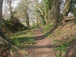
Avon Valley Path
Coordinates: 51°04′01″N 1°47′53″W / 51.067°N 1.798°W
| Avon Valley Path | |
|---|---|
|
Between Winkton and Burton in Dorset | |
| Length | 34 mi (55 km) |
| Location | South west England |
| Trailheads |
Salisbury Cathedral, Wiltshire Christchurch Priory, Dorset. |
| Use | Hiking |

The Avon Valley Path is a long-distance path in the English counties of Wiltshire, Hampshire and (for about 2½ miles) Dorset.
The path takes its name from the River Avon. From Salisbury it passes through the towns of Fordingbridge and Ringwood as well as the villages of Odstock, Nunton, Charlton-All-Saints, Downton, Hale, Woodgreen, Turmer, Ibsley, Kingston, Sopley and Burton. It ends near the coast at Christchurch Priory, Dorset.[1]
The path is waymarked and can be walked in either direction. The path crosses the Clarendon Way and Castleman Trailway, and passes through the western edge of the New Forest.
This route is shown as a series of coloured diamonds on Ordnance Survey 1:25,000 and 1:50,000 maps.
References
External links
See also
![]() Media related to Avon Valley Path at Wikimedia Commons
Media related to Avon Valley Path at Wikimedia Commons
