Asberg (Westerwald)
| Asberg | |
|---|---|
|
The Asberg seen from the Birkig | |
| Highest point | |
| Elevation | 441 m above sea level (NHN) (1,446.9 ft) [1] |
| Coordinates | 50°37′31″N 7°17′46″E / 50.6254°N 7.2962°ECoordinates: 50°37′31″N 7°17′46″E / 50.6254°N 7.2962°E |
| Geography | |
 Asberg | |
| Parent range | Rheinwesterwald Volcanic Ridge, Niederwesterwald |
| Geology | |
| Mountain type | basalt |
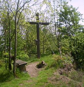 Summit of the Asberg | |
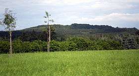
The Asberg is a hill, 441 m above sea level (NHN),[1][2] on the Rheinwesterwald Volcanic Ridge on the northern edge of the Linz Heights (Linzer Höhe). Until the 1970s it was the site of a basalt quarry.
Geography
The Asberg lies in the east of the borough of Unkel (central section and summit) and the municipalities of Rheinbreitbach (northern section) and Erpel (southern section) and is highest point of each district. The stumpy dome (kuppe) of the Asberg rises above the surrounding plateau of the volcanic ridge by around 80 metres. Three flooded pits, with a total are of two hectares, are distributed over a distance of 500 metres to the west and east of the summit, the easternmost and largest lake containing zones of silting.
References
- 1 2 Map services of the Federal Agency for Nature Conservation
- ↑ Landesvermessungsamt Nordrhein-Westfalen: topographic map 1:25,000 series, 5309 Königswinter, Bonn 2000; according to the land registry the height is 432.8 m above NN
Literature
- Jürgen Fuchs: Basalt vom Asberg. In: Heimat-Jahrbuch des Landkreises Neuwied 2008, ISBN 978-3-935690-61-4, S. 231–236.
External links
| Wikimedia Commons has media related to Asberg (Westerwald). |
- Cable car – Basalt from the Asberg
- FFH of Asberg bei Kalenborn
- Biotope complex of Asberg bei Kalenborn
This article is issued from Wikipedia - version of the 10/19/2016. The text is available under the Creative Commons Attribution/Share Alike but additional terms may apply for the media files.