Arkansas Highway 89
| ||||
|---|---|---|---|---|
 | ||||
| Route information | ||||
| Maintained by AHTD | ||||
| Highway system | ||||
| ||||
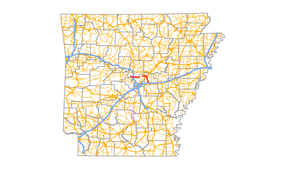
Highway 89 (AR 89, Ark. 89, and Hwy. 89) is a highway in the central part of the U.S. state of Arkansas. Its southern terminus is at an intersection with U.S. Route 70 near the western end of Lonoke, Arkansas. From there, it runs 7 miles (11 km) north and west to Furlow then 8½ miles north to Highway 367 at Cabot, Arkansas, the largest city through which the highway runs. Within Cabot, it serves as a portion of two major commercial thoroughfares — first as South Pine Street from city limits into downtown, then turning westward as West Main Street. From Cabot, it runs approximately 6 miles (9.7 km) west crossing Highway 5 at the Pulaski County/ Lonoke County before ending at Highway 107 8 miles (13 km) south of Vilonia, Arkansas.
It resumes again 3½ miles south as Pulaski County Road 89 running west and north 4½ miles to the Faulkner County line where it becomes a state highway again. It continues west 11 more miles intersecting Highway 365 1-mile (1.6 km) north of Mayflower. From there, it travels south 1-mile (1.6 km) then turns west again traveling approximately 5 miles (8.0 km) before continuing as Lollie Road.
Lonoke spur
| |
|---|---|
| Location: | Lonoke |
| Length: | 0.29 mi[1] (0.47 km) |
Highway 89 Spur is a former spur route in Lonoke. It is 0.29 miles (0.47 km) in length.[1] It was deleted from the state highway system in 2014.[2]
- Major intersections
The entire route is in Lonoke, Lonoke County.
| mi[3] | km | Destinations | Notes | ||
|---|---|---|---|---|---|
| 0.00 | 0.00 | Western terminus | |||
| 0.29 | 0.47 | Eastern terminus | |||
| 1.000 mi = 1.609 km; 1.000 km = 0.621 mi | |||||
See also
-
 Arkansas portal
 -
 US Roads portal
References
- 1 2 Planning and Research Division (2010). "Arkansas Road Log Database". Arkansas State Highway and Transportation Department. Archived from the original (Database) on 23 June 2011. Retrieved June 9, 2011.
- ↑ General Highway Map, Lonoke County, Arkansas (PDF) (Map). 1:62500. Cartography by Planning and Research Division. Arkansas State Highway and Transportation Department. 2010. Retrieved August 14, 2015.
- ↑ Map of Lonoke, Arkansas (PDF) (Map) (August 2014 ed.). Arkansas State Highway and Transportation Department. Retrieved January 16, 2011.
