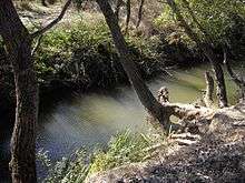
Alma River (Crimea)
| Alma | |
|---|---|
 Alma river near memorial of Battle of Alma | |
| Native name | Альма |
| Country | Crimea |
| Basin | |
| Main source | Babuğan Yayla, Crimean Mountains |
| River mouth | Kalamita bay of the Black Sea |
| Physical characteristics | |
| Length | 83 km (52 mi) |
The Alma (Ukrainian: Альма; Russian: Альма, Crimean Tatar: Alma) is a small river in Crimea that flows into the Black Sea. Its mouth is located half-way between Yevpatoria and Sevastopol. Alma is the Crimean Tatar word for an "apple".
The Alma is formed by the confluence of the Sary-su, the Savlykh-su and the Babuganka (Babuğan Yayla) rivers, and flows mostly through the mountains.[1] The Alminskoye and Partizanskoye storage reservoirs are located along its course.[1]
Near the Alma river the allied British, French, and Ottoman armies defeated the Russians under Prince Aleksandr Sergeevich Menshikov 20 September 1854, see Battle of Alma.[2]
References
Coordinates: 44°50′45″N 33°35′38″E / 44.84583°N 33.59389°E
This article is issued from Wikipedia - version of the 10/27/2016. The text is available under the Creative Commons Attribution/Share Alike but additional terms may apply for the media files.