Alleruusakasiit
This article is about the mountain. For the cliff, see Thumbnail (cliff).
| Alleruusakasiit | |
|---|---|
| Agdlerussakasit | |
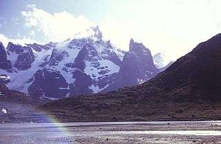
 View of Stordalen Havn in Torsukattak Fjord with the Alleruusakasiit in the background | |
| Highest point | |
| Elevation | 1,743.7 m (5,721 ft) |
| Coordinates | 60°8′8″N 44°31′44″W / 60.13556°N 44.52889°WCoordinates: 60°8′8″N 44°31′44″W / 60.13556°N 44.52889°W [1] |
| Geography | |
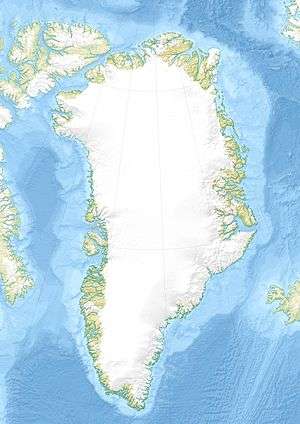
Alleruusakasiit, former spelling Agdlerussakasit, is a mountain in the Kujalleq municipality, southern Greenland.
Geography
This mountain is a 1,743.7 m high largely unglaciated rocky summit rising 2.8 km west of the shore of Torsukattak Fjord[2] located across the valley south of Angiartarfik.[3]
Alleruusakasiit is famous for its massive eastern cliff, known as the Thumbnail.[4]
See also
References
- ↑ GoogleEarth
- ↑ "Torsukattak". Mapcarta. Retrieved 10 June 2016.
- ↑ "Later visits to Stordalens Havn". 1975 University of St Andrews Greenland Expedition. Retrieved 10 June 2016.
- ↑ Ian Parnell: Learning Process. American Alpine Journal (AAJ) 2001, pp. 57–70, Greenland: The Thumbnail. Fragile moments, pp. 61–65
This article is issued from Wikipedia - version of the 7/5/2016. The text is available under the Creative Commons Attribution/Share Alike but additional terms may apply for the media files.
