Affler
| Affler | |
|---|---|
 Affler | |
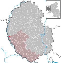
Location of Affler within Eifelkreis Bitburg-Prüm district  | |
| Coordinates: 50°00′51″N 06°09′12″E / 50.01417°N 6.15333°ECoordinates: 50°00′51″N 06°09′12″E / 50.01417°N 6.15333°E | |
| Country | Germany |
| State | Rhineland-Palatinate |
| District | Eifelkreis Bitburg-Prüm |
| Municipal assoc. | Südeifel |
| Government | |
| • Mayor | Herbert Steins |
| Area | |
| • Total | 1.99 km2 (0.77 sq mi) |
| Population (2015-12-31)[1] | |
| • Total | 27 |
| • Density | 14/km2 (35/sq mi) |
| Time zone | CET/CEST (UTC+1/+2) |
| Postal codes | 54689 |
| Dialling codes | 06524 |
| Vehicle registration | BIT |
| Website | Affler at site www.suedeifelinfo.de |
Affler is a municipality in the district of Bitburg-Prüm, in Rhineland-Palatinate, western Germany.[2]
Geography
Affler is located in the West Eifel, south of Dasburg and above the Our, near the border with Luxembourg.[2]
History
In October 1795, the French Republic annexed the Austrian Netherlands, which included the Grand-Duchy of Luxembourg. Under the French administration, the area belonged to the canton of Clervaux in the district of Diekirch, department of Forêts. In 1815, due to the resolutions of the Congress of Vienna, the former Luxembourg area east of the Sauer and Our was assigned to the Kingdom of Prussia.
The population of Affler from 1815-2014, based on census:
|
|
Religion
The community has a small chapel, built in 1887, which holds occasional services. At the end of a tunnel (in which the inhabitants of the village hid for three weeks in 1944) in the nearby forest stands a small statue of Mary. It was built in gratitude that the American bombings in September 1944 killed none of the inhabitants of Affler.[2]
References
- ↑ "Gemeinden in Deutschland mit Bevölkerung am 31. Dezember 2015" (PDF). Statistisches Bundesamt (in German). 2016.
- 1 2 3 "Affler | Hierzuland | Landesschau Rheinland-Pfalz". swr.online (in German). Retrieved 2016-05-22.