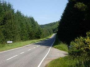
A957 road
|
The summit 6 miles (9.7 km) from Crathes | |
| Route information | |
| Length: | 14.5 mi[1] (23.3 km) |
| Major junctions | |
| southeast end: |
56°56′59″N 2°13′33″W / 56.9498°N 2.2259°W |
|
| |
| northwest end: |
57°03′32″N 2°24′54″W / 57.0590°N 2.4151°W |
| Location | |
| Primary destinations: | Stonehaven |
| Road network | |
The A957 road, commonly called the Slug Road, is a two lane paved public roadway in Aberdeenshire, Scotland connecting Stonehaven to the A93 road near Crathes after crossing the River Dee, Aberdeenshire over Durris Bridge.[2]
History and route
The A957 passes slightly to the south of the historic Ury Estate and somewhat to the north of Rickarton House. Proceeding northwesterly, the Slug Road passes by Fetteresso Forest and Durris Forest and eventually by the Balbridie Neolithic timber hall.
The etymology of Slug Road is asserted to be a derivation of the Gaelic word sloc, which means hollow or dell, thus named due to the road traversing a narrow mountain pass.[3]
See also
References
- ↑ "Driving directions to A957". Google. Retrieved 22 September 2013.
- ↑ United Kingdom Ordnance Survey Map Landranger 45, Stonehaven and Banchory, Scale: 1:50,000
- ↑ "Scottish National Dictionary". Dictionary of the Scots Language, Dundee. Retrieved 22 September 2013.
This article is issued from Wikipedia - version of the 9/23/2013. The text is available under the Creative Commons Attribution/Share Alike but additional terms may apply for the media files.
