Žumberak Mountains
| Žumberak Mountains | |
|---|---|
 View of Gorjanci, the highest ridge, with Trdinov vrh, from Slovenia. The village of Pangrč Grm is visible at the foot. | |
| Highest point | |
| Coordinates | 45°45′37″N 15°19′15″E / 45.76028°N 15.32083°ECoordinates: 45°45′37″N 15°19′15″E / 45.76028°N 15.32083°E |
| Geography | |
 Žumberak Mountains Sveta Gera/Trdinov vrh | |
| Location | Croatia, Slovenia |
| Parent range | Dinaric Alps |
| Geology | |
| Age of rock | mostly Triassic |
| Mountain type | Dolomite, Limestone |
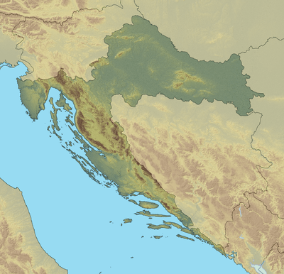
The Žumberak Mountains (Croatian: Žumberačka Gora, Slovene: Žumberška gora, historic German name: Uskokengebirge[1]) is a range of hills and mountains in northwestern Croatia and southeastern Slovenia, extending from the southwest to the northeast between the Krka and the Kupa. It covers an area of 430 km2 (170 sq mi). The geographically unified massif consists of two parts, separated by the Bregana River and Žumberak River (Croatian: Žumberačka rijeka). The northeastern part is the Samobor Hills (Croatian: Samoborsko gorje) with the foothills. The central and western part is named Žumberak Hills (Croatian: Žumberačko gorje, Žumberak). Its northwesternmost part, named Gorjanci, lies in Slovenia. The highest peak of the range is Sveta Gera (Trdinov vrh) on the border between Croatia and Slovenia, being 1,178 m (3,865 ft) high. Since 1999, an area of the range in Croatia has been protected as the nature park Žumberak–Samobor Hills.[2][3]
Setting
Žumberak Mountains lie near and partly on the border between Croatia and Slovenia, which, mostly, passes through the highest parts of the massif. Croatian part of the mountain range is in Central Croatia, mostly in western part of Zagreb County and a smaller part is in Karlovac County. Slovene part belongs to the traditional region of Lower Carniola. The Žumberak Mountains is situated only 25 km 25 km (16 mi) from Croatian capital, Zagreb. Cities near this range are Samobor, Jastrebarsko, and Ozalj in Croatia, and Novo Mesto, Brežice, and Kostanjevica na Krki in Slovenia. The range is on territory of four cities:
- Samobor, Novo Mesto, Jastrebarsko and Ozalj
and 7 municipalities
- Krško, Kostanjevica na Krki, Šentjernej, Brežice, Žumberak, Krašić and Klinča Sela.
Border dispute
The highest peak, Sveta Gera/Trdinov vrh, is subject to a border dispute between Croatia and Slovenia. An old Yugoslav People's Army barracks building stands there that is used as an outpost by the Slovenian Army since the 1990s, although it is recorded in the Croatian land registry, and Croatian side see this as an occupation of their land. Since then that has been a subject of a dispute between the two new countries.[4][5][6]
The situation became more complex when the dispute nearly derailed Croatia's application to join NATO. It escalated further with Slovenia's blockade of Croatia's EU accession from December 2008 until September–October 2009, when Slovenia (a European Union member state) blocked the negotiation progress of Croatia (at the time an EU candidate state). However, further escalation was prevented due to amicable diplomacy of the Croatian and Slovenian prime ministers Jadranka Kosor, and Borut Pahor.[7][8]
Flora
There are more than 1,000 species of different plant life recorded in this area, some of which are strictly protected. In the area of the Nature Park 90 species of Croatian vascular flora from the Red Book are recorded. On the global level 3 of them are critically endangered, 11 are endangered and 28 are globally sensitive.
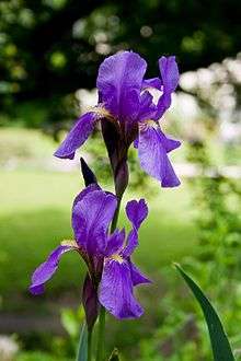
Forests cover huge area of the range. there are few Old-growth forests mostly on slovene part of the highest ridge, close to Sveta Gera. These are Old-growth forest Ravna Gora, and Old-growth forest trdinov vrh. Most common are the forests of Sessile Oak and hornbeam and on steeper slopes are the forests of Downy Oak and hop hornbeam. Beech forests cover the highest ridges. Some endangered and protected plants are found here, such as are globally sensitive species Iris croatica and Daphne blagayana. Globally sensitive species of wild orchids and lilies can be found in areas between forests and open habitats.
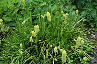
There is only a small area of grassland of natural origin. The local population exploited grassland. Grassland are rich in species. In some areas more than 40 species of plants have been recorded on one square meter! Many of them are in the Red Book of vascular flora in Croatia. The areas of damp and marsh-like grassland and plain and moors also can be found here. Important example is the area along the Jasinje creek where even 7 strongly protected and 12 protected plant species have been recorded. Among them we stress critically endangered species on global level – tall cottongrass (Eriophorum angustifolium) and alpine asphodel (Tofieldia calyculata); globally endangered species of sedges, globally sensitive species: grass-like sedge (Carex panicea) and lesser butterfly-orchid (Platanthera bifolia) and species with the status of not sufficiently explored (DD) in Croatia, elongated sedge (Carex elongata).
There are 377 species of mushrooms in the Park area. It is supposed that this is only smaller number of a total number of mushrooms in this area, In the research carried on in 2007, 7 new species of mushrooms were found in Žumberak – Samoborsko gorje Nature Park. Arched Woodwax (Hygrophorus camarophyllus) is on the Red List of the mushrooms in Croatia with EN category of endanger (globally endangered species).
There are 79 discovered species of lichens, three of which are on the Red List of lichens in Croatia. These are Bryoria fuscescens (with status VU – sensitive family), Lobaria pulmonaria (with status EN – endangered family) and genus Usnea (status VU). The research discovered several localities rich in lichen species like wild forest of beech in area of Kuti and wider area of Budinjak, Sv. Gera. Old orchards in grassland are explored as well. Following families are found and put on the Red List of Croatia: Baeomyces rufus (almost endangered species – NT), Dibaeis baeomyces (VU), Lobaria pulmonaria (VU), Menegazzia terebrata (VU) i Solorina saccata (VU).[9]
Edelweiss (Leontopodium alpinum) 
Common cottonsedge (Eriophorum angustifolium) 
Iris Croatica 
Daphne blagayana .jpg)
Lesser Butterfly-orchid (Platanthera bifolia) 
Tofieldia calyculata
Fauna
Here you may see large predators as bears (Ursus arctos) and wolf (Canis lupus). There are also numerous species of small mammals, amphibians, reptiles, and invertebrates.
There are many birds living in this area. Some are birds of prey like goshawk, and birds living next to creeks (white-throated dipper and grey wagtail). In lower parts, Grey Heron (Ardea cinerea) can be seen, and occasionally even white stork (Ciconia ciconia).
Most of amphibian and reptile species which you can find in continental Croatia, can be found here. Spotted salamander (Salamandra salamandra) is a regular inhabitant of the areas near creeks. Very rare black salamanders (Salamandra atra) can be seen in higher areas.
Ponds, which were formerly used as stock waterholes, are important hatching places for amphibians like toads, newts and frogs. Snakes are common here. Venomous snakes - Viper (Vipera ammodytes) and grass snake (Natrix natrix), and nonvenomous - Aesculapian snake (Elaphe longissima), smooth snake (Coronella austriaca) and dice snake (Natrix tessellata) – strictly protected species listed on the Red List. The commonest lizard is wall lizard (Podarcis muralis), slow-worm (Anguis fragilis), European green lizard (Lacerta viridis) and common lizard (Lacerta vivipara).
There are 21 species of fish, from 8 families. They live in river Kupa, Kupčina, and other rivers and creeks in the area. Some of them are Eudontomyzon vladykovi, Squalius cephalus and Cobitis elongata. Brown Trouts are common inhabitants in the Park because of suitable ecological conditions (water temperature, quantity of oxygen and creeks' speed).[10]Austropotamobius torrentium, also called the stone crayfish, can be found in creeks, although very rare. There are numerous invertebrates which enrich biological diversity of the area. Many of them are endangered. However, due to insufficient research, not all are recorded . The most endangered is globally sensitive species of butterfly mountain alcon blue (Phengaris rebeli), whose existence is closely related to equally endangered and protected forest ant.
There are numerous species of invertebrates, in caves and holes, that have not been explored yet. There are bats as well – our most endangered mammal. Recent exploration of karstic underground in the Park discovered some species of arthropods which are completely new in science.[9]

brown bear 
wolf 
black salamander 
spotted salamander 
goshawk 
Vipera ammodytes 
Austropotamobius torrentium 
The dice snake 
Mesotriton aplestris 
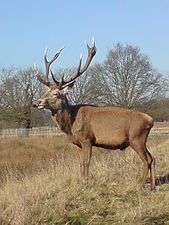
Red deer 
Brown trout 
Red deer
History
Prehistoric times
Eneolithic
The earliest artefacts in the Žumberak Mountains, small axe, and fragments of a pot, were found in the village of Mrzlo Polje Žumberačko. They belong to the people of Baden culture (Lasinya culture).[11]
Iron Age
There is a large archaeological survey in Budinjak. Large settlement and a necropolis with 140 tumuli were discovered. One of the most important findings is bronce,Kneževa kaciga (Prince's Helmet), found in one of two biggest tumuli, with diameter of 19 meters 19 m (62 ft). Today it is in Archaeological Museum in Zagreb. This is a proof that Budinjak was a settlement with powerful economy which had contacts with faraway lands.[11]
In late Iron Age, the Celtic tribes started conquering and colonizing this part of Europe. It is pressumed that they had many settlements in the Žumberak Mountains, since mint was discovered in Samobor. Under the Okić castle, in the forest of Jama near Podgrađe, a man found 1600 silver Celtic coins. These coins are now called Samobors.
Roman period
In 35 - 33 BC the Žumberak Mountains became part of the Roman Republic, later empire, province of Pannonia. The most important remains are several graveyards dating from 1st century AD found in the central Žumberak Mountains, in villages of Gornja Vas and Bratelji. People buried in those graveyards belonged to the Celtic tribe of Latobics. Many glass containers were found in these graves. These containers were produced in northern Italy, and they are proof that people in the Žumberak Mountains had a powerful economy at that time.[11]
Middle Ages
After the decline of the Roman Empire, numerous Germanic and Slavic tribes passed across the Pannonian Plain. Almost nothing is known when the Croats came to the Žumberak Mountains. The earliest written texts and archaeological finds enlighten the history of the Žumberak Mountains from the 12th century on. At that time the Žumberak Mountains were the border between the Croatian-Hungarian Kingdom and the Holy Roman Empire.[12]
Uskoks
The isolated region on Croatian side has always had a low population. In 1530, the immigration of Uskoks started, which lasted until the 17th century, which brought a large population of Štokavian speakers to the region. The Žumberak Mountains were then part of Austrian Military Frontier, created by the Habsburgs to serve as a defensive buffer between their empire and the Ottoman Empire. Uskoks from this area, were the only military personnel in Military frontier, that weren't living close to the border itself, the Žumberak Mountains themselves were an enclave within Banovina and did not directly border the Ottoman Empire, so they had to walk for half a day or longer to their posts in Ogulin, Cazin, Bihać etc. It is believed that 500 Uskoks from the Žumberak Mountains fought in the Battle of Sisak. They had huge losses for their standard, losing 40 soldiers in crucial mission of taking over the bridge over Odra river.[13][14] In the year 1545. they were called by citizens of Zagreb, to defend the city from the Ottomans because the regular army under the leadership of Croatian Ban was heavily defeated in Hrvatsko Zagorje. As we know Zagreb was never occupied by the Ottomans.[12]
Language and religion
Because of the immigration of Uskoks, the region is the intersection of all three Croatian dialects. The descendants of Uskoks who are Štokavian speakers are the majority in the Žumberak Mountains. The Žumberak Uskoks were mostly Orthodox Christians of the Serbian Patriarchate of Peć, but during 17th and 18th centuries came under the Union with Rome and became Greek Catholic, so there are more Greek Catholic churches in the Žumberak Mountains than Latin Catholic churches (approx. 2 to 1).
Mass emigrations
Mass emigrations started in the 19th century, when Military frontier was distablished. People in the Žumberak Mountains were no longer needed in the army. Since army salaries, which were main source of wealth, were not coming any more to the Žumberak Mountains. This was the main reason why people fell to poverty and started immigrating to the USA.
World War II
World War II in Yugoslavia began on 6 April 1941 with the invasion by Nazi Germany. Soon after that, the Croatian part of the Žumberak Mountains became a part of the Independent State of Croatia (NDH), a World War II puppet state of Nazi Germany and Italy, with the western part being directly occupied by Italy. The Slovenian part was annexed directly to the Third Reich. The resistance movement in the Žumberak Mountains began when Partisans from 1st Zagreb Partisan Detachment came to this area. Matija Gubec Partisan detachment was established here in August 1941, However it was quickly destroyed. In 1942 partisans from Kordun managed to attract local people to join the resistance, so in 1942 Žumberak-Pokuplje partisan detachment was established. Later they merged with First Croatian proleterian battalion in famous XIII. proleterian brigade Rade Končar. That brigade managed to liberate Krašić in January 1943, which was a great victory for Partisan movement, since North-West Croatia was considered to be NDH stronghold. Many villages were completely burned and destroyed by the fascists, because their inhabitants allegendly helped the partisans. Žumberak was finally liberated on 9 May 1945, by the 10th division of Yugoslav People's Army.
The Žumberak Mountains are the site of the Jazovka Pit, location of a World War II massacre of retreating Ustasha soldiers and civilians mostly from hospitals in Zagreb by the communists, not partisans from Žumberak-Pokuplje partisan detachment, or local people.[15]
In SFRY
In sixties an seventies, second mass emigration started, mostly to Germany. Žumberak-Gorjanci memorial area established in 1971.
Modern Croatia
In 1991 area of the Žumberak Mountains became a part of independent Croatia and Slovenia. A military complex near the top of Trdinov vrh, created by the Yugoslav People's Army, has been a subject of a dispute between the two new countries since the 1990s since it is possessed by Slovenian army, but the complex is actually located on Croatian soil. Escalation was prevented due to amicable diplomacy.
Both, Slovenia, and Croatia, are members of the European Union, and it is expected that Croatia will soon join Schengen area, so there will be no actual border in the Žumberak Mountains.
Conservation and threats
The biggest threats to the range are deforestisation and illegal dumping of waste. Some argue that Krško nuclear power plant is endangering the northern parts of the range, but it's not scientifically proven Most of the Croatian part of the range was protected as Nature park Žumberak-Samoborsko gorje by Croatian parliament Sabor, on 28 May 1999. which is since 2012. Natura 2000 site Some areas inside the park itself are specially protected.
List of protected areas
Croatia
- Nature park Žumberak-Samoborsko gorje
- Significant landscape Slapnica
- Significant landscape Okić
- Special nature reserve (forest) Japetić
- Nature monument Grgos cave
- Park-forest Tepec and Stražnik
- Special botanical reserve Smerovišće
- Natura 2000 Vugrin cave
Slovenia
- Natura 2000 Gorjanci-Radoha
- Ecologically immpotant area (EPO) Gorjanci
- Nature reserve Old-growth forest Trdinov vrh
- Nature reserve Old-growth forest Ravna gora
- Natural value of national important Kobila
Gallery
St. Elijah chapel on Sveta Gera 
Okić 
Pleterje Charterhouse, Carthusian monastery 
Plešivica, view from Japetić 
Sichelberg, fortress from 13th century 
View towards Sveta Gera St. Nicholas church in Gorjanci 
southern part of Mrzlo polje Mrzlo Polje 
Blood stone (Krvavi kamen) 
Minutnik spring
References
- ↑ Karst [2] in Meyers Großes Konversations-Lexikon, Band 10., Leipzig, 1907, p 680-681
und in dem gegen das rechte Saveufer streichenden Uskokengebirge mit dem St. Geraberg (Gorianc) 1181 m erreichend. (German)
- ↑ Lukić, Aleksandar (2008). "Žumberška gora". In Kladnik, Drago. Zamejska Hrvaška [Žumberak Mountains] (in Slovenian). pp. 66–84.
- ↑ Žumberak Nature Park
- ↑ "Dogovor Janša – Sanader: Nerešena meja se seli v Haag: Kje na kopnem ni soglasja". Dnevnik (in Slovenian). 27 August 2007. Retrieved 29 September 2008.
- ↑ "Slovenski vojnici se povlače sa Svete Gere?". Index.hr (in Croatian). 23 February 2004. Retrieved 5 May 2009.
- ↑ "Slovenia Is Occupying Croatian Land in Sveta Gera". Javno. 21 February 2009. Retrieved 5 May 2009.
- ↑ "Slovenia unblocks Croatian EU bid". BBC News Online. 11 September 2009. Retrieved 12 September 2009.
- ↑ "Slovenia backs Croatia border deal in referendum vote". BBC News Online. 6 June 2010. Retrieved 7 June 2010.
- 1 2 http://www.park-zumberak.hr/posebni/biologija.html/retrieved on 2014-04-24 (Croatian)
- ↑ http://www.ribe-hrvatske.com/attachments/article/613/Sucic,%20I.%20&%20Jelic,%20D.%20(2010)%20Ihtiofauna%20potoka%20%C5%BDumberka%20i%20Samoborskog%20gorja.pdf/ retrieved on 2014-04-24 (Croatian)
- 1 2 3 http://www.park-zumberak.hr/posebni/povijest.html/retrieved on 2014-04-24 (Croatian)
- 1 2 http://www.zumberacki-vikarijat.com/zumberacka-povijest/retrieved on 2014-04-23 (Croatian)
- ↑ http://www.dlib.si/details/URN:NBN:SI:doc-IN5KZOA6, retrieved from dlib.si on 2014-04-23 (Slovene)
- ↑ http://www.zgodovina.eu/slovenci/bitka_pri_sisku.htmretrieved on 2014-04-23 (Slovene)
- ↑ http://www.mojzumberak.com/Povijest__umberka/_umberak_za_vrijeme_II__svjets/_umberak_za_vrijeme_ii__svjets.html/retrieved on 2014-04-24 (Croatian)
External links
![]() Media related to Žumberak Highlands at Wikimedia Commons
Media related to Žumberak Highlands at Wikimedia Commons
![]() Žumberak travel guide from Wikivoyage
Žumberak travel guide from Wikivoyage
